
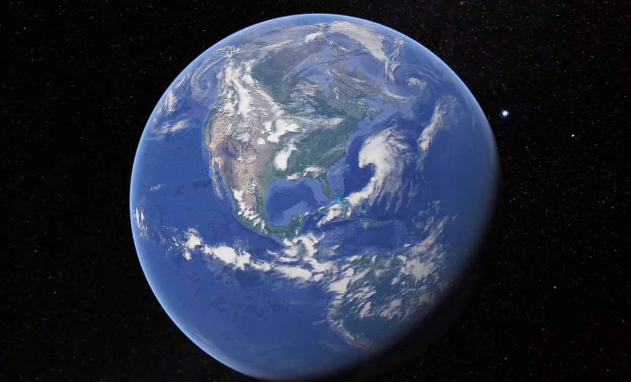
Google Earth is a cool tool that lets you see satellite images of pretty much anywhere on Earth. But have you ever wondered when those images were updated?
Searching for an answer to this question online will likely lead you to a lot of sites that speculate about the answer. But we’re here to give you the real answer:
Yes, you can use Google Earth to view a specific date. In the “Historical Imagery” layer, you can select a date and see how the location looked at that time. Tapping and zooming in on a location is another way to view a specific date.
To learn more, let’s get into the details!
Can Google Earth show a Specific Date?
Yes, Google Earth can surely display specific dates if that’s what you’re looking for.
You can view historical imagery on Google Earth! Just enter a specific date and time, and you’ll be able to see how the earth looked at that time.
Google Earth will show you a satellite view of the earth and any changes that have happened since that date. You can use this feature to see how your hometown has changed over the years or to view historical events like natural disasters or the construction of major landmarks.
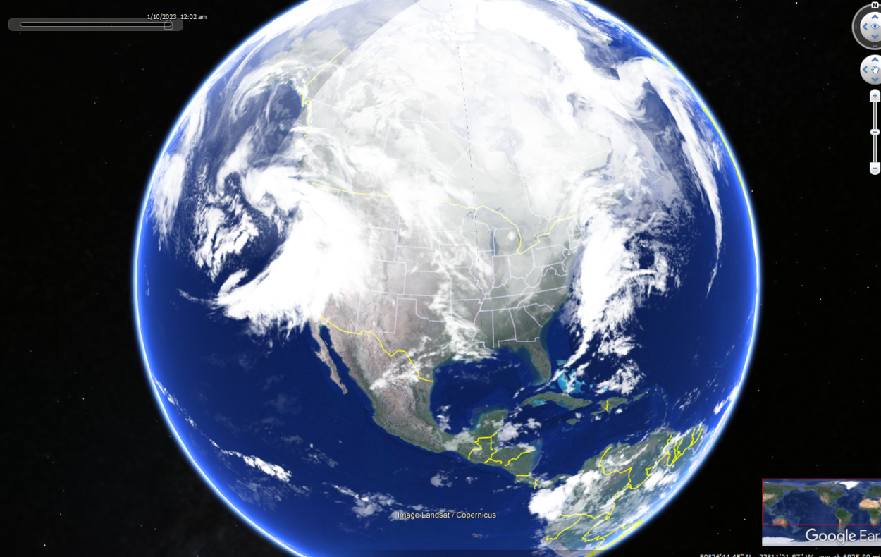
Another way Google Earth shows you a specific date is when you tap into the screen or zoom in on a particular location; in the status bar below, you can easily see the date of the image.
However, not all images have dates, and it’s because the provider of images doesn’t always provide the dates of the images to Google.

How do I go Back in Time on Google Earth?
Have you ever looked at Google Earth and wished you could go back and see how a place looked in the past? Well, you can! Google Earth has a ” Timeline ” feature that lets you see historical imagery of any place on Earth.
To use Timeline, simply type in the location you want to see and then click on the “Time” icon in the upper-left corner of the screen. From there, you can choose to view satellite imagery from different dates. You can also view Street View images from different times by clicking on the “Street View” option.
So go ahead and give it a try. And who knows, you might just find yourself taking a trip down memory lane.
How far Back does Google Earth go?

Google Earth contains historical imagery dating back to around 1930, but the coverage varies depending on the location.
In some places, you can only view images from the present day, while in others you can view images from the last few decades.
So if you’re curious about the history of your neighborhood or a certain landmark, Google Earth is definitely worth a try. Who knows, you might just stumble upon some hidden gems from the past.
Does Google Earth have a Time Slider?
Google Earth has a nifty feature called the time slider that lets you see how the Earth has changed over time. You can see different layers of the Earth’s history, from the present day all the way back to the formation of the planet.
This is a great way to see how the Earth has changed over time and can be educational too. If you’re a history buff, you can use the time slider to see how different historical events have shaped the Earth. For example, you can see how the rise and fall of empires have changed the landscape.
If you’re feeling adventurous, you can even use the time slider to see how the Earth will change in the future. For example, you can see how melting ice caps will affect the coastline. So whether you’re looking to learn about the past, present, or future, the time slider is a wonderful tool.

Where is the Time slider on Google Earth?
There’re a lot of different ways to use Google Earth, and one of the handiest is the time slider feature. This allows you to see how an area has changed over time, which can be really useful if you’re studying history or trying to understand how an area has developed.
The time slider on Google Earth allows you to view the past or future movements of the Earth‘s continents, oceans, and atmosphere.
To find the time slider, open Google Earth and zoom in on a specific location. Then, click the “View” option in the file menu bar and select “Historical imagery.” A slider will appear at the top of the screen that you can use to view the past or future movements of the Earth’s continents, oceans, and atmosphere along with time.
Can you Change Google Earth Year?
So you want to know if you can change the year on Google Earth? Well, you’ve come to the right place!
The answer is yes, you can change the year on Google Earth, and we’ll show you how.
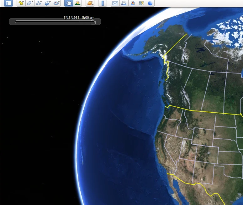
To do so, simply go to the “time” bar at the top of the screen and use the arrows to move forward or backward in time. You can also use the “play” button to have Google Earth automatically move through time.
This is a great way to see how the Earth has changed over the years – from natural changes like the advance of glaciers or the growth of forests to man-made changes like the construction of cities and the development of new technologies.
Can you go back 10 Years on Google Earth?
Most people think that Google Earth is a view of Earth from space, but it’s actually a lot more than that. Google Earth is a digital globe with years of images and data you can explore. So, can you go back 10 years on Google Earth?
The answer is yes! Google Earth has a time-lapse feature that lets you see how Earth has changed over time. You can go back 10 years, 20 years, or even further back in time to see how your favorite location has changed.
If you want to check out the time-lapse feature, just open up the Google Earth “Time” slider. You can then use the slider to choose the year you want to view. It’s really that simple!
Moreover, you can learn how you can view different dates on Google Earth, by checking the video below:
How often does Google Earth take a Picture of my House?
This is the most searched question and the answer is that it depends.
Google Earth updates its imagery regularly, but it can take some time for new satellite imagery to make its way to the platform. In general, major metropolitan areas are updated more frequently than rural areas.
Moreover, Google Earth employs several different satellites to take its images, and each satellite has its own schedule. So, if you’re looking at an image of your house that was taken by a certain satellite, it might be several years old.
And, of course, if there’s something specific going on in your area that’s captured by a satellite (like a natural disaster), you might see that imagery appear on Google Earth sooner than usual.
Final Verdict
- Google Earth has several really cool features, one of the coolest features is that you can use the time slider to see how the Earth has changed over time.
- You can go even back to 10 years on Google Earth, and there’re images present on Google Earth that date back to even the 1930s.
- There’re several ways to view the specific image dates on the program. The time slider allows you to search specific dates to view how Earth appeared back in time.
- Another way to view the date is by simply zooming in on the location – and with the zoomed-in location, you can see the specific date in the status bar below.
- It’s to be noted that not every image has a date. Some images are without dates, it’s mainly due to that Google being more interested in providing its users “Pretty Earth”, rather than other irrelevant information and another reason is that the image provider didn’t deliver the images with dates on them.
Related Articles
- Is Google Earth Free? [Revealed!]
- Can You Use Google Earth Without Downloading It? [Find Out]
- Can I See My House on Google Earth? (Find Out!)