![How Accurate Is Google Earth? [Answered]](https://gearthhacks.com/wp-content/uploads/2023/01/pef64n-1.jpg)
![How Accurate Is Google Earth? [Answered]](https://gearthhacks.com/wp-content/uploads/2023/01/pef64n-1.jpg.webp)
Hey there, curious explorers! Have you ever wondered just how accurate Google Earth really is? I know I have! With its ability to show us the world from the comfort of our own homes, Google Earth is an amazing tool that opens up a whole new world of exploration and discovery.
But just how accurate is all that information we’re seeing on our screens? Well, wonder no more, because we’re about to dive into the truth behind the accuracy of Google Earth.
From satellite imagery to Street View, Google Earth provides a wealth of information and data that allows us to explore the world in a new and exciting way. But with so much information at our fingertips, it’s important to know just how accurate and trustworthy that information is.
In this blog post, we’ll take a closer look at the accuracy of Google Earth, and answer all your burning questions about this amazing tool. So whether you’re a seasoned explorer or just curious about the world around you, this post has got you covered!
How Google Earth Works?


Google Earth works by using a combination of satellite imagery, aerial photography, and 3D modeling to create an interactive map of the world. The data collection process begins with satellite imagery, which is taken by a variety of commercial and government-owned satellites.
These satellites capture images of the earth’s surface at various resolutions and frequencies. These images are then processed and stitched together to create detailed maps of the earth’s surface.
In addition to satellite imagery, Google Earth also uses aerial photography to capture street-level views. This is done by using cameras mounted on cars and airplanes to capture images of streets and buildings. These images are then processed and stitched together to create a seamless street-level view of the area.
| Feature | Accuracy | Limitations |
| Satellite Imagery | High | The resolution, Timeliness, Weather, and Environmental factors |
| 3D Models | High | Environment, location |
| Street level views | High | Weather, Traffic, Obstructions |
Google Earth also uses 3D modeling to create realistic, virtual representations of buildings and other structures. This is done by using a combination of:
- Satellite imagery
- Aerial photography
- Ground-level photography to create detailed 3D models of the structures
The 3D models are then placed in the correct location on the map, based on the coordinates provided by the data.
Once the data is collected and processed, it’s then presented to the user through the Google Earth interface. The interface allows users to navigate the map, view satellite imagery, street-level views, and 3D models, and search for specific locations.
The interface also includes a variety of tools and features, such as the ability to measure distance, add annotations, and create custom tours.
Overall, Google Earth is a complex system that uses a variety of data sources and processing methods to create an accurate and interactive map of the world.
However, the information is constantly updated and the process of collecting data, processing, and stitching it to create a consistent map is a dynamic and ongoing process.
The Accuracy of Google Earth’s Imagery
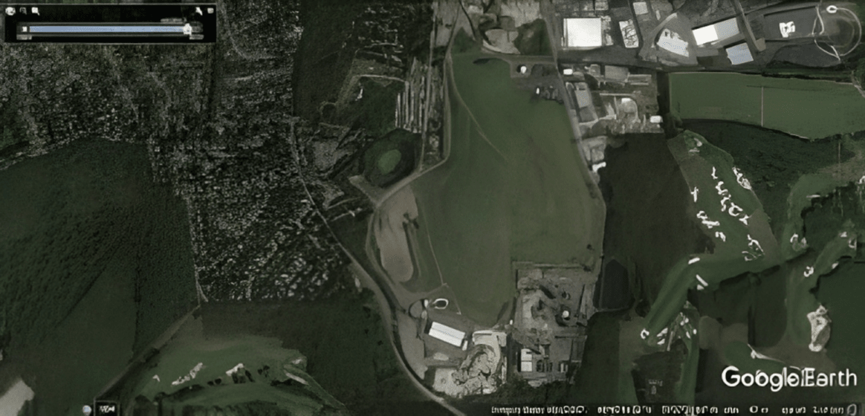
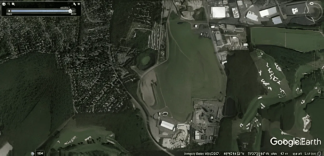
The accuracy of Google Earth’s imagery is one of the most important factors in determining the overall accuracy of the tool. Google Earth’s imagery is sourced from a variety of commercial and government-owned satellites, which capture images of the earth’s surface at various resolutions and frequencies.
These images are then processed and stitched together to create detailed maps of the earth’s surface.
When compared to other satellite imagery sources, Google Earth’s imagery is generally considered to be very accurate. The resolution of the imagery is high, and the images are up-to-date. However, as with any satellite imagery, there are limitations to the resolution and timeliness of the images.
For example, some areas of the world may be obscured by clouds, and the imagery may not be as detailed as other sources. Additionally, the imagery may not be as up-to-date in certain regions, especially in remote or underdeveloped areas.
The accuracy of the imagery also varies depending on the environment. For example, Google Earth’s imagery is more accurate in urban areas, where there are more buildings and landmarks to reference. In rural areas, the imagery may be less accurate due to the lack of identifiable landmarks.
Additionally, the imagery may be less accurate in areas with heavy vegetation, as the trees and bushes can obscure the view of the ground.
In summary, Google Earth’s imagery is generally considered to be very accurate when compared to other satellite imagery sources. However, there are limitations to the resolution and timeliness of the images, and the accuracy of the imagery can vary depending on the environment.
The Accuracy of Google Earth’s Street View
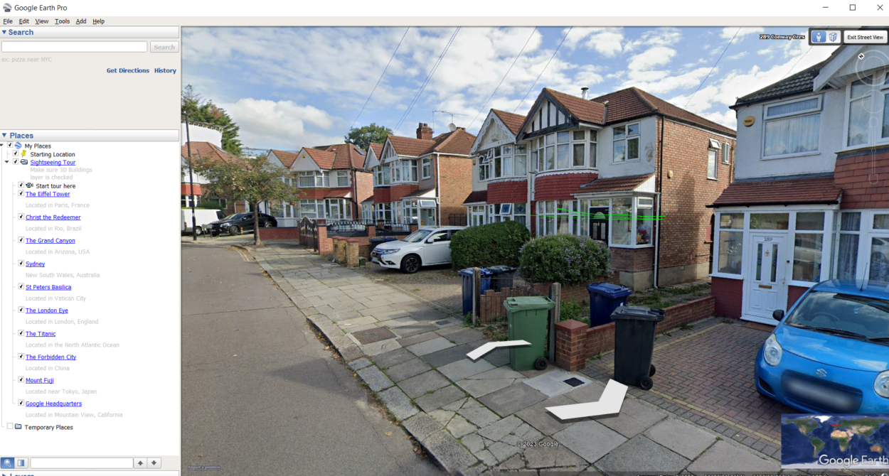

Google Earth’s Street View feature is an important aspect of the tool, as it allows users to explore the world at a more detailed, street-level view. Street View imagery is captured by cameras mounted on cars and airplanes, which drive or fly along streets and capture images of buildings and other structures.
These images are then processed and stitched together to create a seamless street-level view of the area.
When compared to other street view services, Google Earth’s Street View is generally considered to be very accurate. The imagery is detailed and up-to-date, and the street-level views are immersive. However, as with any street view service, there are limitations to the accuracy of the imagery.
For example, some areas may not be covered by Street View, or the imagery may not be as up-to-date in certain regions. Additionally, Street View imagery can be affected by weather, traffic, and other factors that may cause the images to be blurry or distorted.
The accuracy of Street View also varies depending on the environment. For example, Street View is more accurate in urban areas, where there are more buildings and landmarks to reference. In rural areas, Street View may be less accurate due to the lack of identifiable landmarks.
Additionally, Street View may be less accurate in areas with heavy vegetation, as the trees and bushes can obscure the view of the street.
Overall, Google Earth’s Street View is considered to be a very accurate tool for exploring the world from a street-level view. However, as with any street view service, there are limitations to the accuracy of the imagery and it can vary depending on the environment. Also, Street View imagery is constantly updated, and coverage may vary over time.
It’s important to keep in mind that Street View is just one aspect of Google Earth, and other features such as satellite imagery and 3D models can provide additional information and context when evaluating the accuracy.
FAQs
How Often Is Google Earth’s Data Updated?
Google Earth’s data is constantly updated with new satellite imagery, aerial photography, and 3D models.
The frequency of updates varies depending on the region, but Google Earth’s imagery is generally considered to be very up-to-date.
How Accurate Is Google Earth’s Street View?
Google Earth’s Street View is considered to be very accurate when compared to other street view services. The imagery is detailed and up-to-date, and the street-level views are immersive.
However, as with any street view service, there are limitations to the accuracy of the imagery, such as:
- Weather
- Traffic
- Other factors that may cause the images to be blurry or distorted
Q: Is Google Earth’s Imagery Better Than Other Satellite Imagery Sources?
Google Earth’s imagery is generally considered to be very accurate when compared to other satellite imagery sources. The resolution of the imagery is high, and the images are up-to-date.
However, as with any satellite imagery, there are limitations to the resolution and timeliness of the images. For example, some areas of the world may be obscured by clouds, and the imagery may not be as detailed as other sources.
Conclusion
- In conclusion, Google Earth is an incredibly accurate tool for exploring the world. The data collection process, which includes satellite imagery, aerial photography, and 3D modeling, is complex and thorough.
- As with any technology, there are limitations and potential sources of error. The resolution and timeliness of the imagery may vary depending on the region, and the accuracy of the imagery, 3D models, and street-level views can be affected by weather, terrain, and other environmental conditions.
- The accuracy of the place labels may vary depending on the region and language.
- Despite these limitations, Google Earth is still considered to be a highly accurate tool for exploring the world. The data is constantly updated, and new features and tools are added regularly to improve the user experience.
- The value of Google Earth lies in its ability to provide detailed and up-to-date information about the world, and its potential to be used in a wide variety of fields such as geography, travel, education, and many more.
Related Articles
- How Do I Change The Year On Google Earth On My IPAD? (Find out)
- Why Would a House Be Blurred Out on Google Earth? (Must Know)
- What is the Difference Between Google Earth Pro and Free? (Must Know)