How Do I Find Old Google Earth Images on iPhone? (Detailed)
Posted on Last updated:
With the ever-changing world of technology, it can be hard to keep up. Google Earth is a great way to explore different places across the globe, but you may find yourself wanting to view previous images of certain locations.
If you’re traveling where you don’t have access to Google Earth desktop software, then you don’t need to worry. You can access the old images of Google Earth through your iPhone simply by the time-lapse option.
In this blog post, we’ll discuss some easy ways you can find old Google Earth images on your iPhone. We’ll cover how to access the History feature and how to search for older images. Keep reading to learn more about finding old Google Earth images on your iPhone!
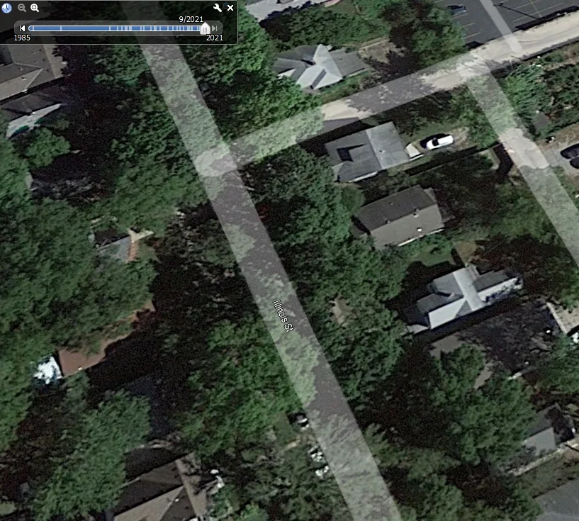
The time-lapse feature on Google Earth allows users to see how a particular location has changed over time. This feature is built using satellite imagery from the past three decades, and it’s a really incredible way to see how the Earth has changed over time.
To use the time-lapse feature, simply type in a location into Google Earth and then select the “Time-lapse” option from the menu. You can then use the controls to fast forward, rewind, or pause the time-lapse. This is a really great way to see how a particular location has changed over the years, and it’s a lot of fun to use.
Is Time Lapse Google Earth Available for iPhone?
The popular time-lapse Google Earth feature is now available for iPhone. With this feature, you can see how the Earth has changed over time.
This is a fantastic method to observe how the Earth has been influenced by natural calamities or how the environment has been altered by man-made constructions. It may even be used to monitor the development of a building project.
To use the time-lapse Google Earth feature on your iPhone, simply open the Google Earth app and search for the location you want to see. Then, select the “Time Lapse” option from the layer option in the voyager icon. You can choose to view the time lapse in real time or fast-forward.
Time Lapse Google Earth
How do I change the Year on Google Earth iPhone App?
Assuming you would like to view imagery from a specific year in the past on the Google Earth iPhone app, it’s not completely possible as on the Google Earth Desktop software. However, if you want to view how the earth appeared at a particular time period, you can follow the steps below:
1
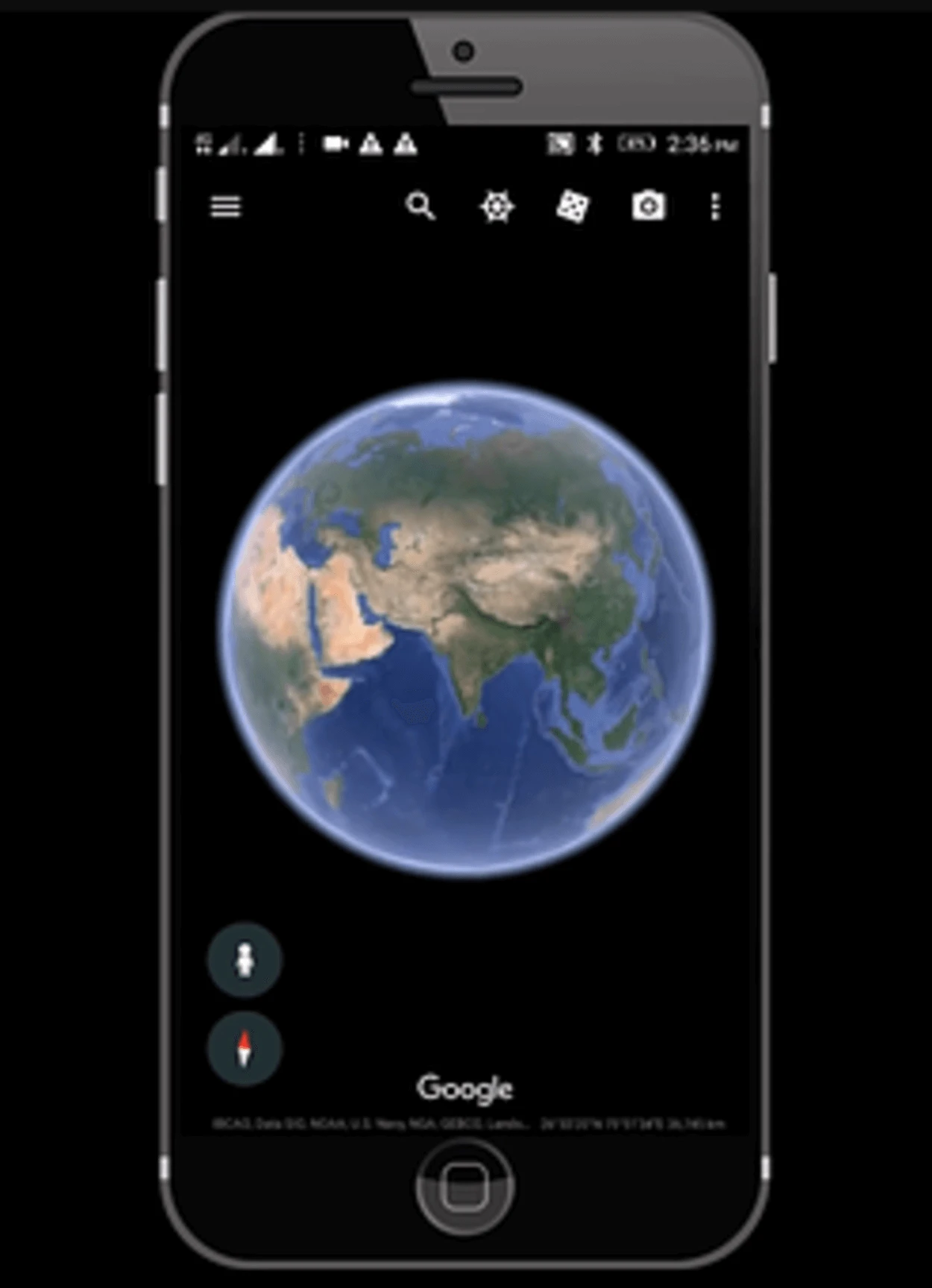
Open the Google Earth app on your iPhone.
2
Then you can click on the voyager option, where you need to tap on the layers option.
3
Once you click on the voyager option, you’ll be able to see certain other options, such as satellite view and time-lapse options.
4
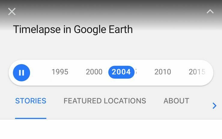
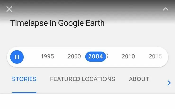
Click on the Time-lapse option, which allows you to view satellite imagery from different years on the time slider.
5
You can pause the time lapse from the slider and tap on the year from which you want to view the earth.
Change the Year on Google Earth iPhone App
How Do I Find Old Google Earth Images on iPhone?
Although you can’t find old Google Earth images on your iPhone directly, you can access them in a couple of ways. One way is to use the time-lapse feature in the Google Earth app. This will show you a series of images from different times, which you can then scroll through to find the one you’re looking for.
Another way you can view old images is by clicking on the street view option. By tapping on different places, you might be able to notice that there’re several images for the places uploaded in different time frames. In this way, you can view old Google Earth images.
So, while you can’t find old Google Earth images on your iPhone directly, there’re a couple of ways you can access them. With a little bit of effort, you should be able to find the image you’re looking for.
There’re several images for the places uploaded in different time frames
Can I go Back in Time on the Google Earth App?
Yes, you can go back in time on the Google Earth app.
Even though the Google Earth app doesn’t have a time machine feature that lets you go back and see how the world looked in the past. However, the app does have a “historical imagery” feature that lets you see how specific locations have changed over time.
To use this feature, just search for a location and then select the “historical imagery” option from the menu. From there, you can browse through a timeline of images to see how the location has changed.
Is Google Earth Pro Available for iPhone?
There’s a lot you can do with Google Earth Pro, but unfortunately, one thing you can’t do is use it on your iPhone. Google Earth Pro is a desktop application that isn’t available for mobile devices.
However, the application of Google Earth is available on iOS and Android and offers pretty cool features. It might not have the exact same features that are available for the Google Earth Pro desktop version. But you can still enjoy high-quality satellite imagery.
How Old are the Images on Google Earth on iPhone?
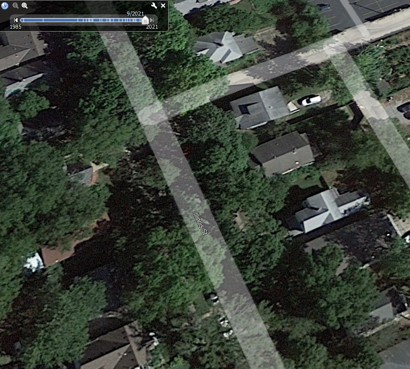
If you want to know how old an image on Google Earth on iPhone is, it’s not difficult. All you’ve to do is, search for the location you want to view. Once you find the place, zoom it in.
After that, click on the street view option in the screen’s lower-right. You can then tap on the location to zoom it in. Once you’ve zoomed in, you’ll be able to see clear images with a date on them. Not every image has a date, but most of them do. In this way, you can figure out how old an image is.
Not every image on Google Earth has a date, but most of them do
Is it Better to Use Google Earth on a Desktop or iPhone?
There’s no right answer to this question – it all depends on your needs and preferences. If you need to use Google Earth for work or school, a desktop version will likely be better. It has more features and is more accurate than the mobile versions.
However, if you’re just using Google Earth for fun or to explore the world from your home, an iPhone version may be better for you. It’s more convenient to use on a mobile device and can be more fun to explore.
So, which is better? It all depends on what you need it for. If you’re not sure, why not try both and see which one you like better?
Can You go Back 10 Years on Google Earth?
Yes, you can go back 10 years on Google Earth. You’ll need to access the “Historical Imagery” feature to do this. This feature lets you view satellite images of any location on Earth from the past, all the way back to 1984.
All you need to do is choose “Historical Imagery” from the “View” menu at the top of the screen. After that, you may choose the year you wish to watch by using the timeline at the bottom of the screen.
In order to learn more about the Satellite images of Google Earth from the past, you can check out the video below!
Yes, you can go 10 years back on Google Earth!
Conclusion
Finding old earth images can be tricky, but it’s possible with the right tools and resources. Google Earth offers you ways to find how the earth appeared in the past.
There’re certain ways to view images from the past, such as historical imagery. However, iPhone doesn’t have a historical imagery option.
Nonetheless, you can still use the time-lapse option to view the earth from different time frames.
Not only this, but you can also zoom in on the location and view the images people provide. Many of these images are around 4 to 5 years older.
With a careful search and some patience, you should now be able to find the perfect photo for any location.