Do you want to learn more about different locations around the globe or conduct research on geographic data? Look no further than Google Earth!
Google Earth is an innovative application that combines satellite imagery, aerial photography, and 3D mapping technology to offer an immersive and interactive virtual experience of the Earth’s surface.
It provides a unique and detailed perspective of our planet, enabling users to learn and appreciate the world’s beauty and diversity. Whether for education or entertainment purposes, Google Earth is a versatile tool with many features and functionalities, making it a valuable resource for people from all walks of life.
In this article, we’ll delve deeper into the information about Google Earth and the uses of Google Earth from all backgrounds and fields.
What is Google Earth?
Imagine having a magic wand that can instantly transport you to any corner of the world. With a flick of your wrist, you could soar over snow-capped mountains, dive into crystal-clear oceans, or stroll through bustling city streets. That’s exactly what Google Earth does, but without the wand.
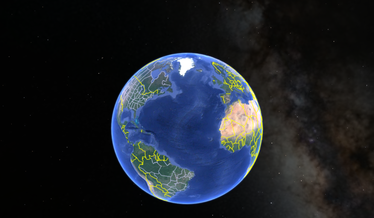
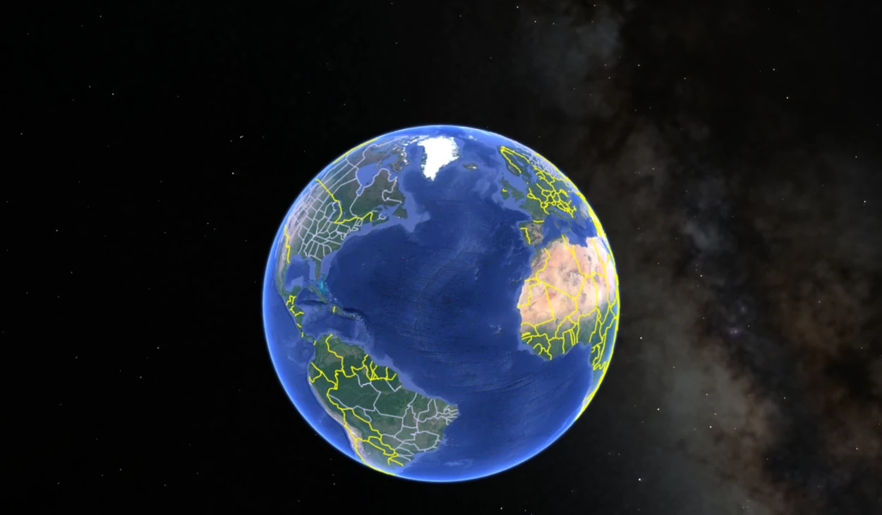
At its core, Google Earth is a geospatial visualization tool that enables users to explore the world in a way never possible. It combines data from various sources, including satellite imagery, aerial photography, and geographic information systems (GIS), to create a seamless and interactive digital representation of the planet.
It’s like having a virtual passport that lets you visit any place on earth, from the highest peaks to the deepest valleys. You can zoom in to see street-level details or zoom out to get a bird’s-eye view of entire continents.
With Google Earth, you can discover new places, learn about different cultures, and marvel at the beauty of our planet, all from the comfort of your own device.

Whether you’re an armchair traveler or an intrepid adventurer, Google Earth is an incredible resource that lets you experience the world in a whole new way.
How does Google Earth Work?
Google Earth is a digital globe that aggregates a vast amount of geographical data from various sources. This data includes satellite imagery, terrain information, 3D models, and more. Google uses a process called photogrammetry to stitch together images taken from satellites, airplanes, and drones to create a 3D model of the Earth’s surface.
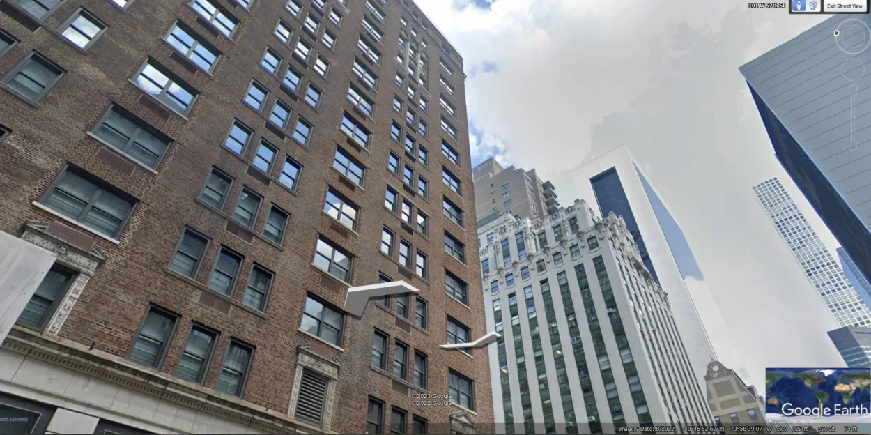
Users must download the Google Earth application or use the web-based version to access this data. When you open the application, you’ll see the virtual globe, which you can explore by dragging and zooming in or out. Users can switch between different views, such as street view, satellite view, or underwater view.
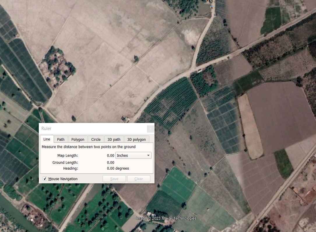
Google Earth also offers various tools and features to enhance the user’s experience. For instance, users can measure distances, draw lines and shapes, add pins and labels, and create virtual tours. Additionally, Google Earth offers a time-lapse feature that allows users to see how the Earth’s surface has changed over time.
Behind the scenes, Google Earth uses vast computational power and algorithms to deliver such an immersive experience. Google’s servers process and store the massive amount of data needed to generate and serve the virtual globe to users worldwide.
In short, Google Earth is a complex system that combines data from various sources and uses advanced algorithms and computational power to create an immersive 3D representation of our planet.
Whether you’re a casual user or a scientist, Google Earth offers a unique perspective on our world that would otherwise be impossible to obtain.
Is Google Earth Free?
Yes, Google Earth is free to use. Users can download and install or access the desktop application through their web browser. The basic version of Google Earth provides access to vast satellite imagery and 3D terrain data, which can be explored and manipulated using various tools and features.
However, there are also paid versions of Google Earth, such as Google Earth Pro, which offer additional features and capabilities for professional use. These versions may require a subscription or a one-time purchase.
Overall, Google Earth’s free version is a powerful and accessible tool for anyone who wants to explore the world from a different perspective, whether for personal or professional use. It allows users to navigate the globe, view topography, explore landmarks and historic sites, and even track weather patterns.
What can I do with Google Earth?
Google Earth is an excellent choice if you want to explore the Earth’s surface without leaving your home. This web-based application offers users a detailed virtual globe using satellite imagery, aerial photography, and 3D mapping technology.
In addition to its exploration features, Google Earth provides tools for measuring distances and areas, creating custom maps and overlays, and sharing geographic data. This makes it a valuable tool for researchers, educators, and anyone who needs to visualize and analyze geographic information.

One of the most exciting aspects of Google Earth is its ability to provide access to regions of the world that are difficult to visit in person. This includes remote areas like the Arctic and Antarctic and regions affected by conflict or natural disasters.
Google Earth allows users to explore these areas and gain a deeper understanding of the challenges people who live in these regions face.
What Devices can I use to Access Google Earth?
Google Earth can be accessed on various devices, including desktop computers, laptops, tablets, and smartphones.
For desktop and laptop users, Google Earth can be accessed through a web browser by visiting the Google Earth website or downloading the Google Earth software. The Google Earth software is available for Windows, macOS, and Linux operating systems.
For tablet and smartphone users, Google Earth is a free app for iOS and Android devices. The app offers similar features to the web and desktop versions, including the ability to explore the Earth’s surface, view 3D models, and take virtual tours.
In addition to these devices, Google Earth can be accessed on virtual reality headsets, such as Google Cardboard and Oculus Rift. These devices offer an immersive and interactive way to explore the Earth’s surface, with the ability to move around and explore in 3D.
Overall, Google Earth is a versatile tool that can be accessed on many devices, making it easy for users to explore and discover the world from almost anywhere.
FAQS
What is Google Earth mostly used for?
Google Earth primarily explores the Earth’s surface and provides a virtual view of global locations. It is used by individuals for entertainment and educational purposes and by researchers and professionals for visualizing and analyzing geographic data.
With Google Earth, users can view 3D models of buildings and terrain, measure distances and areas, and take virtual tours of famous landmarks.
What is the best way to use Google Earth?
The best way to use Google Earth depends on your interests and goals. For general exploration, start by searching for a location or landmark you want to visit, and then use the navigation tools to zoom in and explore.
To use Google Earth for research or analysis, learn how to use the measuring and drawing tools, and consider importing and overlaying your own data. Regardless of how you use it, Google Earth offers a unique and powerful way to explore and understand our planet.
Why is Google Earth good for students?
Google Earth is a great tool for students because it provides an interactive and engaging way to learn about geography and other subjects.
Students can use Google Earth to explore different parts of the world, view 3D models of buildings and terrain, and take virtual tours of historical sites and landmarks. It can also be used to visualize data and information, making it a valuable tool for research projects and presentations.
Conclusion
- Google Earth blends satellite imagery, aerial photography, and 3D mapping technology to create an immersive and interactive virtual experience of Earth’s surface.
- Users can easily explore different locations around the globe, view 3D models of buildings and terrain, and take virtual tours of famous landmarks with Google Earth.
- Google Earth is a versatile tool that can be utilized for various purposes, from education and entertainment to research and professional analysis.
- It presents an exceptional and robust approach to learning about geography, comprehending the environment, and admiring the world’s diversity and beauty.
- Google Earth is continuously developing and enhancing, with new functionalities and features being added regularly, providing an invaluable resource for people from all walks of life.
Related Articles
- What is Google Earth Used for? (Must Know)
- Can You Use Google Earth Without Downloading It? [Find Out]
- Can I See My House on Google Earth? (Find Out!)