
Google Earth Mobile has become a great way to explore the world around us. With its interactive street view, high-resolution satellite imagery, and 3D maps of cities, it’s easy to see why so many people use it on their mobile devices.
But if you’re wondering if you can access historical imagery on Google Earth Mobile, then the answer is a little complicated. You can and cannot view historical imagery in Google Earth on Mobile phones as you can on the desktop version.
In this blog post, we’ll discuss how to view historical imagery on Google Earth Mobile. From accessing old locations to seeing how cities have changed over time, read on to learn more about using historical imagery on Google Earth Mobile!
What is Historical Imagery Google Earth?
If you’ve ever used Google Earth, you know that you can see satellite imagery of pretty much anywhere in the world. But did you know that you can also view historical imagery?
Historical imagery shows you a collection of pictures that depict how a place has evolved over time.
A sizable archive of historical photographs from the first days of satellite photography is available on Google Earth.
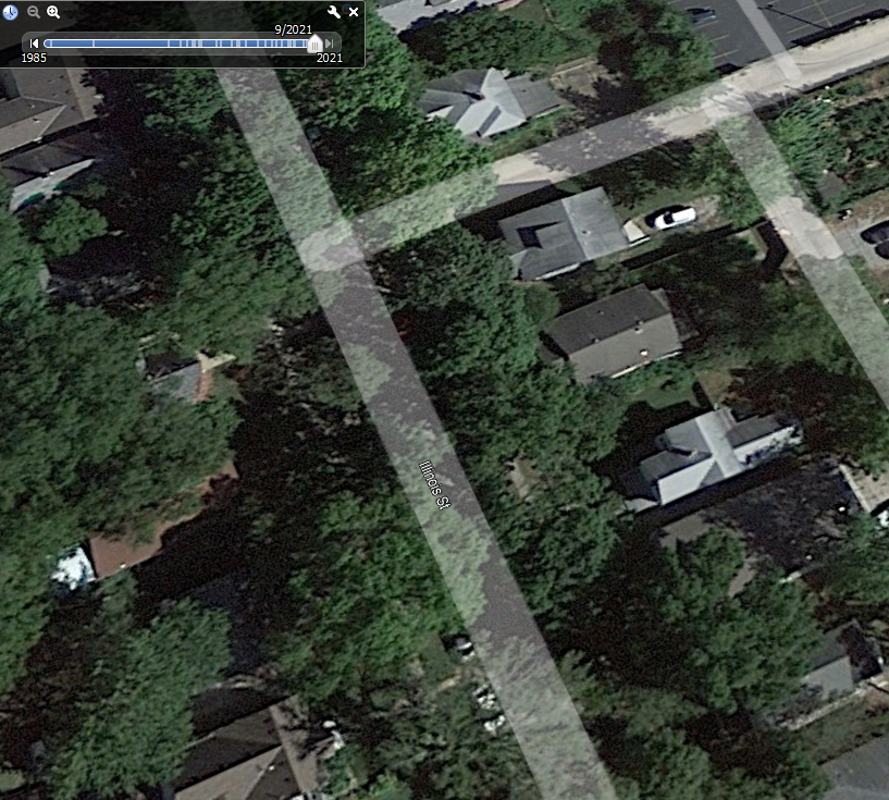
To view historical imagery, open Google Earth and zoom in on an area of interest. Then, click the “View” menu and select “Historical Imagery.”
A timeline will appear, allowing you to select the date range you want to view. Google Earth will then show you the available images for that time period.
It’s a great tool to see how a location seemed in the past, assess changes through time, or even carry out research on a subject; you may explore historical imagery features.
Is the Historical Imagery Option Available for Mobile Phones?
If you’re looking for historical imagery on Google Earth, you’re out of luck if you’re using a mobile phone. However, you can still access this feature on a desktop computer.
To do this, just open Google Earth and select the “View” menu. Then, click on “Historical Imagery,” and you’ll be able to see a timeline of images for the area you’re looking at. You can use the time-lapse feature to see how an area has changed over time.
Can you View Historical Images on Google Earth Mobile?
You cannot view historical images on Google Earth as you can on the desktop version of Google Earth. The mobile application doesn’t have the historical imagery option. However, you can try out other things.
Simply open the app and search for the place you want to see. Then, tap the “View in 3D” button and tap on the places with a small camera icon on them. You can go through different images and see the time when the images were uploaded. Most images are 5 to 6 years older, which means the images you’re seeing are already from different years.
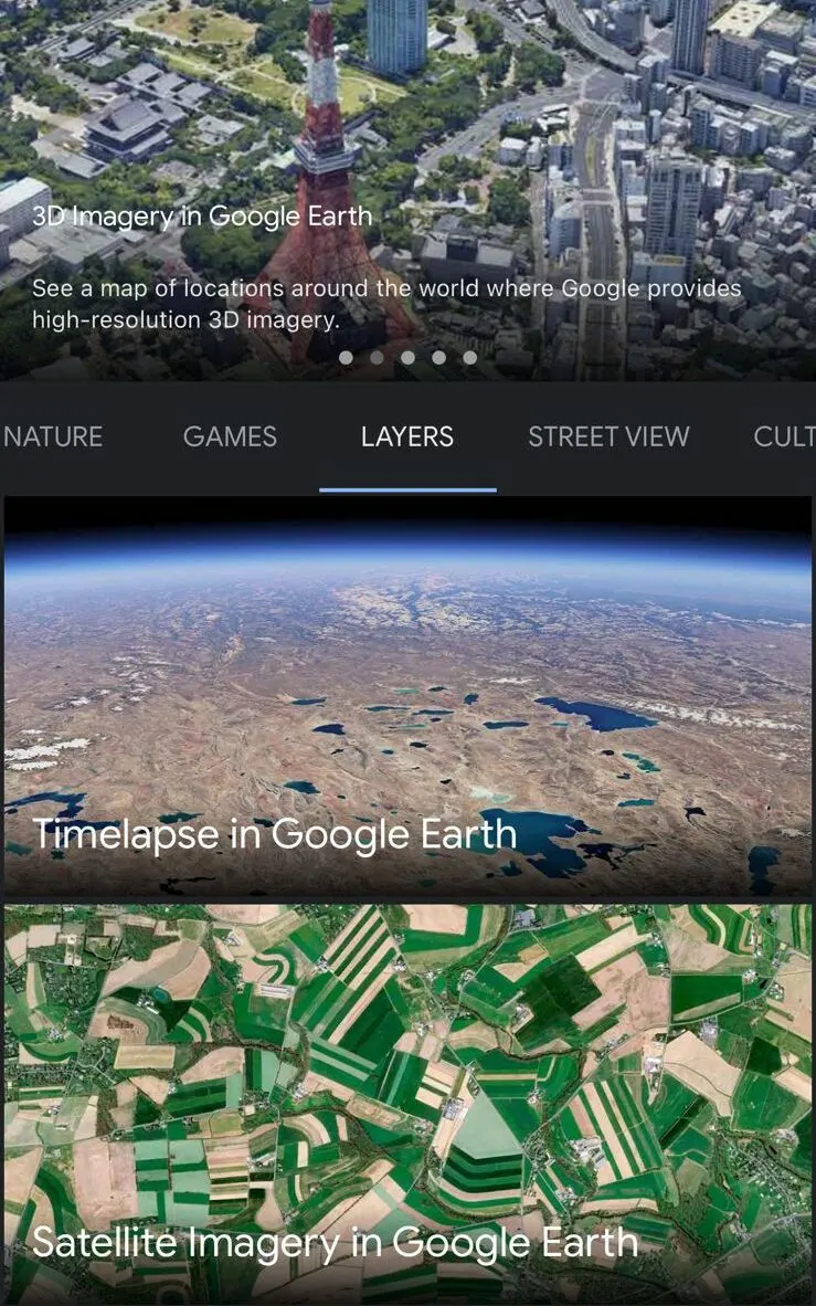
Another way to view the old historical earth view is by using the Time-lapse option. This feature allows you to view the earth from different years.
Is the Time-lapse Option Available for Mobile?
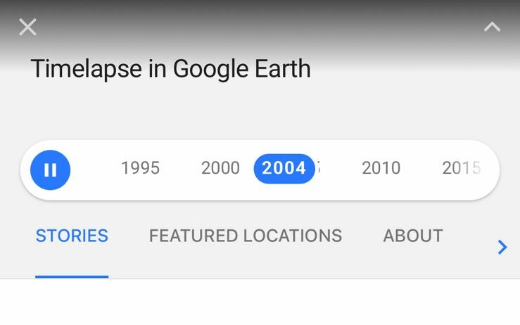
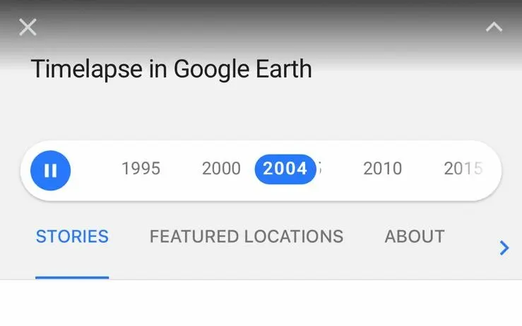
Google has announced that its Time Lapse feature, which allows users to see how the Earth has changed over time, is now available on the iPhone and Android.
Time Lapse is a really cool way to see how the Earth has changed over time. Google has been collecting satellite imagery for years, and with Time Lapse, you can now see how specific locations have changed since 1984. The feature is available on the Google Earth app for iOS and Android, and it’s really easy to use.
To use Time Lapse, search for a location on Google Earth and tap on the “Time Lapse” button available in the voyager feature. You can then use the playback controls to fast-forward or rewind through time and see how the location has changed.
Can You go Back in Time on Google Earth Mobile?
While you can go back in time on Google Earth Desktop by selecting the “Historical Imagery” option in the layers menu and then using the slider at the bottom of the screen to scroll through time. But you can’t do that on Google Earth mobile application.
However, you can go back on mobile using the time-lapse option. The time-Lapse option will show you how the earth has changed over time.
How do I use Google Earth Historical Imagery on my iPhone?
If you’re using an iPhone, there’s no direct option for historical imagery as there’s on Google Earth desktop. However, you can access historical imagery on Google Earth on iPhone by following these steps:
| Steps | Description | |
| 1 | Open the Google Earth app and search for the location you want to view. | |
| 2 | Tap the “voyager” icon in the top-right corner of the screen (it looks like a ship helm). | |
| 3 | Click on the “Layers” option. | |
| 4 | Click on the Time-lapse option. | |
| 5 | Select the location which you want to view. | |
| 6 | Use the slider on the screen to choose the date range you want to see your location. |

How do I Change the Year on Google Earth Mobile?
You cannot completely change the year on Google Earth, however, you can access certain photos from years back.
Google Earth gives you the option to view how the Earth appeared in different years by following certain simple and straightforward steps.
First, open the app to change the year on Google Earth Mobile. Then, tap the helm icon in the top right corner of the screen and select layer options to choose time-lapse. You can tap on the year in which you want to view Earth.
How to Search for Specific Dates on Google Earth Mobile Application?
If you’re using the Google Earth mobile application, you may have noticed that you cannot view specific dates the way you can on the desktop version of the program. This is because the mobile app doesn’t have many features like the desktop version.
While this may be frustrating if you’re trying to view images from a specific date range, there’re a few workarounds that you can use. One option is to use the street view option, where you can zoom in on images and see the dates of the images.
Another way is to use this feature on the desktop version of Google Earth to view the images you’re interested in.
Another option is to use a different mobile app that does allow you to view specific dates. One such app is NASA’s World Wind, which is available for both iOS and Android.
Is Google Earth Mobile Application and Google Earth Pro Different?
Google Earth mobile application is based on the same technology as Google Earth Pro but with a simplified design for mobile devices.
Some of the differences between the two products include the following:
- Google Earth Pro offers more resolution options, meaning you can get a better-quality image.
- Google Earth Pro lets you measure distance and areas, which can be handy for things like planning a hike or finding the square footage of a property.
- Google Earth Pro has more options for printing and exporting images.
So, if you’re simply looking to download Google Earth to your phone for casual use, then the mobile app will suffice. However, if you need more features and options, then you’ll want to opt for Google Earth Pro.
Is Google Earth Mobile Application Better than Google Earth Pro?
There’s no one-size-fits-all answer to this question. It depends on your specific needs and preferences. If you need more advanced features, such as printing, measuring tools, and the ability to import and export data, then you may prefer Google Earth Pro.
However, if you just want to explore the world and don’t need all the bells and whistles, then the mobile app may be a better option for you.
Users of both applications may examine 3D topography and buildings as well as high-resolution aerial and satellite photos. Google Earth Pro offers some extra functions. These extra functions include the ability to measure distances and regions, export photos, and make movies.
Moreover, you can decide for yourself by using both versions. If you’re unaware of how to use them, you can check out the video below!
Wrap Up
- Google Earth is a powerful tool that allows you to view the current earth and its historical imagery of the earth.
- Google Earth isn’t only available for desktops but also for mobile phones. However, the mobile application of Google Earth doesn’t have all the features of Google Earth Pro.
- The mobile application of Google Earth lacks the option of historical imagery. Nonetheless, the time-lapse feature can view the earth from different periods.
Other Articles
- Can You Change the Year on Google Earth?[Find Out]
- Why Is Google Earth Not Working Online? [Actual Reason]
- Can You Really See Google Earth in Real-Time?[Answered]