Are you curious about Google Earth and whether or not it is free? If so, you’ve come to the right place! In this blog post, we’ll discuss all you need to know about Google Earth, including whether or not it’s free.
Google Earth is a powerful tool that allows users to explore satellite images of the entire world in great detail. With its 3D mapping capabilities, users can easily explore buildings, cities, and more.
It’s a powerful tool that can be used to explore the world from the comfort of your home. It requires an internet connection to view high-resolution images and 3D models of landscapes, cities, and other locations around the globe.
Read on to find out if Google Earth is free and what features come with it.
What is Google Earth?

Google Earth is a computer program that allows users to explore the world from their computer or mobile device. It provides an interactive 3D map of the planet and its many features, including geographical boundaries, topographical information, political boundaries, satellite images, and more.
Google Earth also enables users to take virtual “tours” around the planet with the help of fly-by animations. Users can also explore different locations by using 3D models and detailed data about the terrain.
It’s a great tool for people interested in geography, geology, and topography. With Google Earth, you can travel the world right from your desk chair!
| Feature | Description |
| Virtual globe | Allows users to view the world in 3D and explore different locations by panning and zooming the map. |
| Map | Provides a detailed view of the world, including roads, landmarks, and geographical features. |
| Satellite imagery | Shows high-resolution images of the earth’s surface, captured by satellites. |
What Do You Need to Use Google Earth?
Google Earth is a powerful tool that can be used to explore the world from the comfort of your home. It requires an internet connection to view high-resolution images and 3D models of landscapes, cities, and other locations around the globe.
To get the most out of Google Earth, you need a computer with at least 8 GB of RAM, a dedicated graphics card, and an internet connection with a speed of at least 1 Mbps. You’ll also need to have the latest version of the Google Earth application installed on your computer.
Google Earth also works on mobile devices, such as smartphones and tablets. To use it on your mobile device, you need to download the app from the App Store or Play Store. Once you have installed it, you’ll be able to enjoy the same features as those available on the desktop version.
The Google Earth application is completely free to download and use, so you don’t have to worry about any upfront costs. However, some features, such as live satellite imagery, are only available if you subscribe to a Pro plan.
How Much Does Google Earth cost?
Google Earth is free to use, but there are additional paid options. The basic version of Google Earth is completely free and provides access to a wealth of data about our planet. It includes satellite imagery, 3D terrain, street maps, and more.
With the free version, you can explore the entire globe from your desktop or mobile device.
For more detailed information and specialized tools, Google Earth Pro is available for around $400/year. This subscription includes advanced features such as measuring tools, high-resolution printing, movies and tours, GIS import/export capabilities, and even API access.
Finally, Google Earth Enterprise is the most expensive option, with prices starting at $500/month. This version of Google Earth is designed for businesses, government organizations, and educational institutions.
It provides an enterprise-level infrastructure with customizable features like a private secure cloud, data streaming, advanced administration tools, and more.
No matter what version of Google Earth you choose, you can explore the world without leaving your home!
What Are the Benefits of Using Google Earth?
Google Earth is an incredibly powerful tool that provides users with access to a virtual globe with high-resolution aerial and satellite imagery. Using Google Earth, users can explore the world from their desktop or mobile device and gain a better understanding of our planet.
Here are some of the many benefits of using Google Earth:
- Get a bird’s eye view of the world
- Easily view global weather patterns
- Discover interesting places
- Share and collaborate
In conclusion, Google Earth offers a wealth of features that make it an invaluable tool for discovering and exploring the world from anywhere. It’s a free resource that’s easy to use and provides a comprehensive overview of the planet in stunning detail.
Whether you are an explorer, a traveler, or simply curious about the world around you. Google Earth is an excellent way to broaden your knowledge and experience more of what our planet has to offer.
Bird’s Eye View
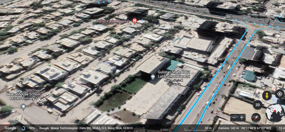
With Google Earth, users can zoom in to take a closer look at any place on Earth. This feature allows you to view 3D buildings and terrain, as well as explore cities, regions, and countries in detail.
You can even use the Street View feature to explore places with 360-degree panoramic views of streets, which can be quite useful for virtual tours.
Weather patterns
Through the use of interactive maps, Google Earth allows you to easily view global weather patterns and stay up to date on the latest forecasts.
You can also get an idea of the wind direction and speed in specific locations around the world.
Discover Places
With Google Earth, you can explore the world from your desktop or mobile device and discover interesting places that you may not have known about before.
You can search for landmarks, restaurants, hotels, parks, mountains, oceans, and much more.
Sharing
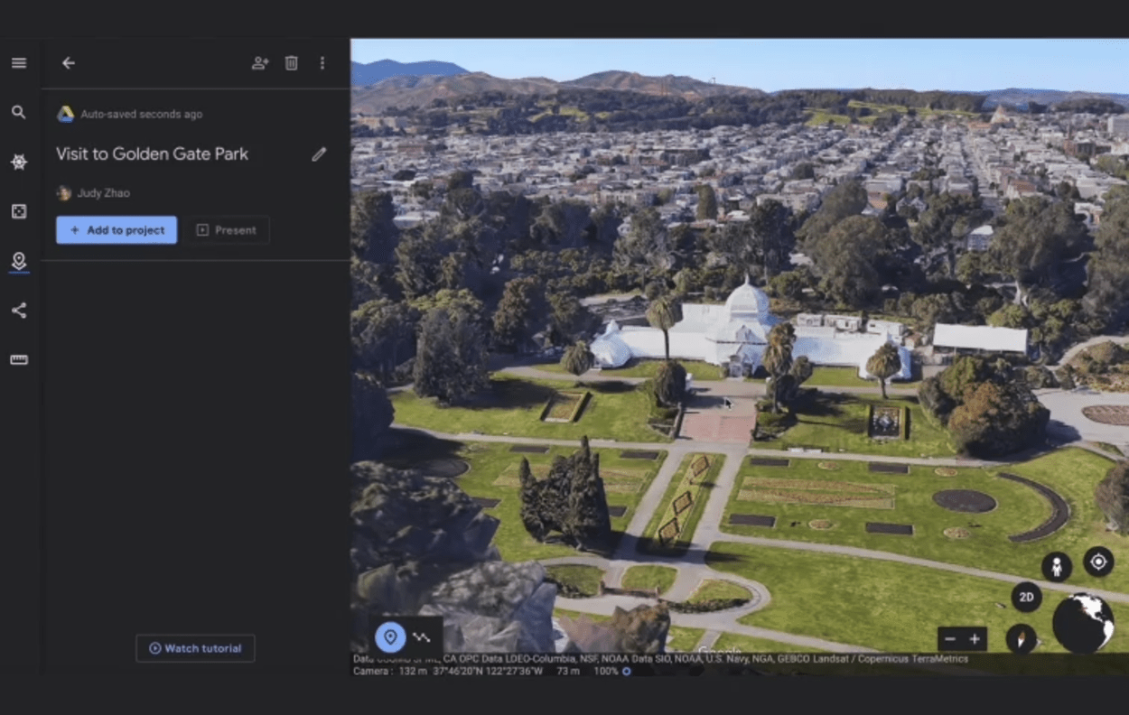
Google Earth allows you to share your discoveries with others by creating custom placemarks and annotations on the map.
You can also collaborate with others in real time by inviting them to view and edit your project together.
How Does Google Earth Work?
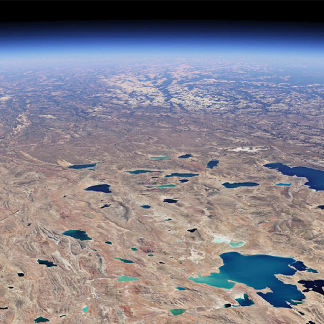
Google Earth is a virtual globe, map, and geographic information program that is free to use. It provides a 3D view of the Earth from space, as well as aerial photographs of almost anywhere on the planet.
Using Google Earth is relatively simple. First, you need to download the program on your computer or mobile device. Once downloaded, you can begin exploring the world.
With the basic version, you can zoom in and out using the mouse or touchscreen, search for places and explore the landscape in 3D.
If you want to get even more detailed, you can activate additional features like street view or satellite images to get a more detailed view of the area. The program also allows users to take measurements and record points of interest on a map.
It’s also possible to create routes or measure distances between two points. These measurements can then be exported into other formats or used with other programs.
Which is Better Google Earth or Google Maps?
When it comes to comparing Google Earth and Google Maps, it really depends on what you’re looking for. Both services offer a fantastic array of features and both provide an easy-to-use interface.
Google Earth offers more detailed satellite images than Google Maps. Google Earth allows users to explore the earth in a variety of ways such as 3D views, street views, flyovers, and historical imagery. With Google Earth, users can also take virtual tours of places worldwide.
Google Maps is a great way to find directions or explore locations on the map, but it doesn’t offer the same level of detail as Google Earth.

Google Maps also offers real-time traffic information, making it easier for drivers to determine the fastest route between two destinations. Google Earth doesn’t offer this feature, so if you’re looking for up-to-date traffic information, then Google Maps is the way to go.
When it comes down to it, the choice between Google Earth and Google Maps really depends on what you’re looking for. If you need detailed satellite images, then Google Earth is the better choice. On the other hand, if you need live traffic updates, then Google Maps will be your go-to service.
FAQs
How Accurate Is the Information on Google Earth?
Google Earth uses a variety of sources to provide the most accurate and up-to-date information possible. The satellite imagery and maps are regularly updated to provide a detailed and accurate view of the world.
However, it’s important to note that some of the information on Google Earth may not be 100% accurate, as it’s based on the data that’s available at the time the map is created.
Can I Measure Distances and Areas on Google Earth?
Yes, Google Earth includes a measurement tool that allows you to measure distances and areas on the map.
To use the measurement tool, simply click on the “Tools” menu and select “Measure.” Then, click on the map to set the starting point of the measurement, and click again to set the ending point. The measurement will be displayed on the map in the units of your choice (e.g. kilometers, miles, etc.).
Can I Use Google Earth to View Historical Imagery?
Yes, Google Earth includes a feature called “Historical Imagery” that allows you to view older satellite images of a location. To access this feature, click on the “View” menu and select “Historical Imagery.” Then, use the slider at the bottom of the map to select the date range you want to view.
Keep in mind that the availability of historical imagery may vary depending on the location and the date range you are looking for.
Conclusion
- Google Earth is an amazing tool for exploring the world and can provide some great insights.
- It’s free to use, though you may need additional subscriptions or hardware in order to access certain features.
- Google Earth also has some advantages over Google Maps when it comes to navigation, including 3D images and street view.
- Google Maps also offers real-time traffic information, making it easier for drivers to determine the fastest route between two destinations. Google Earth doesn’t offer this feature, so if you’re looking for up-to-date traffic information, then Google Maps is the way to go.
- All in all, Google Earth is a great option for anyone looking to explore the world around them and gain insight into our planet.