![Is There Better Quality Than Google Earth? [Find Out]](https://gearthhacks.com/wp-content/uploads/2023/02/imageedit_1_7855155069.jpg)
![Is There Better Quality Than Google Earth? [Find Out]](https://gearthhacks.com/wp-content/uploads/2023/02/imageedit_1_7855155069.jpg.webp)
Greetings, fellow virtual adventurers! Have you ever gazed at the stunning satellite imagery on Google Earth and wondered if there’s an even better way to explore the world from above? Well, hold onto your hats because you’re about to embark on a journey to discover if there’s anything out there that surpasses the quality of Google Earth.
Google Earth is an incredible tool that allows us to explore the world like never before. But with so many advancements in technology, it’s natural to wonder if there’s something better out there.
In this blog post, we’ll be comparing Google Earth to other aerial imagery and mapping platforms, to find out if there’s anything that comes close to matching or even exceeding, its quality.
Therefore, if you’re a fan of Google Earth, or just love exploring the world from above, then this post is definitely for you. Get ready to be amazed, and find out if there’s anything out there that can top the incredible quality of Google Earth!
Comparison of Google Earth to Other Mapping Platforms

Some of the mapping platforms other than Google Earth are:
- Bing Maps
- Mapbox
- OpenStreetMap
- ESRI ArcGIS
- Apple Maps
| Platform | 3D modeling and visualization | Real-time data integration |
| Google Earth | High | Low |
| Bing Maps | High | Low |
| Mapbox | High | High |
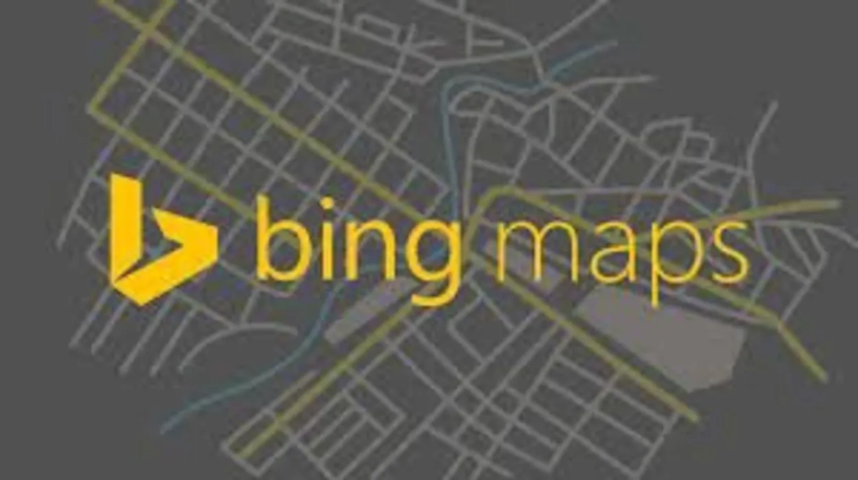
Bing Maps
Bing Maps is a mapping platform developed by Microsoft that offers similar features to Google Earth, including 3D imagery and street-level views.
However, it’s not as widely used as Google Earth and may not have as extensive coverage in some areas.
Mapbox
Mapbox is a cloud-based mapping platform that offers a wide range of customization options for developers.
It also has a strong focus on real-time data integration, making it a great option for businesses that need to track and analyze large amounts of data.
OpenStreetMap
OpenStreetMap is a community-driven mapping platform that is completely open-source.
It has a strong focus on local data and community contributions, making it a valuable resource for businesses and individuals who need detailed information about specific areas.
ESRI ArcGIS
ESRI ArcGIS is a powerful GIS software that is commonly used by businesses, governments, and researchers for mapping and analyzing data. It offers advanced functionality for 3D modeling, spatial analysis, and data visualization, making it a great option for businesses that need to analyze large amounts of data.
Apple Maps
Apple Maps is a mapping platform developed by Apple, available on all Apple devices. It offers similar features to Google Earth and Bing Maps but is only available on Apple devices.
It has a strong focus on providing a seamless experience for Apple users, but the coverage and the features are not as extensive as Google Earth.
Features and Functionality

3D Modeling and Visualization
Google Earth offers advanced 3D imagery and visualization tools that allow users to explore the world in a realistic and interactive way. Other mapping platforms such as Bing Maps and ESRI ArcGIS also offer 3D modeling and visualization, but the level of detail and interactivity may vary.
Mapbox, for example, provides 3D maps with customizable design and data visualization which can be very useful for developers.
Real-time Data Integration
Google Earth does not have a strong focus on real-time data integration, making it less suitable for businesses that need to track and analyze large amounts of data in real time.
Mapbox, on the other hand, has a strong focus on real-time data integration and offers a wide range of tools for tracking and analyzing data in real time.
Navigation and Routing
Google Earth offers basic navigation and routing features.
But other mapping platforms such as Bing Maps and Apple Maps have more advanced routing options and provide more detailed information about traffic and road conditions.
Street-level Imagery
Google Earth offers street-level imagery for many areas, allowing users to explore cities and neighborhoods in detail.
Other platforms such as Bing Maps and Apple Maps also offer street-level imagery, but coverage and the level of detail may vary.
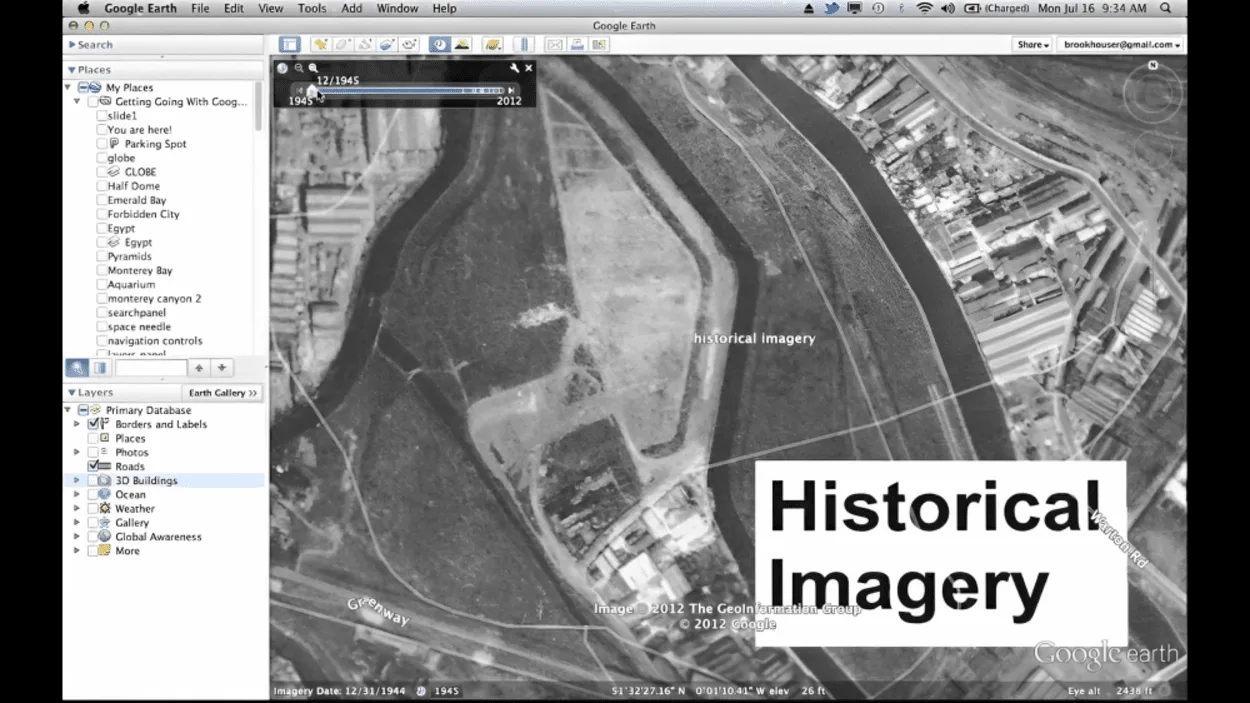
Historical Imagery
Google Earth offers the ability to view historical imagery, which can be useful for researchers and businesses looking to track changes over time.
Other platforms like Bing Maps also have an option for historical imagery, but they may not have as extensive of a collection as Google Earth.
Accuracy and Precision

The comparison of the precision and accuracy of mapping services is as follows:
- Comparison of data sources: Google Earth, Bing Maps, Mapbox, OpenStreetMap, ESRI ArcGIS, and Apple Maps all use various data sources to generate their maps, such as satellite imagery, aerial photography, and user-generated content. The quality and accuracy of these data sources can vary, which can affect the overall accuracy of the maps.
- Comparison of updating frequency: Google Earth, Bing Maps, Mapbox, OpenStreetMap, ESRI ArcGIS, and Apple Maps all update their maps on a regular basis, but the frequency and timeliness of updates can vary. For example, Google Earth updates its maps every month, while OpenStreetMap updates its maps more frequently, as the data is community-driven.
- Comparison of error margin: All mapping platforms have a degree of error, which can vary between platforms. For example, Google Earth has an error margin of around 1-2 meters for its satellite imagery, while OpenStreetMap has a higher error margin due to the fact that the data is community-driven and not all contributors use the same level of precision.
When it comes to accuracy and precision, all mapping platforms have some level of error. However, the data source, updating frequency, and error margin can vary, and it’s important to consider these factors when choosing a mapping platform.
For example, if you need high-precision data, ESRI ArcGIS may be a better option than OpenStreetMap.
In summary, accuracy and precision are important factors to consider when choosing a mapping platform. Businesses and individuals should compare the data sources, updating frequency, and error margin of different platforms and choose the one that best meets their needs.
UI and Experience
Ease of Use
Google Earth, Bing Maps, Mapbox, OpenStreetMap, ESRI ArcGIS, and Apple Maps all have user-friendly interfaces, but the level of ease of use can vary depending on the platform.
For example, Google Earth has a simple and intuitive interface that is easy for most users to navigate, while ESRI ArcGIS has a more complex interface that is better suited for advanced users.
Customization Options
Google Earth, Bing Maps, Mapbox, OpenStreetMap, ESRI ArcGIS, and Apple Maps all offer some level of customization options, but the level of customization can vary between platforms.
For example, Mapbox offers a wide range of customization options for developers, while OpenStreetMap has more limited options.
Mobile Compatibility
Google Earth, Bing Maps, Mapbox, OpenStreetMap, ESRI ArcGIS, and Apple Maps all have mobile applications that allow users to access maps and navigation features on their mobile devices.
However, the level of compatibility and functionality can vary between platforms. For example, Google Earth’s mobile application is available on both iOS and Android, while OpenStreetMap’s mobile application is only available on Android.
FAQs
Can I Use Google Earth for Navigation?
Yes, Google Earth offers basic navigation and routing features.
But other mapping platforms such as Bing Maps and Apple Maps have more advanced routing options and provide more detailed information about traffic and road conditions.
Is Google Earth Accurate?
Google Earth is generally accurate, but all mapping platforms have some level of error.
The accuracy of Google Earth can be affected by the quality of data sources, the frequency of updates, and the error margin.
Can I Customize Google Earth?
Yes, Google Earth offers some level of customization options, such as the ability to add placemarks and create custom tours.
However, other platforms such as Mapbox offer more advanced customization options for developers.
Is There Any Alternative to Google Earth?
Yes, there’re several alternative mapping platforms available such as:
- Bing Maps
- Mapbox
- OpenStreetMap
- ESRI ArcGIS
- Apple Maps
These offer unique features and functionality that may be better suited to specific needs.
Conclusion
- In conclusion, Google Earth is a widely used and powerful mapping platform, but it may not be the best option for all businesses and individuals.
- Other mapping platforms such as Bing Maps, Mapbox, OpenStreetMap, ESRI ArcGIS, and Apple Maps offer unique features and functionality that may be better suited to specific needs.
- Businesses and individuals should consider their specific mapping needs and compare the features of these platforms before deciding which one to use.
- The user interface and experience are important factors to consider when choosing a mapping platform. Businesses and individuals should compare the ease of use, customization options, and mobile compatibility of different platforms and choose the one that best meets their needs.
Related Articles
- Why Is Google Earth so Good? [Truth]
- How Do I Change the Year on Google Earth iPhone App? [Revealed]
- How do I Look at Old Pictures on the Google Earth App? (Informative)