Google Earth is a pretty cool tool that lets you explore the world from various perspectives, like having your own virtual globe and map. It’s useful for all sorts of people – whether you love to travel or want to explore new places from the comfort of your home.
With Google Earth, you can view detailed maps, satellite imagery, and even 3D models of cities and landmarks worldwide. Plus, it has some pretty advanced features like Street View and historical imagery that make it even more interesting and informative.
Using Google Earth can be a lot of fun, and it can give you a whole new perspective on the world we live in. You can discover new places, explore familiar ones in greater detail, and even get directions to your next destination.
In this article, we’ll take a closer look at all the amazing features of Google Earth that you can use for yourselves. So without any delay, let’s get started.
What are the Main Features of Google Earth?
The following are the main features of Google Earth:
Search Feature
The search bar in Google Earth is like a magic wand that can instantly transport you to any place you desire. Want to see the Eiffel Tower in Paris? Just search for “Eiffel Tower”, and Google Earth will take you there, showing you a 3D model of the tower and its surrounding area.
Not only does the search feature allow you to find famous landmarks, but it also lets you search for specific addresses, cities, and even zip codes. You can even use it to find businesses in a specific area, such as restaurants and stores.
What’s more, the search feature also supports natural language queries, which means you can type in questions like “Where is the nearest park?” and you’ll be able to find it. In addition to its basic search functionality, Google Earth offers various advanced search options, such as filtering by category and refining your search with keywords.
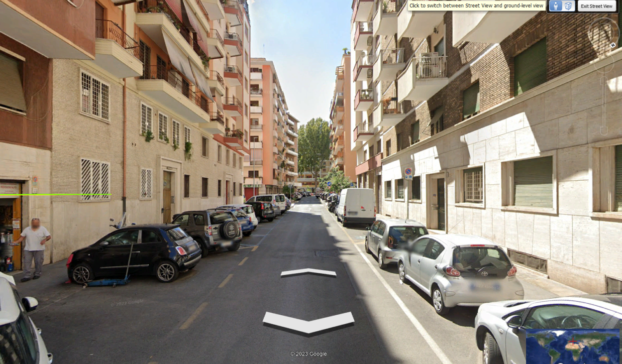
Street View
Google Earth’s Street View feature is like having a personal tour guide take you around the world from the comfort of your own home. It’s a mind-blowing experience that lets you explore famous landmarks, bustling city streets, and remote countryside roads from a first-person perspective.
With Street View, you can experience the sights and sounds of a location as if you were actually there. You can explore neighborhoods, get a sense of the local culture, and even find hidden gems you might have missed.
One of the coolest things about Street View is that it allows you to “walk” down streets and see everything from storefronts to street art and even get a glimpse of the locals going about their daily business. You can also take a 360-degree look at your surroundings, creating a truly immersive experience.
But Street View is not just limited to streets. You can also explore indoor locations like museums and shops, climb mountains, and explore hiking trails.

Voyager
Google Earth’s Voyager feature is a virtual guide that can take you on an adventure to some of the fascinating places on earth. It’s an interactive experience that lets you explore the world’s most interesting locations, from deep-sea trenches to mountain peaks.
Voyager offers guided tours and interactive stories that allow you to discover new things about our world. It’s a tool for learning about history, science, and culture in a fun and engaging way. With constantly updated content, there’s always something new to discover.
What sets Voyager apart is its interactive nature. You can zoom in on specific locations, play games, and test your knowledge about the places you’re exploring. Voyager is not just for entertainment but a great educational resource as well.
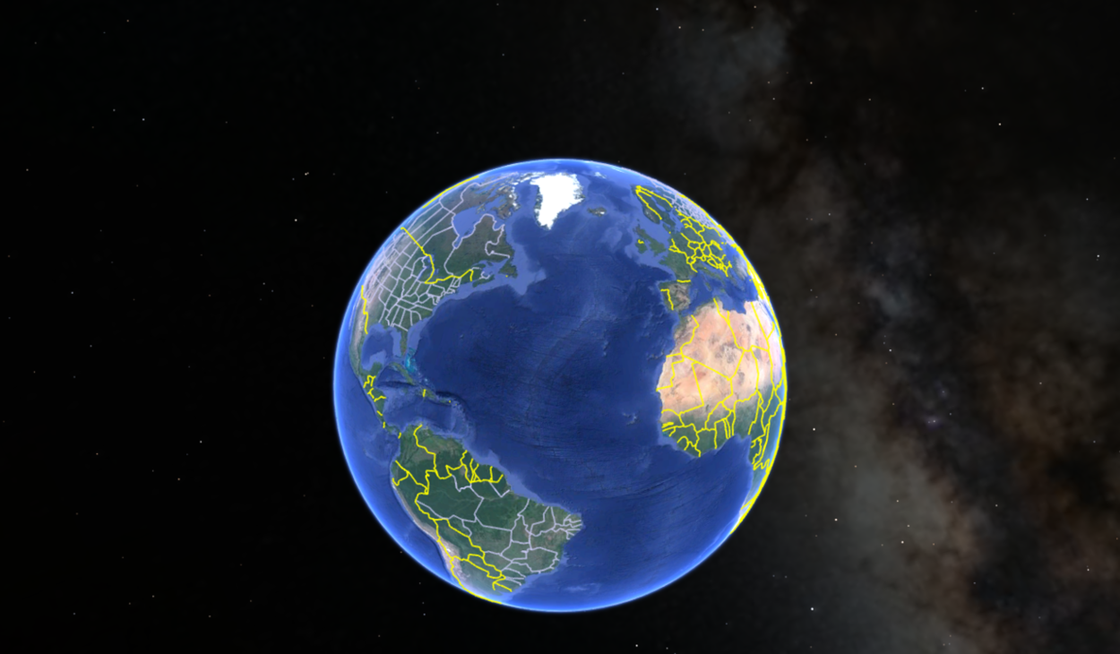
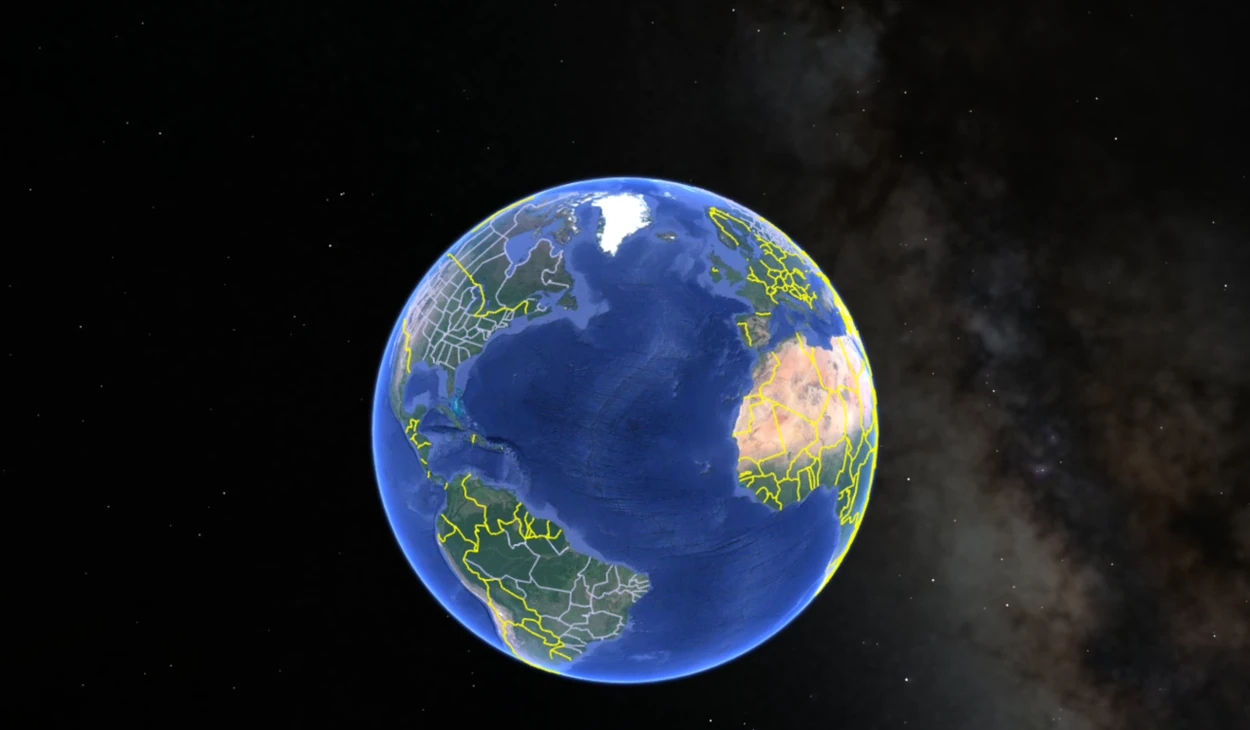
3D Maps
Google Earth’s 3D maps can take you on a breathtaking journey across the globe. With every nook and cranny of the world visible in stunning 3D, you’ll feel like you’re standing right in the middle of it all.
You can use 3D maps to explore world-famous landmarks and natural wonders from a whole new perspective. The attention to detail is incredible; you’ll be amazed by it. You’ll feel like you’re there, from the Great Barrier Reef to the Grand Canyon.
Beyond their stunning visual impact, 3D maps are also valuable for planning and analysis. You can use them to understand city layouts better, plan your next road trip, or even assess the potential impact of natural disasters.
Historical Imagery
Have you ever wished you could travel back in time and witness how the world looked like in the past? Well, Google Earth’s historical imagery feature makes it possible! This amazing tool allows you to compare satellite images from different years and observe how cities, landscapes, and countries have transformed over time.
Not only is it a captivating visual experience, but it’s also an essential resource for researchers, historians, and educators. With historical imagery, you can gain a unique perspective on the evolution of our planet and how various events have impacted the environment.
Imagine being able to track the growth of a bustling city or seeing the effects of a natural disaster from above. You can even use it to explore the history of your own neighborhood and discover how it has changed over the years.
Moreover, you can check out a basic tutorial on Google Earth below:
Time-lapse
Google Earth’s time-lapse feature is a visually stunning tool that allows you to see how our planet has transformed over time. With this feature, you can watch cities grow and expand, coastlines shift, and nature takes its course in a mesmerizing video experience.
However, the time-lapse feature is more than just a breathtaking visual display. It also serves as an important educational tool for understanding the effects of climate change and human activity on our environment. By viewing the changes that occur over decades in a matter of minutes, we gain a unique perspective on the impact of our actions.
What’s more, you can explore these time-lapse videos from various angles and perspectives, making it feel like you’re soaring above the Earth and watching the world evolve beneath you.
If you’re fascinated by our planet and its history, Google Earth’s time-lapse feature is a must-try. Get ready to be awestruck by our world’s stunning beauty and complexity, captured in stunning detail.
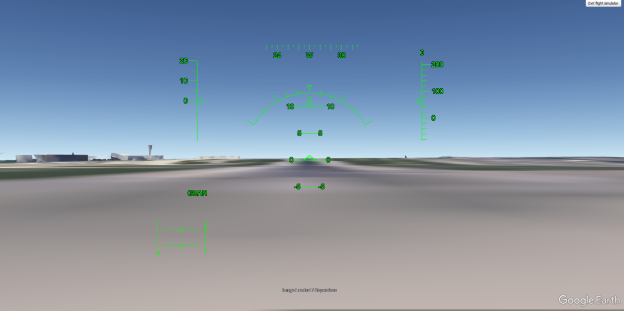
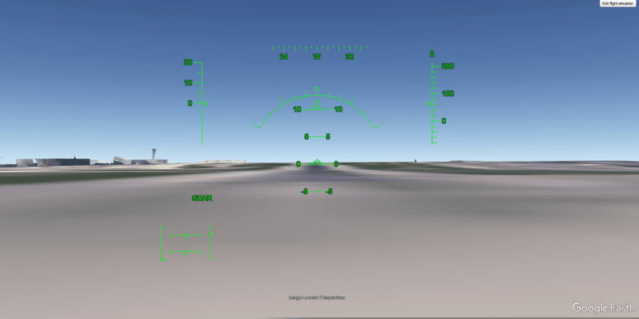
Flight Simulator
This amazing feature allows you to experience the thrill of flying a plane and explore the world from above in a whole new way.
With the flight simulator, you can choose from a range of aircraft and fly over any location on the planet. Whether you want to soar over the majestic mountains, tour the bustling city skyline or even fly over your own neighborhood, the choice is yours.
But the flight simulator is more than just a fun way to pass the time. It’s also a valuable tool for pilots and aviation enthusiasts who want to practice their skills and test their knowledge of flight systems and navigation.
And with realistic controls and a dynamic weather system, the flight simulator provides an incredible experience that will leave you feeling like a pro pilot.
What are the Benefits of Google Earth Features?
Google Earth features provide numerous benefits, including virtual world exploration through 3D maps, street view, and flight simulators. Its historical imagery and time-lapse videos offer an engaging and interactive learning experience for students of all ages.
The search feature helps in discovering new places and information about them. The Voyager feature lets users take guided tours of the world’s wonders and cultures.
An app is a valuable tool for planning trips, hiking, and exploring new cities. It’s also free and easily accessible from various devices, including desktops, laptops, smartphones, and tablets.
FAQS
What is the 3D Map feature in Google Earth?
Google Earth’s 3D Map feature offers a lifelike, 3D planet perspective. This feature provides a user-friendly interface to explore locations with satellite imagery and terrain modeling technology, creating a realistic and interactive experience.
What is the Voyager feature in Google Earth?
Voyager is your very own private tour guide within Google Earth! This feature enables you to embark on exciting virtual trips all over the world, complete with fascinating tidbits about the places you’re visiting. Consider it as your exclusive travel planner that lets you discover the world while staying snug at home.
Conclusion
- Google Earth is a fun tool that provides a unique perspective on our world. There are several exciting features of Google Earth that users can enjoy.
- This free online mapping tool provides 3D buildings, street maps, and other geographic information.
- It allows users to explore the world in detail, view different locations, and gain insights into different places’ environments, cultures, and historical events.
- Google Earth features offer benefits such as virtual exploration, educational value, and aid in planning and decision-making processes.
Related Articles
- Is Google Earth A True GIS? (Know now)
- What Are The Benefits Of Google Earth? (Revealed)
- How Do I Navigate Google Earth On iPad? (Know now)