![What Are the Three Advantages of Google Earth?[Find Out]](https://gearthhacks.com/wp-content/uploads/2022/12/Google-Earth-GeologyPage_1250x-2.jpg)
![What Are the Three Advantages of Google Earth?[Find Out]](https://gearthhacks.com/wp-content/uploads/2022/12/Google-Earth-GeologyPage_1250x-2.jpg.webp)
Google Earth is a powerful and versatile tool that offers a wealth of features and benefits. It allows users to explore the world in an interactive and immersive way, making it a valuable tool for personal use, education, and business.
The purpose of this blog post is to explore three of the main advantages of using Google Earth: its detailed mapping capabilities, its educational value, and its business and professional uses.
Google Earth offers high-resolution satellite imagery, 3D terrain and building models, street view integration, and historical imagery. These features make it an incredibly powerful tool for exploring and understanding locations around the world.
Whether you’re a travel enthusiast, a student, or a professional, Google Earth has something to offer. Continue reading to get detailed information.
Google Earth Is Free to Use

One of the great things about Google Earth is that it’s free to use for personal and non-commercial use. This means that anyone can access and explore the world using Google Earth without having to pay any fees.
This makes it an accessible tool for anyone who is interested in exploring the world, whether they are a casual user or a professional. The free version of Google Earth includes all the basic features such as:
- High-resolution satellite imagery
- 3D terrain
- Building models
- Street view integration
- Historical imagery
- The ability to create and save custom maps and placemarks.
It also includes the educational feature Voyager, a measurement feature, and the ability to share custom maps and tours with others.
For businesses and professionals, Google Earth Pro and Google Earth Studio have additional features and capabilities that are useful for their specific needs. However, it’s not free, but it’s offered with a low-cost subscription.
The fact that Google Earth is free to use for personal and non-commercial use makes it an accessible tool for anyone who is interested in exploring the world. The free version includes all the basic features, and for businesses and professionals, additional features and capabilities are available with a low-cost subscription.
This allows users to take advantage of the power of Google Earth without having to worry about high costs or hidden fees.
Explore the World From Your Computer
Google Earth is a web-based application and a mobile app that allows users to explore the world from their computers or mobile devices. This means that users can access Google Earth from anywhere, at any time, as long as they have an internet connection. This makes it an incredibly convenient tool for anyone who is interested in exploring the world.
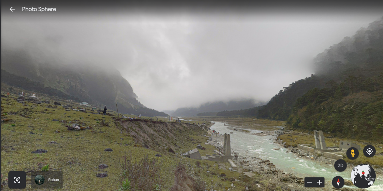
One of the great things about Google Earth is that it provides users with an interactive and immersive experience. Users can zoom in and out of different locations and explore them in 3D.
They can also switch between different types of maps, such as satellite, terrain, and street view, to get a better understanding of a location. This makes it an incredibly powerful tool for anyone who is interested in exploring the world, whether they are a travel enthusiast or a professional.
Google Earth also provides users with the ability to save their favorite locations and tours, allowing them to revisit them later or share them with others. This feature is particularly useful for travel enthusiasts, as it allows them to plan their own virtual tours and share them with others.
The fact that Google Earth is a web-based application and mobile app that allows users to explore the world from their computers or mobile devices makes it an incredibly convenient tool for anyone who is interested in exploring the world.
The interactive and immersive experience, combined with the ability to save and share locations and tours, makes it an incredibly powerful tool for anyone who is interested in exploring the world. Whether you’re a traveler, a student, or a professional, Google Earth has something to offer.
Detailed Mapping Capabilities
| Feature | Description |
| High-resolution satellite imagery | Allows users to zoom in and out of different locations and view them in stunning detail. |
| 3D terrain and building models | Provide a more realistic experience, allowing users to see the contours of a location and the heights of buildings and other structures. |
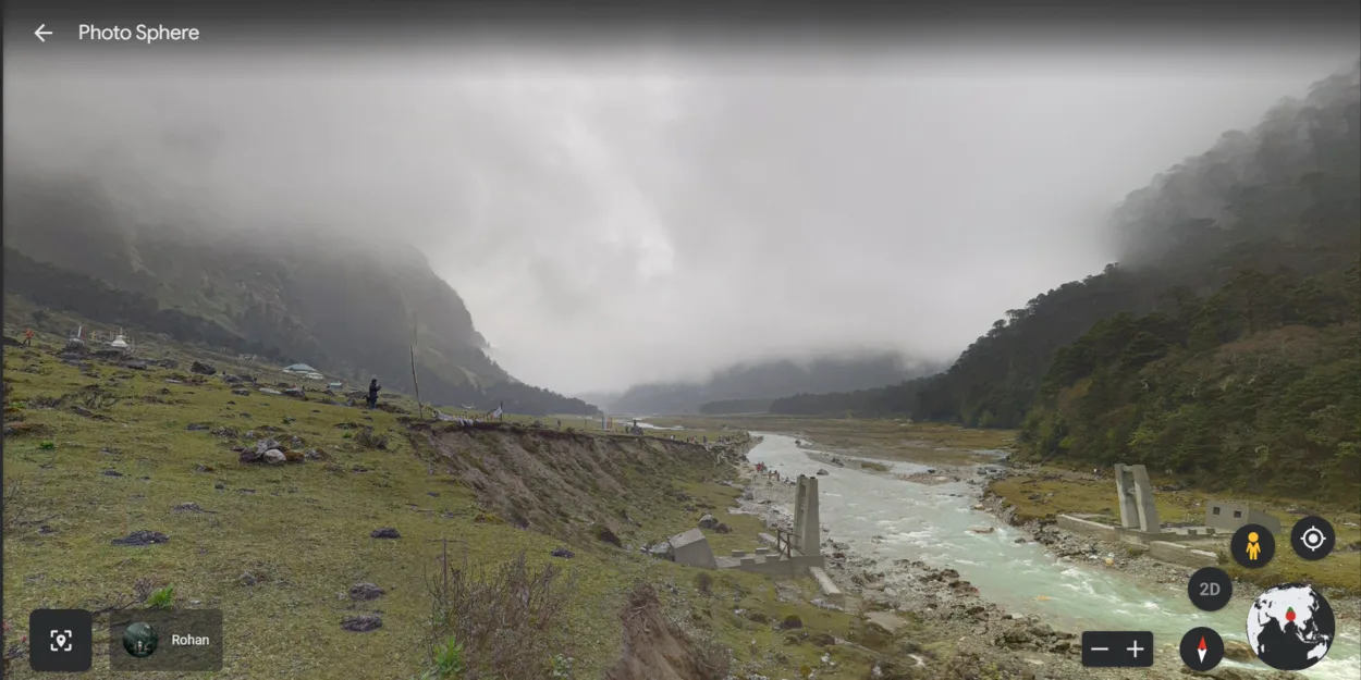
| Street view integration | Allows users to explore a location as if they were walking down the street. |
One of the most notable features of Google Earth is its comprehensive mapping capabilities. With high-resolution satellite imagery, users can zoom in and out of various locations, providing a detailed and stunning view of the place.
This is particularly useful for remote locations and identifying specific landmarks. Additionally, users can switch between different types of maps such as satellite, terrain, and street view, to get a better understanding of the location.
Another key advantage of Google Earth is its 3D terrain and building models, which provide a more realistic experience. Users can view the contours of a location and the heights of buildings, making it useful for urban planning and identifying potential hazards.
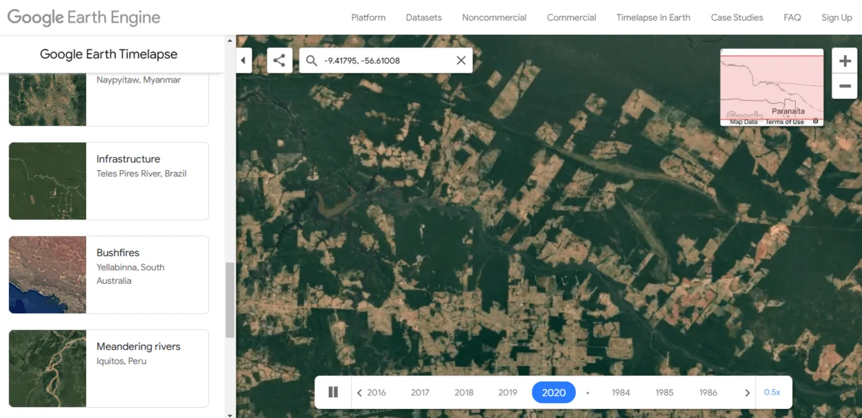
Google Earth also provides historical imagery, which allows users to see a location as it appeared in the past. This is particularly useful for researchers and those interested in how a location has changed over time. It also allows for tracking the development of a specific location and comparing changes that have occurred.
Lastly, the street view integration allows users to explore a location as if walking down the street. This feature is beneficial for businesses as it allows them to showcase their location and attract customers. It also allows users to see the street-level view of a location and get a sense of the surrounding area.
Analysis and Research

Google Earth is an incredibly powerful tool for analysis and research. The detailed mapping capabilities and historical imagery allow users to view and analyze locations in a variety of ways. This makes it a valuable tool for researchers and analysts in a wide range of fields.
One of the key advantages of using Google Earth for analysis and research is its ability to view and analyze entire cities and regions. This allows users to identify patterns and trends that can inform decisions in fields such as urban planning, environmental monitoring, and emergency management.
For example, in urban planning, Google Earth can be used to identify patterns of development, analyze transportation networks, and identify areas that may be at risk of flooding or other hazards.
Another advantage of using Google Earth for analysis and research is its ability to view and analyze changes over time.
The historical imagery feature allows users to view a location as it appeared in the past, and compare it to how it looks today. This is particularly useful for researchers and analysts who are studying the effects of climate change, land use, and other factors on the environment.
Google Earth’s ability to measure distances, and areas and create annotations and placemarks, makes it a valuable tool for researchers, analysts, and surveyors. They can use it to create and share maps, data, and information, which allows them to collaborate and make data-driven decisions.
In conclusion, Google Earth’s detailed mapping capabilities and historical imagery make it an incredibly powerful tool for analysis and research. It allows users to view and analyze entire cities and regions, as well as changes over time, making it a valuable tool for researchers and analysts in a wide range of fields.
The ability to measure, create annotations and placemarks and collaborate on projects, makes it a valuable tool for surveyors and analysts as well.
FAQs
Can I Use Google Earth for Commercial Use?
Yes, Google Earth Pro and Google Earth Studio are available for commercial use with a low-cost subscription.
However, the basic version of Google Earth is free to use for personal and non-commercial use only.
Does Google Earth Have Real-time Updates?
Google Earth relies on satellite imagery, which isn’t always in real-time. The imagery is typically updated every one to three years, depending on the location.
However, Google is constantly working on improving the image quality and frequency of updates.
Can I Measure Distances and Areas on Google Earth?
Yes, Google Earth has a built-in measurement feature that allows users to measure distances and areas.
This feature is particularly useful for researchers, surveyors, and educators.
Can I Create My Own Tours and Presentations on Google Earth?
Yes, Google Earth has a built-in feature that allows users to create and share custom tours and presentations.
This feature is particularly useful for educators and professionals who want to share information about a specific location or topic.
Conclusion
- In conclusion, Google Earth is a powerful and versatile tool that offers a wealth of features and benefits.
- The detailed mapping capabilities, including high-resolution satellite imagery, 3D terrain, and building models, street view integration, and historical imagery, make it an incredibly powerful tool for exploring and understanding locations around the world.
- It’s free to use for personal and non-commercial use, making it accessible to everyone.
- Google Earth is also an incredibly valuable tool for education and research, with its Voyager feature, measurement feature, 3D imagery and VR support, and tools for creating and sharing custom tours and presentations.
- Its ability to view and analyze entire cities and regions, as well as changes over time, makes it a valuable tool for researchers and analysts in a wide range of fields.
Related Articles
- Is Google Earth Really Live? [Revealed]
- How Old Are the Images on Google Earth?[Revealed]
- How Often Does Google Earth Get Updated?[Truth]