A versatile tool, Google Earth is quite effective and may be used for many different things. You can use it to see the globe from above, travel to new locations, discover more about the local area and topography, and even navigate.
There’re endless possibilities for what you can do with Google Earth. You can do lots of cool things, discover new places, have a tour in an unknown town (virtually), and you have multiple things that you can do at each point. In this article, we’ll show you how to find your way around, learn about different places, and use Google Earth for business and marketing purposes.
So what’re you waiting for? Start exploring the world today with Google Earth.
What can Google Earth be Used for?
Google Earth is a versatile tool that can be used for a variety of purposes. Many people use it for leisure, such as exploring new places or getting a bird’s eye view of their hometown. Others use it for work, such as planning a hiking trip or checking out a potential vacation rental.
But Google Earth can also be used for more serious pursuits, such as research or environmental conservation. By accessing satellite data and other public information, Google Earth can be used to track changes in the environment, monitor endangered species, or investigate human rights abuses.
Whether you’re using it for fun or for work, Google Earth is a helpful tool that can help you learn more about our world.
What Cool Things can you do on Google Earth?
Google Earth is an all-rounder tool that can be used for all sorts of things, from exploring different parts of the world to planning a vacation. And while it’s fun to explore different places, did you know that you can also use Google Earth for some pretty cool stuff?
If not, so let’s check out some really cool features of Google Earth that you’ll love!
Features of Google Earth
Following are some amazingly impressive features of Google Earth that you must know:
Discover new places
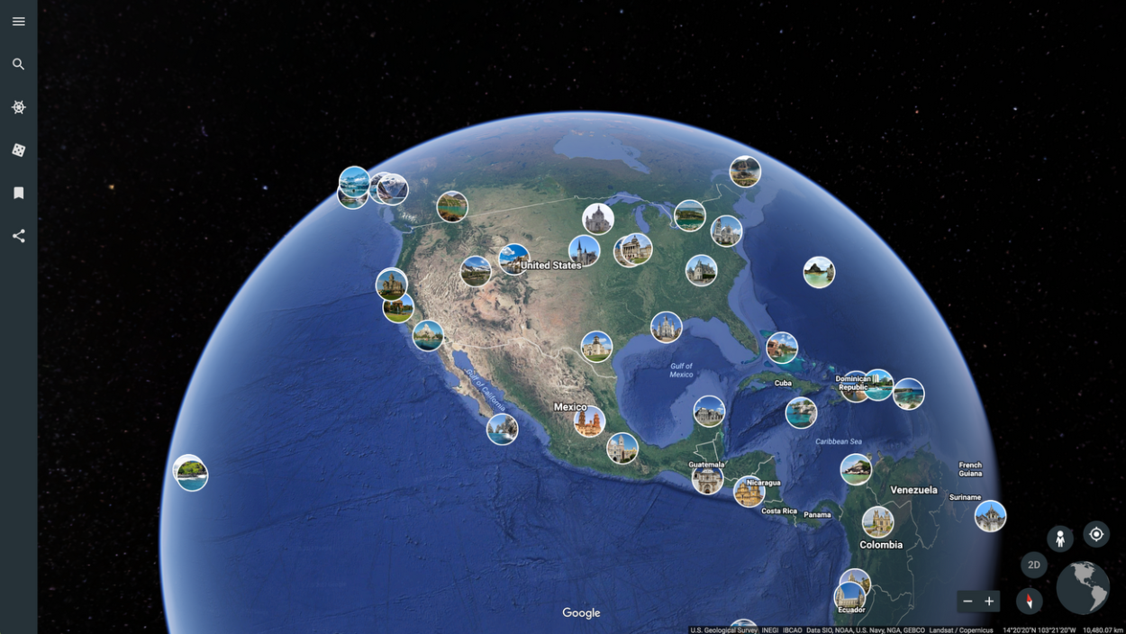
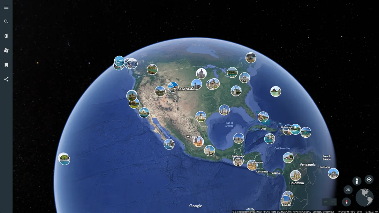
Looking for a new place to explore? Google Earth is a great resource for finding new places to visit. And best of all, it’s not going to cost you any penny.
To get started, simply open Google Earth and zoom in on an area you’re interested in exploring. You can use the search function to find specific places, or you can just browse around. Once you find a place you’d like to visit, you can learn more about it by reading the information that’s available. You can also view photos and videos to get a better idea of what the place is like.
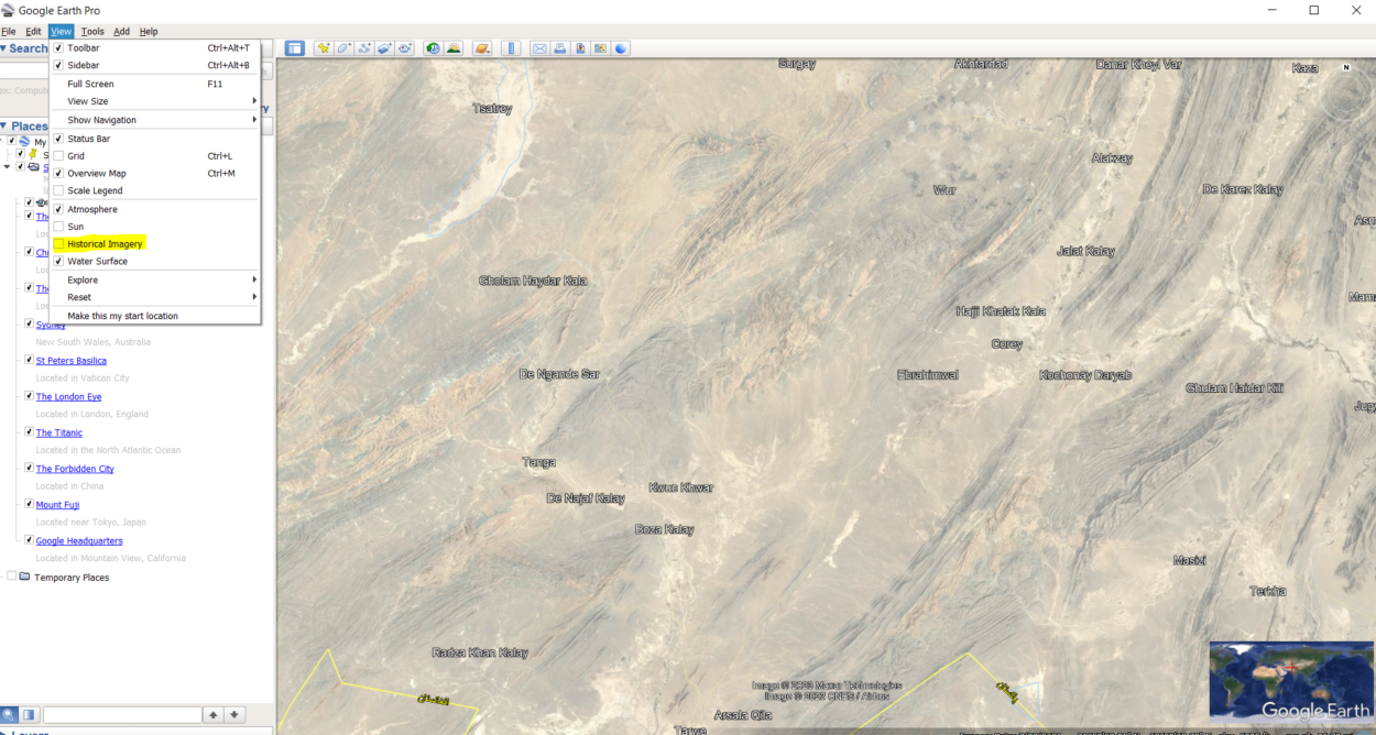
View past
You may view previous satellite photographs of any location on Earth with Google Earth. When examining how a region has changed through time, such as the expansion of a city or the clearing of a forest, this can be helpful.
Enter the place into Google Earth’s search box and then choose the “Historical Imagery” option from the menu to view earlier images. Google Earth will then display the satellite image from that time period once you choose the precise date you want to view it.

Find your house
Google Earth is a free program that you can download onto your computer. Once you have it installed, you can use it to search for homes in any location. Just enter an address or city name into the search bar and hit enter. A map of the area will appear on your screen.
If you see your home, you can use the “Street View” option to get a 360-degree view of the surrounding area.
Plan a road trip
Figuring out the route you’re going to take is one of the first steps in road trip planning. This might be a tricky task, especially if you don’t know the area well. Fortunately, there’s a tool that can greatly simplify things: Use Google Earth.
You can examine an aerial picture of your route on Google Earth to better understand the topography. It may be used to schedule your stops, locate attractions, and much more. Therefore, be sure to test Google Earth if you’re planning a road trip.
Data analysis
Google Earth allows users to view data in a three-dimensional environment. This capability can be particularly helpful when trying to visualize data sets or patterns. Google Earth also offers a variety of other features that make it a valuable tool for data analysis, including the ability to measure distances and areas, view historical data, and overlay different data sets.
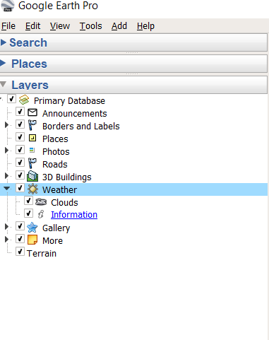
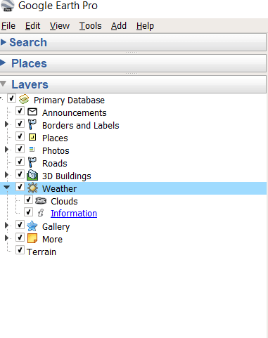
See real-time weather patterns
Google Earth provides you access to weather patterns. To access the weather layer, simply open Google Earth and click on the “Layers” menu.
Then, scroll down and select the “Weather” layer. Once you have the weather layer turned on, you’ll see icons for various weather conditions, such as clouds, precipitation, and temperature. You can click on these icons to see more information about the current weather conditions in that area.
The weather layer is a great way to stay up-to-date on the latest weather patterns, whether you’re interested in tracking a storm or planning your next vacation.
What is the Best Way to use Google Earth?
There’s not a single answer to this question as there can be several best ways to use Google Earth; the following are just a few wonderful ways to use Google Earth.
What can Students do with Google Earth?
Students can use Google Earth for academics such as research, creating presentations, planning journeys, and more. Here’re some ideas on how students can use Google Earth:
| Use it for research: | Google Earth can be used to research a variety of topics. For example, students can research the location of a historical event, the geography of a place, or the habitat of an animal. |
| Create presentations: | Google Earth can be used to create presentations about a place or topic. For example, students could create a presentation about the Amazon rainforest or the history of the Egyptian pyramids. |
| Plan journeys: | Google Earth can be used to plan journeys. For example, students can use it to plan a road trip or a trekking expedition. |
What can Professionals do with Google Earth?
Google Earth isn’t only great for students but it can also be used by professionals. Here’re just a few examples of what professionals can do with Google Earth:
- Research a new location: You can use Google Earth to get a feel for a new location before making the commitment to move there. Check out the surrounding area, see what the traffic is like, and get an idea of the lay of the land.
- Visualize data: If you have data that you need to visualize, Google Earth can be a helpful tool. You can create charts and graphs overlaid on a map.
Moreover, by learning all the tools of Google Earth from the video below, you can use them for other things as well.
What can Businesses do with Google Earth?
Google Earth is more than just software that lets you see the world from the convenience of your desk.
It’s also a tool for business that can be used for a range of jobs, including event planning and market research.
Google Earth can be used by businesses in a variety of ways. Google Earth can be used by businesses to investigate possible markets, schedule meetings and events, and even assess potential growth sites.
Creating virtual tours of firms or performing market research are just two examples of how Google Earth may be leveraged for marketing.
Therefore, think about using Google Earth if you’re looking for a way to improve your business. It’s a flexible tool that can be applied to many different tasks and is certain to aid in the expansion of your company.
Conclusion
- Google Earth is an all-rounder tool that offers you several features which might leave you in awe because of how accurate and precise they can be.
- There’re several features of Google Earth, such as Time Lapse, Historical imagery, street view, satellite imagery, aerial imagery, etc.
- By using these features, you can do several fun things flying to different places, planning trips, making presentations, writing a historical essay, and much more.
- Google Earth can be used by teachers, students, and businesses in several ways. Therefore, if you want to learn more about Google Earth, make sure to check out other articles!
Related Articles
- How Do I Change the Date in Google Earth? [Steps]
- How Old Are the Images on Google Earth?[Revealed]
- Is Zoom Earth Better Than Google Earth?[Comparison]