

Google Earth is a virtual map and geographical information program originally called EarthViewer 3D, created by Brian McClendon and John Hanke.
This application is designed with much detailed and complex underlying features. Because it enables viewers to view how the Earth has changed through time, this feature is well-liked.
Moreover, Google Earth also gives you features that can help you observe the expansion of cities, the alteration of the landscape, and the impact of human activity on the environment. Furthermore, learning about the Earth and its past is made easy with the help of the historical images function.
It’s also a fantastic method to go to locations throughout the globe that you might not otherwise have the chance to visit. So if you’re keen to learn more about Google Earth, let’s scroll and learn.
How to use Google Earth?
To view Google Earth, you must first download and install the program. Once you have done so, you can launch the program and start exploring.
To view the Earth from space, you must zoom out until you see the entire planet. You can then use the navigation controls to rotate and tilt the view or to zoom in and out. You can also search for specific locations using the search bar.
If you want to view specific layers on the Earth, such as roads, borders, or terrain, you can turn them on by opening the “Layers” menu. You can also view real-time data, such as traffic or weather conditions, by turning on the appropriate layer.
Moreover, you can check out the Google Earth tutorial below:
What are the Main Features of Google Earth?
Google Earth is a revolutionary tool that offers services in several ways, from exploring Earth for fun to exploring Earth for learning. It includes various features that allow you to see the world differently.
Some of the main features of Google Earth include the following:
A 3D Globe
You can explore the world in a new way with the Google Earth 3D globe feature. With this feature, you can see a 3D representation of the globe and zoom in on any location you want. You can also view information about different countries and learn more about their cultures and customs.
This feature will surely be a hit with armchair travelers and anyone who wants to learn more about the world around them.
Satellite Imagery
Satellite imagery is one of the most popular features of Google Earth. It allows users to see high-resolution images of the Earth’s surface from space.
Satellite imagery is a great way to get a bird’s eye view of the Earth. You can use it to explore different parts of the world or to better understand the layout of a specific region.
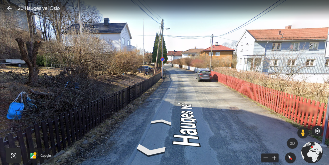
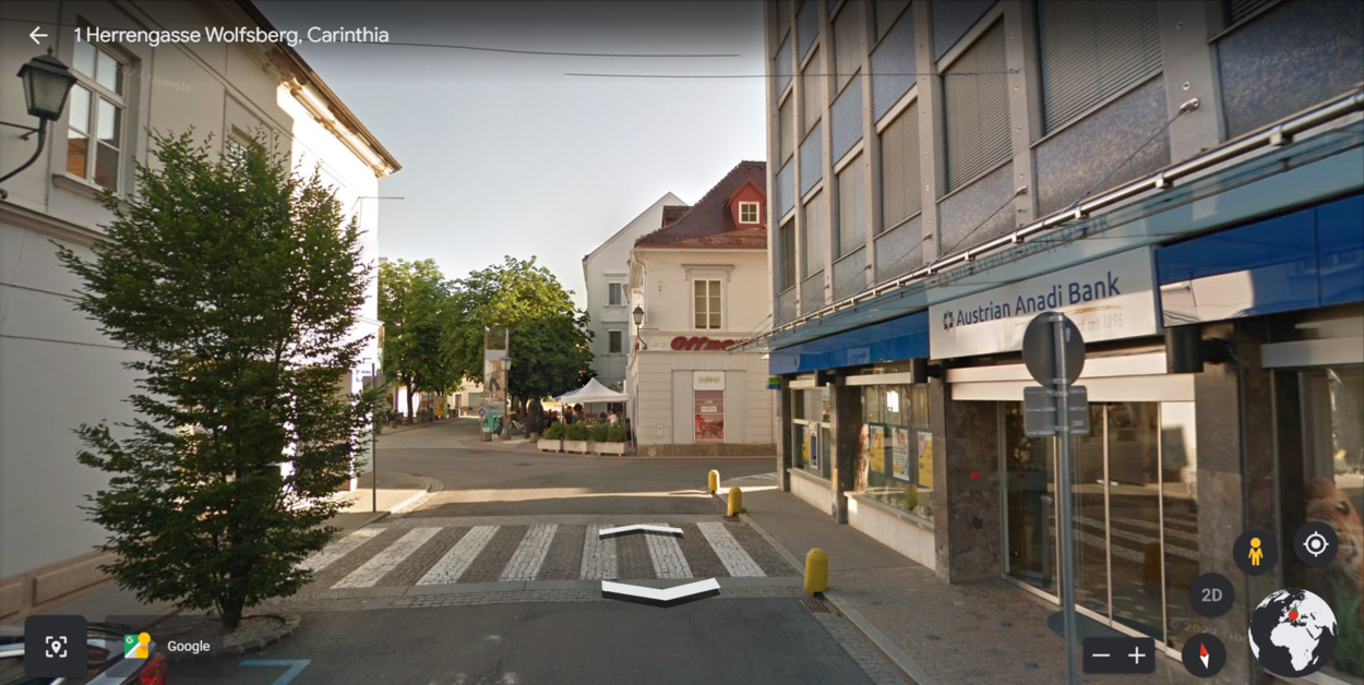
Street View
Google Earth’s street view function offers high-resolution, 360-degree views of streets in a few international locations.
This enables users to tour different neighborhoods and get a first-person view of the city. You may use the street view tool to identify companies, obtain directions, and make travel plans.

The Ability to Measure Distance and Area
Google Earth’s measure distance and area feature can be a helpful tool for both professionals and everyday users. This feature allows users to quickly and easily measure distances and areas on the map.
There’re two ways to use this feature: the first is to use the mouse to click and drag a path on the map, and the second is to use the built-in ruler tool.
To use the mouse to click and drag a path, left-click on the map and hold the mouse button down as you drag the cursor to create a path. The distance of the path will be displayed in both miles and kilometers. To use the built-in ruler tool, click the Measure button in the toolbar, then click the Ruler tool.
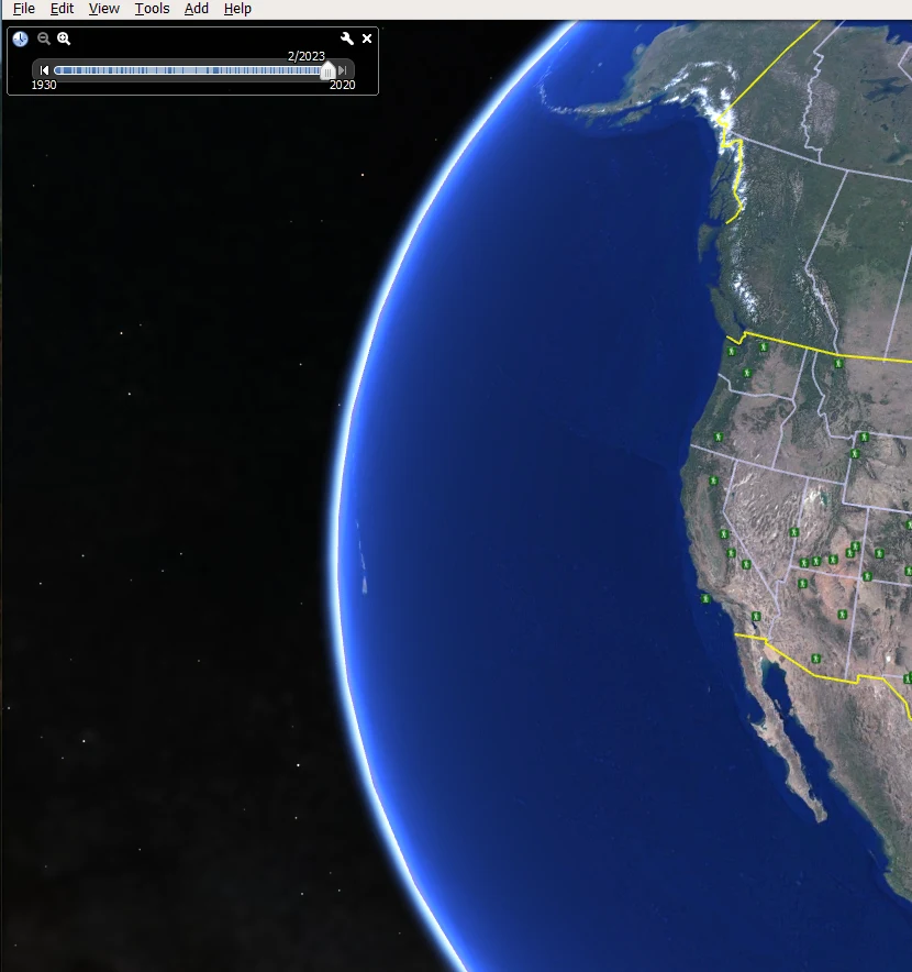
Historical Imagery
One of Google Earth’s most popular features is the historical imagery feature, which allows users to view images of the Earth from different points in history.
This feature is popular because it allows users to see how the Earth has changed over time. They can see how cities have grown, landscapes have changed, and human activity has affected the environment.
The historical imagery feature is a great way to learn about the Earth and its history. It’s also a great way to explore different parts of the world that you might not otherwise have the opportunity to see.

Different Layers
Several layers of Google Earth allow you to view roads, 3D buildings, weather, etc.
What are the Benefits of Google Earth?
Google Earth is a powerful tool that can be used for various purposes. Here’re the benefits of using Google Earth:
| Get a bird’s eye view of the world: | With Google Earth, you can see the world from a new perspective. You can explore different places and get a better understanding of the lay of the land. | ||
| Plan your travels: | Google Earth can be a great tool for planning your travels. You can use it to learn about different destinations and better understand what to expect when you get there. | ||
| Learn about different cultures: | Google Earth can be used to learn about different cultures and lifestyles worldwide. You can virtually visit different places and see how people live. | ||
| See the world’s landmarks: | Google Earth lets you see some of the most popular places. |
How to use Google Earth Step by Step?
This guide will take you through the steps of using Google Earth. Google Earth is a free program that allows you to explore the planet in three dimensions. With Google Earth, you can fly worldwide to view satellite imagery, maps, terrain, and buildings.
To get started, download Google Earth. Once you have installed Google Earth, open the program and click on the “search location” in the bar at the top of the screen. Type in a city or location that you want to explore.
After you type in the location, click on the “enter” key on your keyboard or the “search” button on the screen. Google Earth will then take you to that location. You can use the navigation tool to go around the world. You’ll be taken there for this example if you search New York City.
How can I see My House on Google Earth?
There’re a few different ways to see your house on Google Earth. The most common way is to type in your address in the search bar and hit enter. This should bring up a satellite image of your house and its surroundings.
If you want a closer look, you can zoom in on the image using the zoom tool or double-clicking. You can also pan around the image to get a better view.
If you want to see your house from a different perspective, you can switch to the Street View mode. To do this, click on the screen’s small person icon in the bottom right-hand corner. This’ll take you to a street-level view of your house and its surroundings.
The Final Say
- The design of the Google Earth application is very intricate and detailed. This feature is popular because it allows users to see how the Earth has evolved.
- To avail of all the features of Google Earth, first, you need to download Google Earth pro. However, you can also use the web version of Google Earth.
- There’re several features of Google Earth, such as satellite imagery, street view, 3D map, historical imagery, time-lapse, and so much more.
- With Google Earth’s features, you can do a lot, such as plan trips, learn about the history of places, and have fun exploring the earth.
Related Articles
- Can I See My House on Google Earth? (Find Out!)
- Can You Use Google Earth Without Downloading It? [Find Out]
- How to Use Google Earth in Chrome? [Find Out]