![What Is so Great About Google Earth? [Revealed]](https://gearthhacks.com/wp-content/uploads/2023/01/pef64n-1.jpg)
![What Is so Great About Google Earth? [Revealed]](https://gearthhacks.com/wp-content/uploads/2023/01/pef64n-1.jpg.webp)
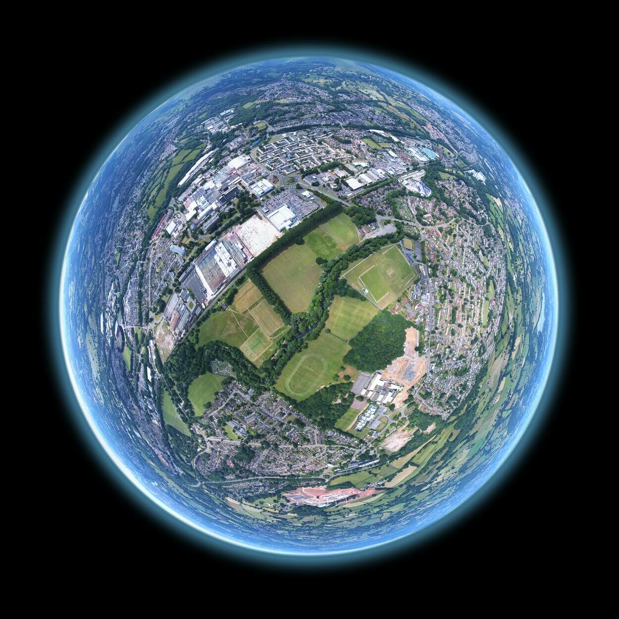
Google Earth is a powerful tool that allows users to explore the world in ways never before possible. With the click of a button, you can travel to the furthest corners of the globe and see the world in stunning 3D imagery. From the peaks of Mount Everest to the depths of the Grand Canyon, Google Earth offers an unparalleled level of detail and accuracy.
But Google Earth isn’t just a tool for armchair travelers and geographers. It has also revolutionized industries such as real estate, tourism, and environmental conservation. The ability to view properties and landmarks in such high detail has greatly impacted the way these industries operate, and Google Earth has become an essential tool for many professionals in these fields.
In this blog post, we’ll take a closer look at the history and development of Google Earth, its features and functionality, its impact on various industries, and its educational value. We’ll also examine any criticisms or controversies surrounding the tool.
Whether you’re a seasoned user of Google Earth or just curious about its capabilities, this post will provide a deeper understanding of what makes it such a great tool.
History and Development of Google Earth

Google Earth was first released in 2005, but its development began several years earlier. The project was initially developed by Keyhole, Inc., a company that was later acquired by Google in 2004. The first version of Google Earth was a Windows-only application that allowed users to explore 3D imagery of the Earth’s surface.
Over the next few years, Google Earth underwent a number of updates and improvements. In 2006, the application was made available for Mac and Linux users. The following year, Google added the “Street View” feature, which allowed users to see street-level imagery of certain areas.
This feature was later expanded to cover more cities and countries.
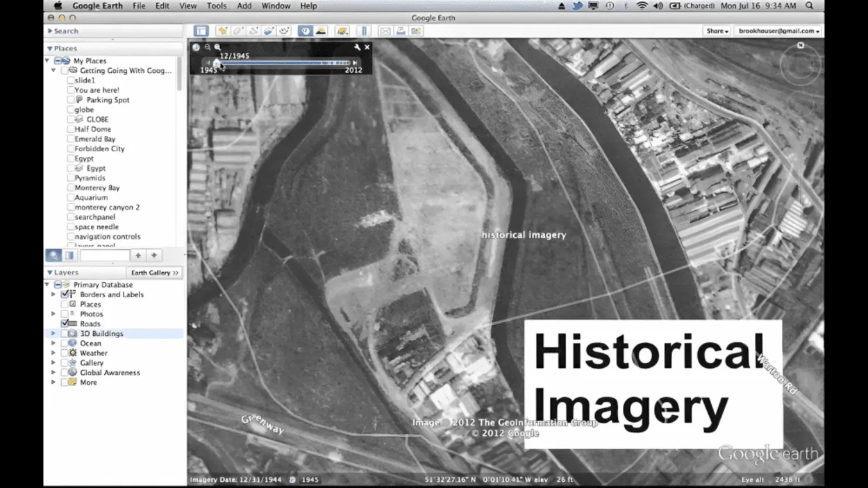
In 2008, Google Earth received a major update with the introduction of the “Ocean” feature. This allowed users to explore the depths of the world’s oceans and view underwater landscapes and shipwrecks. The same year, Google also introduced the “Historical Imagery” feature, which allowed users to view the Earth’s surface as it looked at different points in history.
Since then, Google Earth has undergone several more updates and improvements, including the introduction of 3D building models, the ability to create and share custom maps and tours, and improved satellite imagery. In 2017, Google Earth launched a new version called “Google Earth VR” which allowed users to explore the world in virtual reality.
Google Earth continues to evolve, with new features and improvements added regularly. The latest version of Google Earth allows users to explore the world in more detail than ever before. With its high-resolution imagery, 3D terrain, and street-level views, Google Earth provides a unique and immersive experience that allows users to explore the world in ways never before possible.
Features and Functionality

| Feature | Description |
| Satellite Imagery and 3D Terrain Data | Google Earth uses high-resolution satellite imagery and 3D terrain data to create a detailed representation of the Earth. Users can explore different locations in a realistic, 3D environment. |
| Street View and Historical Imagery | Google Earth allows users to see street-level views of many locations, and also offers access to historical imagery to compare how locations have changed over time. |
| Measurement Tools and Path Creation | Google Earth includes tools for measuring distances and creating paths, making it a useful tool for research and analysis. |
Google Earth offers a wide range of features and functionality that make it a powerful tool for exploring the world. Some of the key features include:
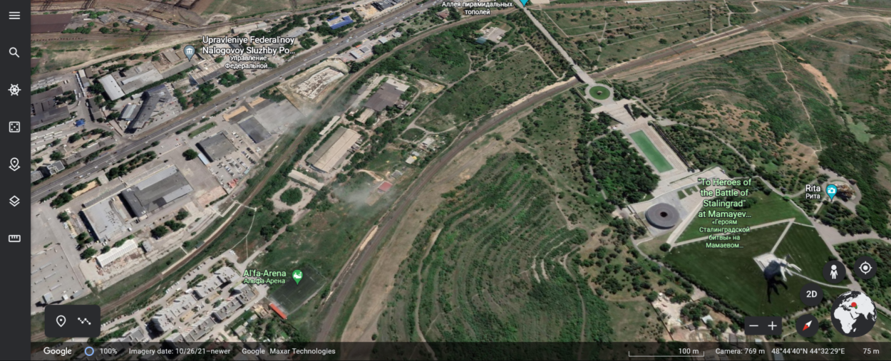
- Google Earth allows users to view the Earth’s surface in stunning 3D imagery. This includes detailed terrain, buildings, and landmarks. Users can also tilt and rotate the view to get a better perspective of the area they are exploring.
- Street View allows users to see street-level imagery of certain areas. Users can navigate through cities and towns as if they were walking down the street in person.
- Historical Imagery allows users to view the Earth’s surface as it looked at different points in history. Users can see how cities, landmarks, and natural features have changed over time.
- Google Earth uses high-resolution satellite imagery to provide detailed views of the Earth’s surface. Users can zoom in to see individual buildings, roads, and other features.
- With Ocean Exploration, users can explore the depths of the world’s oceans and view underwater landscapes and shipwrecks.
- Google Earth allows users to create custom maps and tours, which they can share with others. This feature is great for creating personalized travel guides, educational materials, and more.
- Google Earth VR allows users to explore the world in virtual reality, providing an even more immersive experience.
These features and functionality make Google Earth a versatile tool that can be used for a variety of purposes, such as navigation, research, and education.
Each of these features provides a unique perspective on the world, and together they create a powerful tool that allows users to explore and understand the Earth in ways never before possible.
Google Earths Impact on Various Industries
Google Earth has had a significant impact on various industries, revolutionizing the way we access and analyze geographical data.
One of the most significant impacts of Google Earth has been in the field of real estate. Real estate professionals can now easily access detailed information about properties, including aerial and street views, 3D models, and historical data, allowing them to make more informed decisions and save time and resources.
The construction industry has also been affected by Google Earth. With the help of Google Earth, construction companies can plan and design projects more efficiently, as well as monitor progress and resolve issues more effectively.
In the field of environmental management, Google Earth has been a valuable tool for monitoring and analyzing land use, deforestation, and other environmental issues. Conservation organizations and government agencies can use Google Earth to track changes in land cover, such as the rate of deforestation in a particular area, to identify potential conservation areas, and to monitor the progress of conservation efforts.
The tourism industry has also been impacted by Google Earth, as it has made it easier for people to explore destinations and plan their trips. Tourists can use Google Earth to get a sense of the layout of a city, explore the surrounding landscape, and find points of interest, such as restaurants, hotels, and tourist attractions.
In addition, Google Earth has also been used in fields such as telecommunications, transportation, and mining. Telecommunications companies can use Google Earth to map out network infrastructure and identify potential locations for cell towers.
Transportation companies can use it to plan routes and optimize logistics. Mining companies can use it to explore mineral deposits and identify potential mining sites.
Overall, Google Earth has transformed the way we access, analyze, and utilize geographical information, and it has had a significant impact on various industries. As technology continues to evolve, we can expect to see Google Earth continue to play an important role in a wide range of fields and applications.
FAQs
What Is Google Earth?
Google Earth is a virtual globe, map, and geographic information program that was originally called EarthViewer 3D and was created by Keyhole, Inc, a Central Intelligence Agency (CIA) funded company acquired by Google in 2004.
Google Earth allows users to explore the world in a 3D environment, using satellite imagery, aerial photography, street maps, and more.
How Does Google Earth work?
Google Earth uses satellite imagery, aerial photography, and 3D terrain data to create a detailed representation of the Earth.
Users can explore the world by panning and zooming in on different locations, and can also use the program’s tools to measure distances, create paths, and add placemarks.
What Are Some of the Features of Google Earth?
Some of the features of Google Earth include
- Satellite imagery and 3D terrain data
- Street view and historical imagery
- Measurement tools and path creation
- Placemark creation
- The ability to overlay different types of data, such as weather, traffic, and more
- The ability to explore the ocean floor and other bodies in the solar system
Can I Use Google Earth for Research or Education?
Yes, Google Earth is a powerful tool for research and education. It can be used to study geography, geology, history, and more.
Many educators use Google Earth as a tool to teach students about the world, and researchers use it to study everything from climate change to land use patterns.
Is Google Earth Free to Use?
Google Earth is available as a free web-based version, as well as a paid Pro version.
The free version offers a wide range of features, while the Pro version offers additional tools and capabilities for professional use.
Can I Use Google Earth on My Mobile Device?
Yes, Google Earth is available as a mobile app for both iOS and Android devices.
The mobile app allows users to explore the world on the go and includes many of the same features as the desktop version.
Conclusion
- In conclusion, Google Earth is an incredibly powerful tool that allows users to explore the world in a whole new way.
- From its satellite imagery and 3D terrain to its street view and historical imagery, Google Earth offers a wealth of information and resources for anyone interested in geography, history, or simply exploring the world.
- Whether you’re a student, a researcher, or just someone who loves to travel, Google Earth is a must-have tool for anyone looking to gain a deeper understanding of the world around us. The ability to explore the world from the comfort of your own home and the wealth of information available make it a great tool for education, research, and just plain fun.
- It’s a tool that will continue to evolve and improve, and we can’t wait to see what new features and capabilities will be added in the future.
Related Articles
- How Do I Go to a Specific Place in Google Earth?[Explore]
- How Often Does Google Earth Get Updated?[Truth]
- Can You Tell When a Google Earth Picture Was Taken? [Find Out]