

From the towering peaks of the Himalayas to the vast plains of the African savannas, our planet is a mosaic of diverse landscapes and cultures spread across its seven continents.
Each continent holds its own unique charm and significance, contributing to the vibrant fabric of human history and natural wonders.
Let’s set off on an adventure across the globe, exploring the continents through the lens of cartography, and unraveling their geographical features, cultural diversity, and historical significance.
Asia

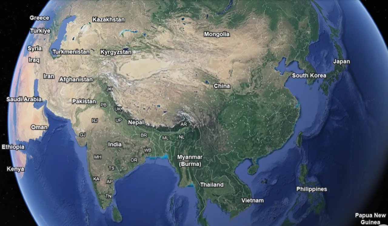
Spanning from the icy tundra of Siberia to the tropical forests of Southeast Asia, Asia is the largest and most populous continent on Earth.
It is home to some of the world’s oldest civilizations, including those of China, India, and Mesopotamia. The Great Wall of China, the Taj Mahal, and the temples of Angkor Wat are evidence of the continent’s rich historical and architectural heritage.
Maps of Asia reveal the complex interplay between geography and human civilization.
From the densely populated cities of Japan and South Korea to the vast steppes of Central Asia, Asia’s landscapes have shaped its cultural and economic development.
The Silk Road, an ancient network of trade routes, facilitated the exchange of goods, ideas, and cultures across the continent, leaving a lasting imprint on its maps and history.
Africa


Africa, the second-largest continent, is often referred to as the cradle of humanity, as it is believed to be the birthplace of Homo sapiens.
Its diverse landscapes encompass vast deserts, lush rainforests, and expansive grasslands. The Nile, the longest river in the world, cuts through the continent, sustaining ancient civilizations and modern communities alike.
The continent’s cultural richness is reflected in its numerous languages, traditions, and ethnicities. From the pyramids of Egypt to the Maasai Mara of Kenya, Africa’s heritage is as diverse as its geography.
Map of Africa not only showcases its natural wonders but also highlights the resilience and ingenuity of its people.
Europe
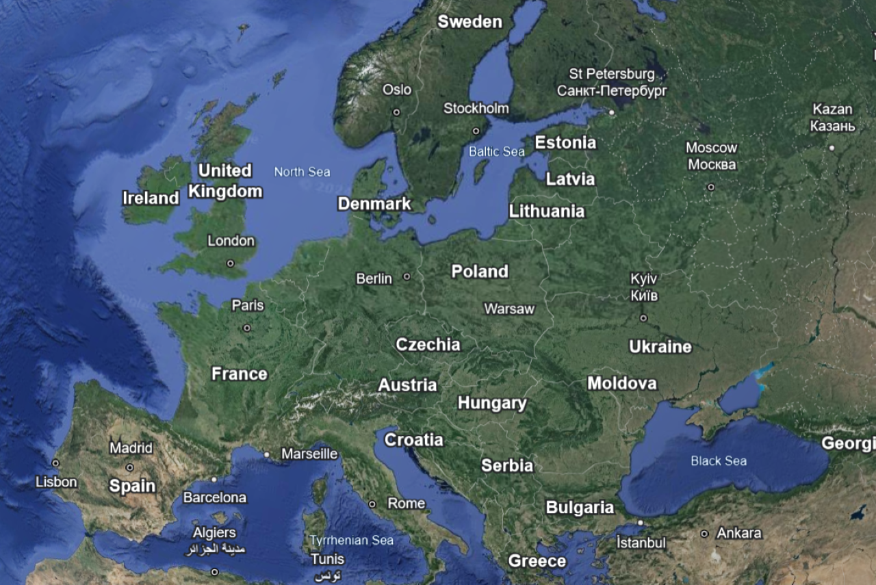

Europe, often referred to as the cradle of Western civilization, is renowned for its historic cities, picturesque landscapes, and cultural diversity.
From the fjords of Scandinavia to the sun-drenched shores of the Mediterranean, Europe’s geography is as varied as its peoples.
Map of Europe shows the rise and fall of empires, the spread of Christianity, and the shifting borders of nations.
The Renaissance, the Age of Exploration, and the Industrial Revolution transformed the continent, shaping its political, economic, and cultural landscape.
Today, Europe remains a mosaic of languages, traditions, and identities, interconnected by a shared history and geography.
North America
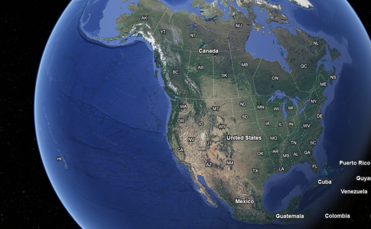

North America, the third-largest continent, is characterized by its vast expanse of wilderness, towering mountain ranges, and diverse ecosystems.
From the Rocky Mountains to the Amazon Rainforest, the continent is home to a wealth of natural resources and biodiversity.
Map of North America reveals the legacy of indigenous civilizations, the impact of European colonization, and the rapid urbanization of the modern era.
The United States, Canada, and Mexico are economic powerhouses, driving innovation and development across the continent.
Yet, challenges such as climate change, inequality, and environmental degradation loom large, highlighting the need for sustainable stewardship of North America’s natural treasures.
South America
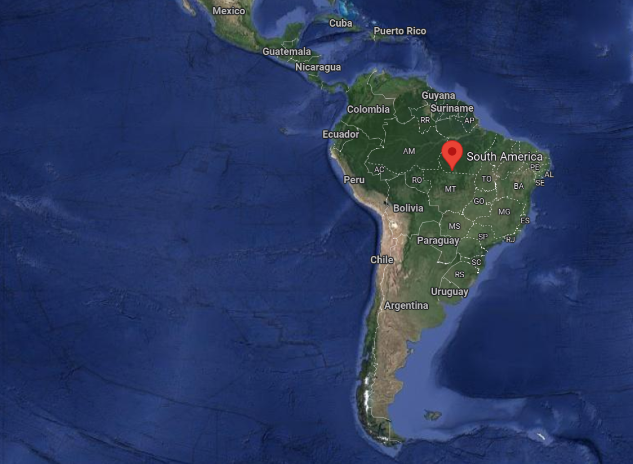

South America, with its rugged Andean peaks, lush rainforests, and vibrant cultures, is a land of contrasts.
The Amazon River, the world’s largest river by discharge volume, flows through the heart of the continent, sustaining a rich tapestry of life.
Map of South America traces the legacies of ancient civilizations such as the Inca and the Maya, as well as the impact of European conquest and colonization.
Today, countries like Brazil, Argentina, and Chile are emerging as global players, harnessing their natural resources and cultural heritage to drive economic growth and development.
Yet, challenges such as deforestation, urbanization, and social inequality pose significant obstacles to the continent’s future.
Australia


Australia, the smallest continent and the largest island, is renowned for its stunning landscapes, unique wildlife, and indigenous heritage.
From the vast Outback to the Great Barrier Reef, the continent’s geography is shaped by millennia of geological processes and environmental changes.
Map of Australia reflects the continent’s colonial history, indigenous cultures, and environmental conservation efforts.
The Aboriginal peoples have inhabited Australia for over 65,000 years, preserving a deep spiritual connection to the land.
Today, Australia is a modern multicultural society, with cities like Sydney and Melbourne serving as vibrant hubs of innovation and creativity.
Antarctica

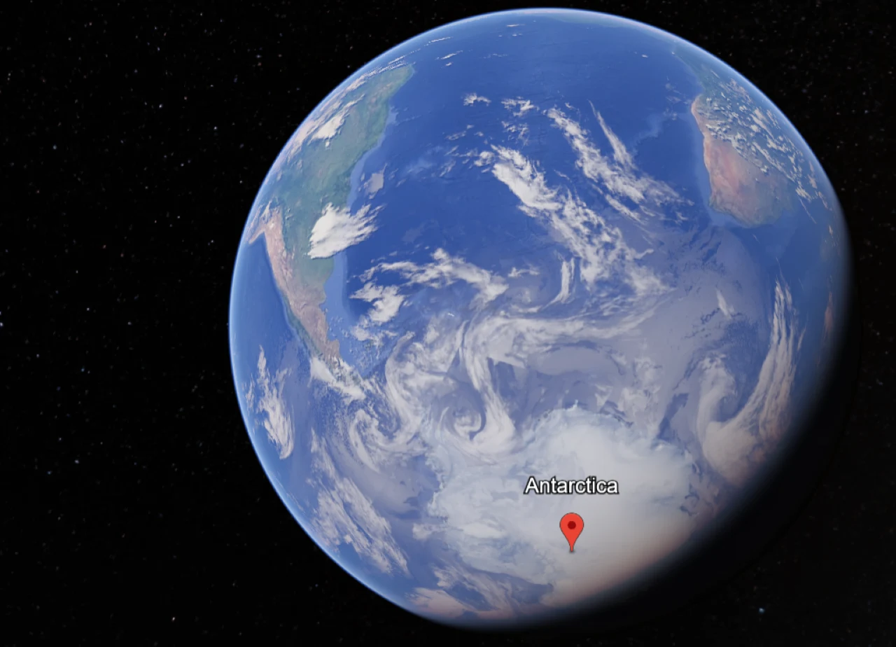
Antarctica, the southernmost continent, is a pristine wilderness of ice and snow, home to some of the harshest conditions on Earth.
Despite its inhospitable climate, the continent supports a rich ecosystem of marine life, including seals, whales, and penguins.
Map of Antarctica reveals the extent of its ice sheets, glaciers, and research stations operated by scientists from around the world.
The continent serves as a crucial barometer of global climate change, offering valuable insights into the health of our planet’s polar regions.
While Antarctica remains largely uninhabited by humans, its importance to scientific research and environmental conservation cannot be overstated.
Continents and their General Locations
| Continent | General Location |
|---|---|
| Africa | Mostly in the Eastern Hemisphere, with the equator passing through the central region. |
| Antarctica | Located at the South Pole, surrounded by the Southern Ocean. |
| Asia | Primarily in the Eastern Hemisphere, extending from the Arctic Ocean in the north to the Indian Ocean in the south. |
| Europe | Mainly in the Eastern Hemisphere, bordered by the Arctic Ocean to the north, the Atlantic Ocean to the west, and the Mediterranean Sea to the south. |
| North America | Predominantly in the Northern Hemisphere, bordered by the Arctic Ocean to the north, the Atlantic Ocean to the east, and the Pacific Ocean to the west. |
| South America | Mostly in the Southern Hemisphere, bordered by the Atlantic Ocean to the east and the Pacific Ocean to the west. |
| Australia (Oceania) | Located in the Southern Hemisphere, surrounded by the Indian and Pacific Oceans. |
This table gives us a general overview of the continents and their respective locations on the Earth’s surface.
FAQs
Are there different types of maps for exploring continents?
Yes, there are various types of maps used to explore continents, including political maps, physical maps, thematic maps, and interactive maps.
Each type serves a specific purpose, such as highlighting political boundaries, showcasing landforms, or depicting demographic trends.
How can I use maps to plan travel or exploration of continents?
Maps are essential for planning travel itineraries, whether for leisure, adventure, or research purposes. They help you identify points of interest, navigate unfamiliar terrain, and make informed decisions about routes, accommodations, and attractions.
Which continent is home to the highest mountain peak?
Asia is home to Mount Everest, the highest mountain peak on Earth, located in the Himalayas on the border between Nepal and China.
What is the driest continent on Earth?
Antarctica is the driest continent on Earth, receiving very little precipitation, primarily in the form of snow.
Conclusion
- Maps of continents are like a peek into the fascinating blend of geography, culture, and history.
- They’re not just about showing us where things are; they’re like stories unfolding before our eyes.
- From the ancient wonders of Africa to the bustling cities of Asia, from the rugged beauty of Australia to the icy mysteries of Antarctica, each continent has its own tale to tell.
- Exploring these maps is like uncovering and appreciating human achievements and challenges.
- These maps give us a deeper understanding of the world’s amazing diversity and how we’re all connected.
- So, let’s keep on exploring, embracing the beauty of our planet, and working together to protect its natural treasures for generations to come, no matter which continent we call home.