
Google Earth is unquestionably the geographic information system (GIS) software that’s most well-known and utilized. People can use it to create, store, view, and interact with location-related data.
Google Earth is the most well-known and widely used geographic information system (GIS) software.
It lets people generate, store, view, and interact with location-related data. Originally known as Keyhole, the program was renamed Google Earth after Google purchased the start-up.
We can trace the history of the software, what ultimately led to its demise, and what the future holds for those who believe they have been abandoned thanks to the Google Earth Blog, a website with almost daily posts about the product.
The Story Behind Google Earth

Keyhole was established in January 2001 by John Hanke, Brian McClendon, and a small group of engineers to combine “vectors, images, and POIs into a single, seamless dataset to create the ultimate geographic reference platform.” They got it done.
The group developed a ground-breaking framework for delivering terabytes of data within a 3D model of the world by utilizing their expertise in the internet and 3D graphics.
In-Q-Tel Invests – June 2003
EarthViewer, a product from Keyhole, quickly became popular. In-Q-Tel, the strategic investment branch of the CIA, announced in 2003 that it would invest in the company based on the software’s capacity to “radically enhance critical decision-making.” After Operation Iraqi Freedom, they quickly put it to use monitoring military operations in Iraq.
Google Purchased Keyhole – October 2004
Shortly after In-Q-Tel’s investment, Google announced its acquisition of Keyhole for an undisclosed amount. The search giant stated that the product’s rich database of roads, businesses, and points of interest, as well as its unique 3D interface, motivated the purchase.
Who Created Google Earth?
American software executive, engineer, and inventor Brian A. McClendon created Google Earth.
He was an angel investor and co-founder of Keyhole, Inc., a company that visualized spatial data and was acquired by Google in 2004 to produce Google Earth.
What were the Initial Google Earth Products?
Following their acquisition of Keyhole, Google launched four products.
| Google Earth Free | A free service for people who just wanted to look at images in the GE database. |
| Google Earth Plus | The plus version allowed users to add their own data for more advanced users. In 2008, it was taken off the market and the majority of its features were incorporated into the free version |
| Google Earth Pro | The pro version offered users advanced capabilities like measurements, data integration, and high-resolution imagery. It was designed for businesses that need to research, collaborate, and present on geospatial data. |
| Google Earth Enterprise | Variable A completely bespoke option for large businesses that need to use geospatial data in their day-to-day operations. |
What Happened to Google Earth?
Google Earth 4th release – Jan 2007
V4 was the first Google Earth’s first major update since the company bought Keyhole, including a new time animation feature for showing historical data, updated 3D modeling capabilities, and a cleaner user interface.
Google Earth 5th release – Feb 2009
Three major changes were made in the fifth version of Google Earth: expanded historical imagery visualizations, the capability to explore the ocean, and a brand-new recording feature that let you record and share a “tour” of the software’s locations.
Google Earth 6th release – Nov 2010
Several new and improved features were announced when Google Earth 6 was released. The addition of 3D modeling for trees, a smoother update to their historical imaging, and smoother integration with StreetView were the most popular.
Google Earth 7th release
New 3D imagery and a tour guide feature that would take users through famous landmarks were both made available in the seventh version of Google Earth, which was the company’s final major update before making all editions free.

Google Earth Support worries rise:
The community’s growing concerns are reflected in a post on the Google Earth Blog: Since V5, there have been no major feature updates, marketing efforts have slowed down, and user support has decreased. It would appear that the company is shifting its focus away from Earth and toward Google Maps.
Google Earth made free
Google announced that Google Earth Pro would now be offered free of charge in response to growing concerns from Google Earth users. The majority of people interpreted this as a sign that Google would no longer be providing much support, even though expanding access to the software was viewed as positive.
Google Earth Enterprise discontinuation
Shortly after announcing that Google Earth would become free, the company announced that Google Earth Enterprise would be discontinued. It was a surprise at that time.
Open source of Google Earth Enterprise
The company announced that it would continue to support Google Earth Enterprise for two years following the product’s deprecation. Google decided to make the software open source as the time came to a close.
There was a sufficient amount of ongoing interest in the software. They simultaneously made a significant effort to convince GEE customers to host their instances on the Google Cloud Platform.
Google Earth 9 announcement
Google Earth 9, which was dubbed “9” rather than “8” because it is more like Google Earth 8 for Android than Google Earth 7 for desktop, received a lot of press coverage when it was announced. The switch to a browser-based app rather than desktop software was the most significant change.
The majority of long-time users of Google Earth were dissatisfied with the version because it removed many of the features they thought were useful.
Where is Google Earth at this time?
From a product perspective, Google Earth currently offers three products, two of which Google actively supports.
- Although Google doesn’t place a high priority on the product, Google Earth Pro is still available for download for those who want the traditional data-focused features of Google Earth.
- The new browser-based Google Earth 9 is designed specifically for casual users who just want to explore the world.
- Last but not least, you can make use of the open-source version of Google Earth Enterprise if you are a business and have access to a legacy instance of the software or the developer skills to develop your instance.
Although the preceding timeline provides a comprehensive summary of Google Earth’s development, it only scratches the surface of the product’s history. It doesn’t cover the development of Google’s Geo Division as a whole or the Google Maps product’s overlapping and sometimes competing for development.
Google’s Geo Division
In 2004, just before going public, Google acquired three businesses to establish its Geo division: ZipDash, Keyhole, and Where 2 Technologies In essence, Keyhole evolved into Google Earth; 2 evolved into Google Maps; and Google Maps Mobile replaced ZipDash.
We can construct a picture of the ultimate objective of Google’s Geo division by assembling information from interviews with team members, even though the purpose of the division is not widely known.
It would appear that they are attempting to accomplish much more than just creating web-based mapping applications or GIS software: organizing all of the physical information in the world. Data has always been Google’s business.
Google can build a framework to index the physical world in the same way it indexed the World Wide Web by starting with Google Maps. It’s evident from this broader context that the primary purpose of the Keyhole acquisition was the development of technology for organizing and rendering large-scale satellite imagery
Even though Google probably thought that Google Earth could be a paid GIS software product, this effort was probably just a bonus for buying the Keyhole codebase.
They were content to abandon development once it became clear that the returns on the Google Earth product wouldn’t be sufficient to justify its purchase: giving away the product for free to concentrate on the larger objective.
Google Earth was essentially an opportunistic offshoot of a larger project. Because it didn’t make enough money, the community didn’t give it the support it wanted.

What Programming is used in Google Earth?
JavaScript API programming is used in Google Earth.
A web-based IDE for the Earth Engine JavaScript API is the Earth Engine (EE) Code Editor at code.earthengine.google.com.
The features of the Code Editor are intended to make it simple and quick to create intricate geospatial workflows.
Conclusion
- Google Earth has been to different stages in its evolving period and is continuously growing to make the user experience easy.
- The latest version of Google Earth 9 allows users to explore the world with better sight.
- The software has a wide range of users in the education, government, real estate, media, insurance, and construction industries, as well as a devoted group of private customers, thanks to its extensive toolset and multipurpose design.
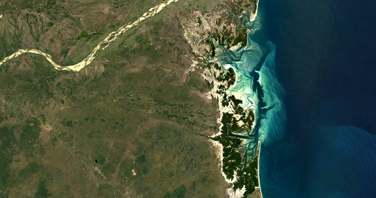
- A detailed, interactive map of the Earth is created using composite imagery by Google Earth, a cutting-edge geomapping and tagging technology. The application offers a flexible tool that enables individuals and groups to track climate change, discover undiscovered geographic and ecological features, and document our history by stitching together more than a billion satellite and aerial photographs.
Related Articles
- Is There an Offline Version of Google Earth? (Must Know)
- How Do I Open Google Earth? (Easy Way)
- How to View Google Earth Live? [Explained!]