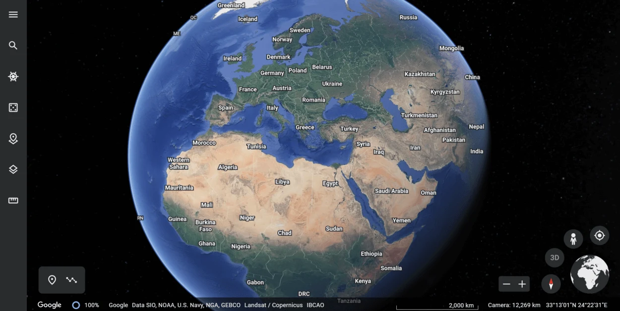
Google Earth has a number of features that allow users to interact with and explore the map in different ways and is constantly being updated with new features and improvements.
The frequency of updates varies depending on the location and the type of data being updated, but overall, Google Earth is designed to be a comprehensive and up-to-date resource for exploring and learning about the earth.
Google Earth is available as a free download for desktop computers and as a mobile app for iOS and Android devices and can be used for a wide range of purposes, including education, research, travel planning, and simply exploring and learning about different parts of the world.
Continue reading to get detailed information!
Where Does Google Earth Get its Data?

Google Earth gets its data from a variety of sources, including satellite imagery, aerial photography, and 3D terrain data.
Satellite imagery is provided by a number of different satellite operators, including companies like DigitalGlobe and Airbus Defense and Space. These satellites are equipped with high-resolution cameras and other sensors that are used to capture images of the Earth’s surface from orbit.
Aerial photography is typically captured by aircraft, such as planes or helicopters, equipped with cameras or other imaging equipment. This type of imagery is often used to supplement satellite imagery or to provide higher-resolution images for specific areas.
3D terrain data is typically created using a combination of satellite imagery, aerial photography, and other data sources. This data is used to create detailed 3D models of the Earth’s surface that include features such as hills, valleys, and buildings in some major cities.
Google Earth also includes a number of other data layers, such as weather data, traffic data, and information about points of interest, that are sourced from a variety of sources.
Overall, Google Earth combines data from a wide range of sources to create a detailed and comprehensive representation of the Earth’s surface.
How Often Is Google Earth Data Updated?
Google Earth is constantly updating its imagery and data to provide users with the most current and accurate view of the earth. The frequency of updates varies depending on the location and the type of data being updated.
Satellite imagery is typically updated every one to three years, although some areas may be updated more frequently or less frequently depending on the availability of new imagery. Some locations may also have higher-resolution imagery that is updated more frequently.
Maps and other data layers are generally updated more frequently than satellite imagery. Google Earth uses a variety of sources for its maps and data, including government agencies, mapping companies, and user-generated content, so the frequency of updates may vary depending on the source of the data.
What Is the Process for Updating Google Earth Data?
Google Earth uses a variety of sources and technologies to update its imagery and data. Here’s a general overview of the process for updating Google Earth data:
| Source data | Google Earth obtains data from a variety of sources, including satellite imagery, aerial photography, maps, and other data sources. The data is collected by satellite sensors, aircraft, and other data-gathering platforms. |
| Data processing | After the data is collected, it’s processed and converted into a format that can be used by Google Earth. This process may involve stitching together multiple images to create a seamless mosaic, removing clouds or other artifacts, and correcting distortions caused by the earth’s curvature or other factors. |
| Data integration | The processed data is then integrated into Google Earth’s database and made available for users to view. In some cases, the data may be enhanced with additional information or features, such as 3D models or interactive elements. |
| User Feedback | Google Earth relies on user feedback to help improve the accuracy and quality of its data. Users can submit corrections or updates to Google Earth through the “Report a problem” feature in the program. |
What Are the Benefits of Regularly Updating Google Earth Data?

There are several benefits to regularly updating the data in Google Earth:
- Updating the data in Google Earth helps to ensure that the program is providing users with the most accurate and up-to-date view of the earth possible. This can be especially important for maps and other data layers, which may change over time due to construction, land use changes, or other factors.
- Updating the data in Google Earth can also provide users with access to new features and enhancements, such as higher-resolution imagery, 3D models, or interactive elements. These features can make the program more engaging and useful for a variety of purposes.
- Regularly updating the data in Google Earth can help to expand the program’s coverage and make more locations and features available to users. This can be especially useful for areas that may not have been well-documented in the past or that are undergoing rapid change.
- Updating the data in Google Earth can also help to incorporate user feedback and suggestions into the program. By allowing users to report problems or suggest improvements, Google Earth can continuously improve and evolve to better meet the needs and interests of its users.
How Can You Access the Latest Google Earth Data?

To access the latest data in Google Earth, you’ll need to have the latest version of the program installed on your device and be connected to the internet. Google Earth updates its data on a regular basis, and the data is automatically incorporated into the program when it’s available.
To ensure that you are using the latest version of Google Earth, you can check for updates by going to the App Store or Google Play Store (for mobile devices) or by visiting the Google Earth website (for desktop computers). If an update is available, you’ll be prompted to download and install it.
Once you have the latest version of Google Earth installed, you can access the latest data by simply using the program as you normally would. The data will be automatically displayed in the program, and you can use the various tools and features of Google Earth to explore and interact with the data.
Note that the availability of the latest data may vary depending on the location and the type of data being accessed. Some areas may have more current data than others, and some types of data, such as satellite imagery, may be updated less frequently than others.
FAQs
How Often Is Satellite Imagery Updated on Google Earth?
The frequency of updates to satellite imagery in Google Earth varies depending on the location and the availability of new imagery.
In general, satellite imagery is updated every one to three years, although some areas may be updated more frequently or less frequently.
How Often Are Maps and Other Data Layers Updated in Google Earth?
Maps and other data layers in Google Earth are generally updated more frequently than satellite imagery.
The frequency of updates may vary depending on the source of the data and the rate of change in the area being mapped.
Can I Access the Latest Data on Google Earth Without an Internet Connection?
No, Google Earth requires an internet connection to access the latest data.
The program relies on real-time data and imagery, so it cannot be used offline.
Is There a Way to See When Specific Data in Google Earth Was Last Updated?
Yes, you can view the date when specific data in Google Earth was last updated by using the “Layers” panel in the program.
To access the “Layers” panel, click on the “Layers” button in the top left corner of the screen. The date when each layer was last updated will be displayed in the “Layers” panel.
Can I Suggest Updates or Corrections to the Data in Google Earth?
Yes, Google Earth relies on user feedback to help improve the accuracy and quality of its data. You can submit updates or corrections to Google Earth through the “Report a problem” feature in the program.
Simply select the “Report a problem” option from the “Help” menu and follow the prompts to submit your feedback.
Conclusion
- Google Earth is constantly updating its data to provide users with the most accurate and up-to-date view of the earth possible.
- The frequency of updates varies depending on the location and the type of data being updated, but overall, Google Earth is designed to be a comprehensive and up-to-date resource for exploring and learning about the earth.
- To access the latest data in Google Earth, you’ll need to have the latest version of the program installed on your device and be connected to the internet.
- You can check for updates by going to the App Store or Google Play Store (for mobile devices) or by visiting the Google Earth website (for desktop computers).
- Once you’ve got the latest version of Google Earth installed, you can access the latest data by simply using the program as you normally would.

![How Often Is Google Earth Data Updated?[Must Know]](https://gearthhacks.com/wp-content/uploads/2022/12/earth-galaxy-elements-this-image-furnished-by-nasa_1250x-1.jpg.webp)