

Hey there! Ready to dive into the beauty of West Virginia? Picture this: rolling mountains, lush forests, and quaint towns awaiting your exploration. But to truly immerse yourself in the wonders of the Mountain State, you’ll need a trusty companion: the map.
This map isn’t just about getting from point A to point B. It’s your ticket to uncovering hidden waterfalls, scenic overlooks, and charming local eateries tucked away in the hills.
Think of it as your personal tour guide, leading you through winding roads and winding rivers to the heart of West Virginia’s beauty.
So, grab your gear, and let’s hit the road! With the West Virginia map in hand, we’re in for an adventure you won’t soon forget.
West Virginia Geography

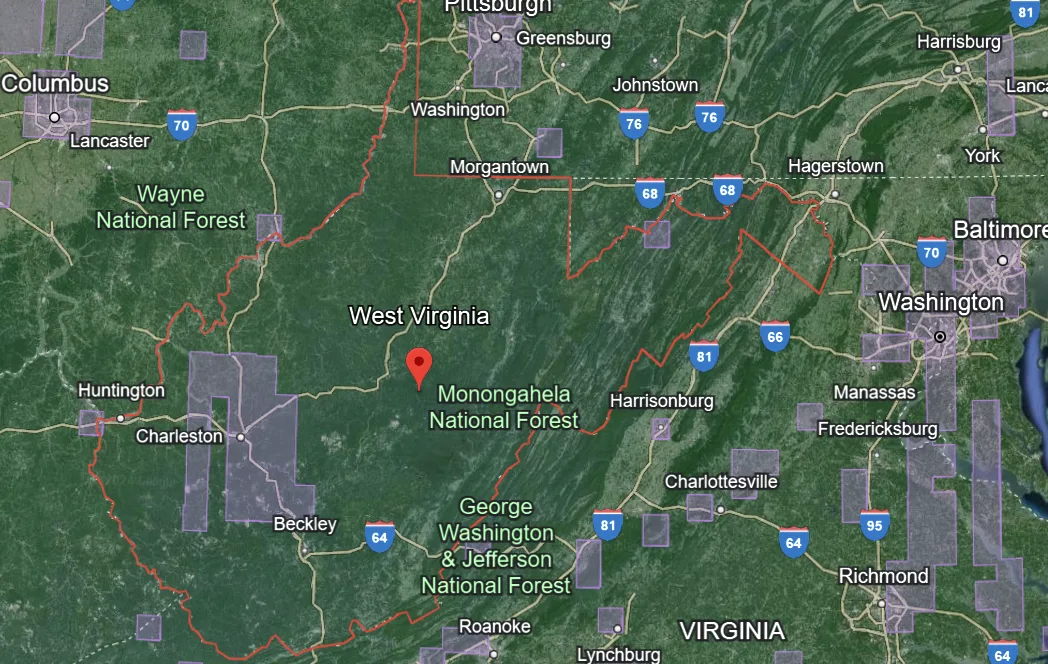
The Appalachian Mountain range runs diagonally across West Virginia from the northeast to the southwest, dominating much of the state’s landscape. Notable peaks include Spruce Knob, the highest point in West Virginia, and Black Mountain, the highest point on the state’s eastern border.
The Allegheny Plateau occupies the western portion of West Virginia and is characterized by its rolling hills, cliffs, and deep gorges. This region is known for its coal deposits, which have historically played a significant role in the state’s economy.
West Virginia is crisscrossed by numerous rivers and streams, which have carved out scenic valleys and gorges throughout the state. The Ohio River forms much of the state‘s western border, while the Potomac River defines its eastern border.
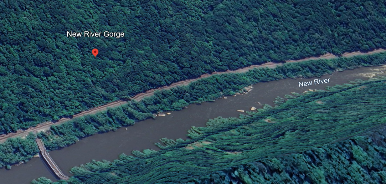
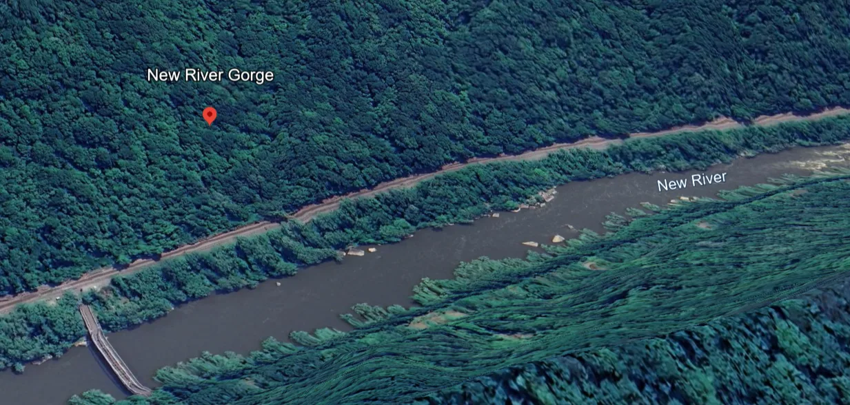
Other major rivers include the New River, known for its whitewater rafting opportunities, and the Gauley River, famous for its challenging rapids.
West Virginia’s mountainous terrain is punctuated by deep valleys and gorges, which provide stunning vistas and recreational opportunities. The New River Gorge, known as the “Grand Canyon of the East,” offers dramatic cliffs, waterfalls, and world-class rock climbing.
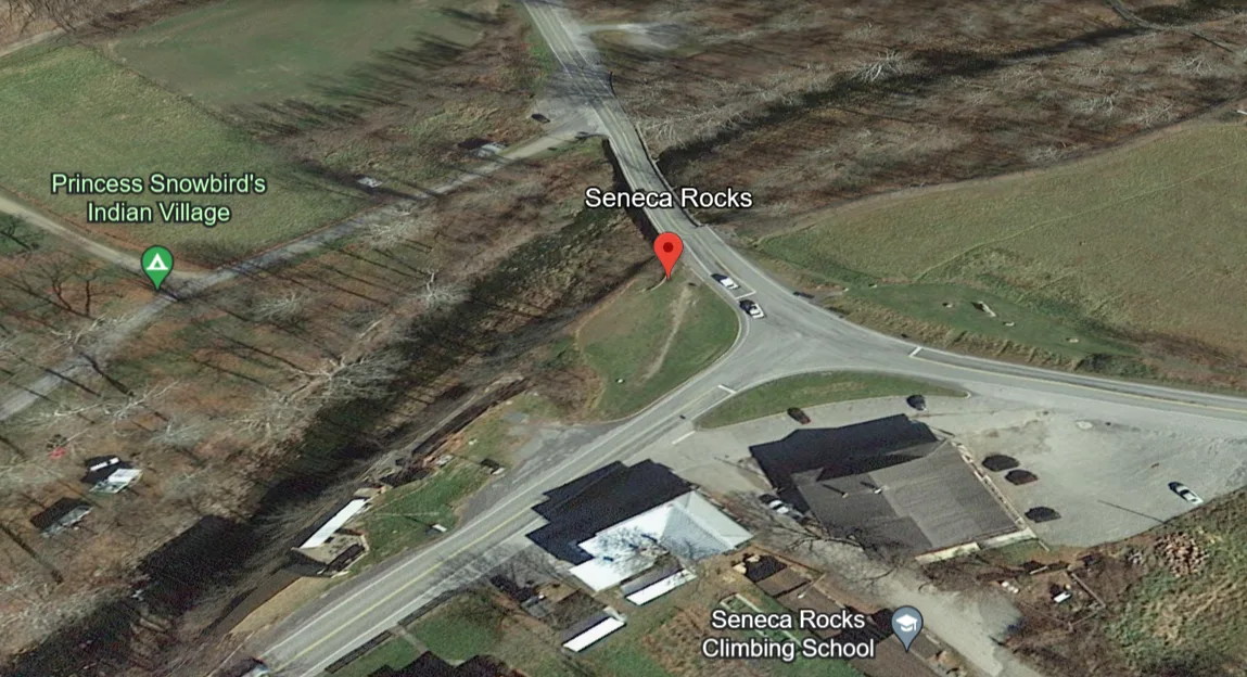
The Cheat River Gorge and the Seneca Rocks area are also popular destinations for outdoor enthusiasts.
The majority of West Virginia state’s forests provide habitat for black bears, white-tailed deer, wild turkeys, and numerous bird species. West Virginia’s state parks and national forests are great for hiking, camping, fishing, and wildlife viewing.
Tourist Destinations in West Virginia
Here’s a table highlighting some of the tourist destinations in West Virginia:
| Tourist Destination | Location | Description |
|---|---|---|
| New River Gorge National Park | Fayetteville | A scenic canyon renowned for its whitewater rafting, rock climbing, hiking trails, and the iconic New River Gorge Bridge, one of the longest single-span arch bridges in the world. |
| Seneca Rocks | Seneca Rocks | The largest lake in West Virginia offers swimming, boating, fishing, and scuba diving opportunities amidst the scenic backdrop of the Gauley River Gorge. |
| Blackwater Falls State Park | Davis | Home to the stunning Blackwater Falls, one of the most photographed waterfalls in the state, as well as hiking trails, scenic overlooks, and winter recreation activities. |
| Greenbrier Resort | White Sulphur Springs | The largest lake in West Virginia offering swimming, boating, fishing, and scuba diving opportunities amidst the scenic backdrop of the Gauley River Gorge. |
| Harpers Ferry National Historical Park | Harpers Ferry | Historic town at the confluence of the Potomac and Shenandoah Rivers, known for its role in the Civil War and its charming cobblestone streets, museums, and scenic hiking trails. |
| Snowshoe Mountain Resort | Snowshoe | Premier ski resort offering skiing, snowboarding, and snow tubing in the winter, as well as mountain biking, golfing, and hiking in the summer amidst the scenic Monongahela National Forest. |
| Cass Scenic Railroad State Park | Cass | Historic steam-driven locomotives take visitors on scenic train rides through the mountains, offering breathtaking views of the Appalachian landscape and opportunities for photography and exploration. |
| Cranberry Glades Botanical Area | Hillsboro | Unique ecosystem featuring boggy wetlands, rare plant species, and boardwalk trails for exploring the diverse flora and fauna of the region. |
| Summersville Lake | Summersville | Largest lake in West Virginia offering swimming, boating, fishing, and scuba diving opportunities amidst the scenic backdrop of the Gauley River Gorge. |
| Berkeley Springs | Berkeley Springs | Charming spa town known for its natural mineral springs, historic bathhouses, and quaint shops and galleries, offering relaxation and rejuvenation in a picturesque setting. |

These destinations offer a glimpse into the diverse natural beauty, history, and recreational opportunities that West Virginia has to offer. Whether you’re seeking adventure in the great outdoors or relaxation in a historic spa town, there’s something for everyone to enjoy in the Mountain State.
FAQs
What types of maps are available for exploring West Virginia?
Various types of maps are available for exploring West Virginia, including road maps, topographic maps, recreational maps, trail maps, geological maps, and tourist maps.
Where can I find a road map of West Virginia?
Road maps of West Virginia are available at most gas stations, convenience stores, tourist information centers, and online mapping websites. They provide detailed information about highways, roads, and points of interest in the state.
How can I obtain a topographic map of West Virginia?
Topographic maps of West Virginia can be purchased from the United States Geological Survey (USGS) website, outdoor retailers, and specialty map stores. These maps depict the terrain, elevation, and geographic features of the state in detail.
Are there maps available for hiking and outdoor recreation in West Virginia?
Yes, there are numerous maps available for hiking, biking, and outdoor recreation in West Virginia. These include trail maps, recreational maps, and park maps that highlight hiking trails, camping areas, scenic overlooks, and other points of interest for outdoor enthusiasts.
How can I find tourist destinations and attractions on a map of West Virginia?
Tourist maps of West Virginia are available at visitor centers, tourism offices, and online travel websites. These maps highlight popular tourist destinations, landmarks, historical sites, and points of interest throughout the state.
Conclusion
- West Virginia boasts a rich cultural heritage shaped by its Appalachian roots.
- From rugged mountains to rolling hills and winding rivers, West Virginia offers diverse outdoor experiences.
- The state is a haven for outdoor enthusiasts, offering opportunities for hiking, biking, whitewater rafting, skiing, and more.
- West Virginia played a pivotal role in the Civil War and has a wealth of historic sites and landmarks.
- Visitors can explore charming small towns, scenic state parks, historic resorts, and cultural festivals throughout the state.
- West Virginians are known for their hospitality and welcoming spirit, making visitors feel right at home.