Is Zoom Earth Better Than Google Earth?[Comparison]
Posted on Last updated:
Google Earth is a virtual globe, map, and geographic information program that was originally created by Keyhole, Inc., a company acquired by Google in 2004. It allows users to explore the Earth by viewing satellite imagery, maps, 3D buildings, and other geographic data on a globe. Google Earth is available as a desktop application and as a mobile app for Android and iOS devices.
Zoom Earth is a web-based application that provides global satellite and aerial imagery from various sources, including NASA, the European Space Agency (ESA), and commercial providers. It allows users to explore the Earth and view satellite imagery in a web browser, similar to Google Earth.
Both Google Earth and Zoom Earth are useful applications for exploring the Earth and learning about its geography. The best choice for a user will depend on their specific needs and preferences.
Continue reading the blog we will explore more about ”Is Zoom Earth better than Google Earth?”
Both Google Earth and Zoom Earth provide a variety of features and tools for exploring and learning about Earth and its geography. Some of the features that both applications offer include:
Google Earth and Zoom Earth allow users to view the Earth in 3D, with realistic terrain, buildings, and other features.
Both applications provide access to high-resolution satellite imagery of the Earth, allowing users to see detailed views of various locations around the world.
These applications provide access to various types of maps, including street maps, terrain maps, and satellite maps.
Both applications allow users to overlay various types of data on top of the map, such as weather data, traffic data, and more.
Both allow users to search for specific locations or points of interest and display them on the map.
Both provide tools for measuring distance and area on the map.
Both Google Earth and Zoom Earth provide tools for creating and sharing presentations and tours of different locations on the map.
Features of Google Earth
Google Earth is a powerful and feature-rich application that allows users to explore the Earth and learn about its geography. Some of the features of Google Earth include:
Google Earth provides realistic 3D imagery of the Earth, with terrain, buildings, and other features rendered in 3D. Google Earth provides high-resolution satellite imagery of the Earth, allowing users to see detailed views of various locations around the world.
Google Earth includes a variety of maps, including street maps, terrain maps, and satellite maps. Google Earth allows users to overlay various types of data on top of the map, such as weather data, traffic data, and more.
Google Earth allows users to search for specific locations or points of interest, and display them on the map. Google Earth provides tools for measuring distance and area on the map. Google Earth provides tools for creating and sharing presentations and tours of different locations on the map.
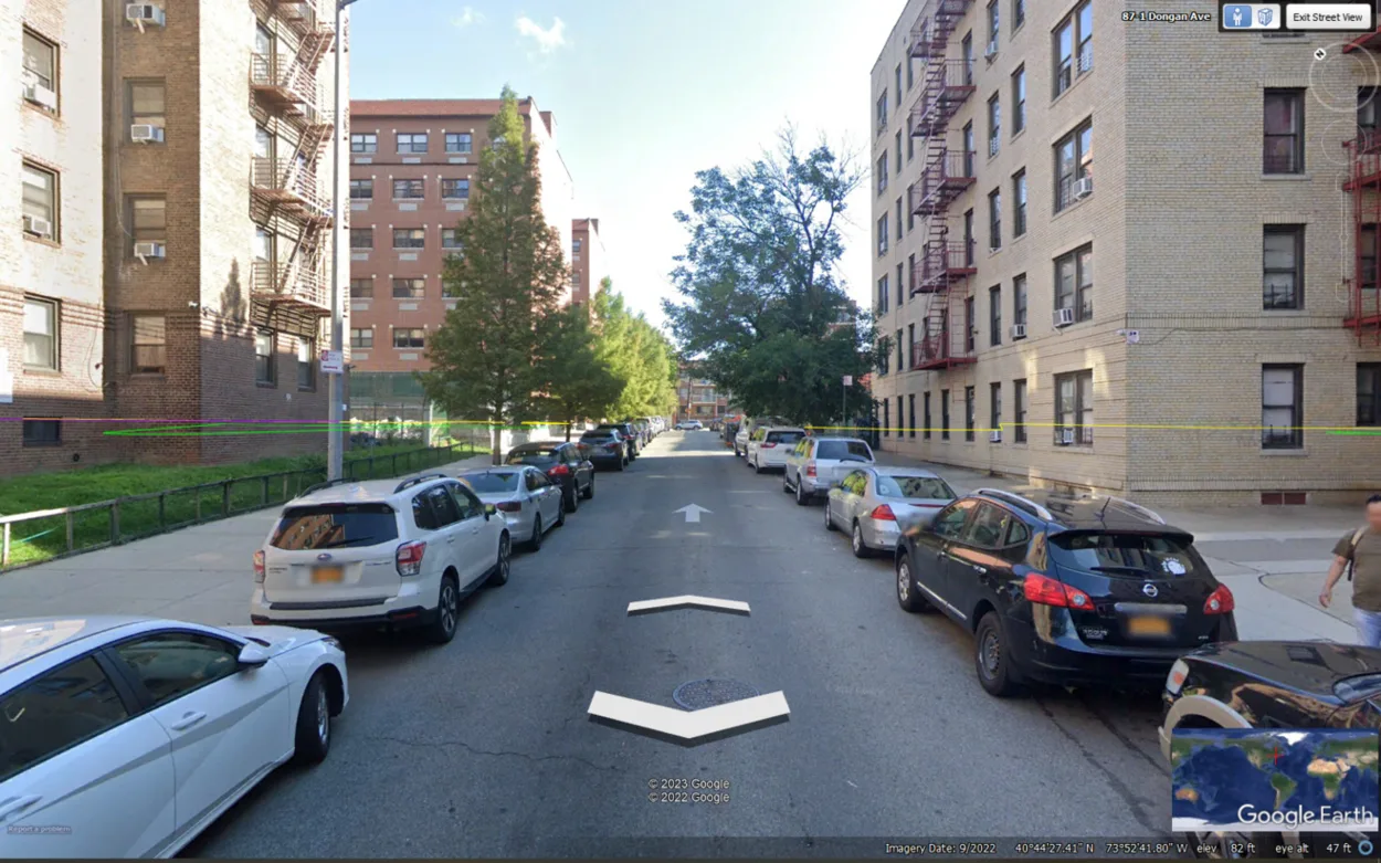
Google Earth includes a “time slider” feature that allows users to view historical satellite imagery of different locations, dating back to the mid-1990s. Google Earth includes Street View, a feature that allows users to explore the streets of various cities around the world in 360-degree panoramic views.
Google Earth Street View
Google Earth includes a library of 3D models of various landmarks and buildings from around the world, which can be viewed in 3D on the map. Google Earth includes tools for collaborating and sharing maps and presentations with other users.
Features of Zoom Earth
Zoom Earth is a web-based application that provides global satellite and aerial imagery from various sources, including NASA, the European Space Agency (ESA), and commercial providers.
Some of the features of Zoom Earth include:
Satellite Imagery
Zoom Earth provides access to high-resolution satellite imagery of the Earth, allowing users to see detailed views of various locations around the world.
Maps
It provides access to various types of maps, including street maps, terrain maps, and satellite maps.
Layers
It allows users to overlay various types of data on top of the map, such as weather data, traffic data, and more.
Search
Zoom Earth allows users to search for specific locations or points of interest, and display them on the map.
Measurement tools
It provides tools for measuring distance and area on the map.
Presentation tools
Zoom Earth provides tools for creating and sharing presentations and tours of different locations on the map.
Historical imagery
It allows users to view historical satellite imagery of different locations, dating back to the mid-1990s.
3D imagery
Zoom Earth provides 3D imagery of the Earth, with terrain, buildings, and other features rendered in 3D.
Features of Zoom Earth
Mobile-responsive design: Zoom Earth is optimized for use on mobile devices, allowing users to easily access and explore the Earth on their phones or tablets.
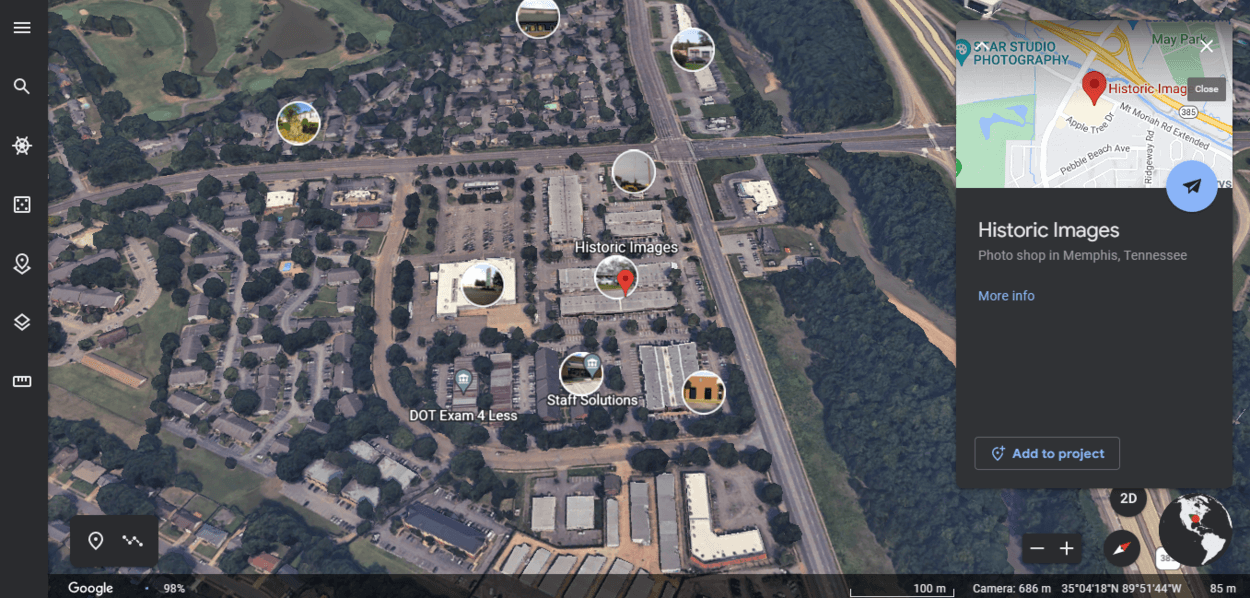
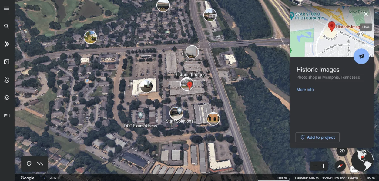
Pros and cons of Google Earth
Google Earth interface shows different features
Google Earth is a powerful and feature-rich application that allows users to explore the Earth and learn about its geography.
Pros
Some of the pros of Google Earth include:
Google Earth is available as a desktop application and as a mobile app for Android and iOS devices, making it easily accessible to a wide audience.
Google Earth provides high-resolution satellite imagery of the Earth, allowing users to see detailed views of various locations around the world.
Google Earth includes Street View, a feature that allows users to explore the streets of various cities around the world in 360-degree panoramic views.
Google Earth includes tools for collaborating and sharing maps and presentations with other users.
Cons
Some of the cons of Google Earth include
Google Earth Pro, which includes additional features and tools, is a paid product, and the mobile app may have in-app purchases.
Google Earth has a wide range of features and tools, which can be overwhelming for some users.
Some satellite imagery may not be available on Google Earth due to data limitations or other restrictions.
Some users may have concerns about Google collecting data from their use of Google Earth.
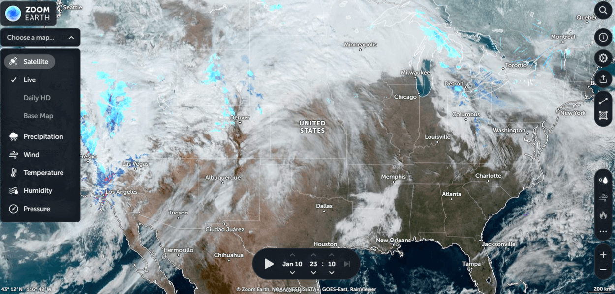
Pros and cons of Zoom Earth
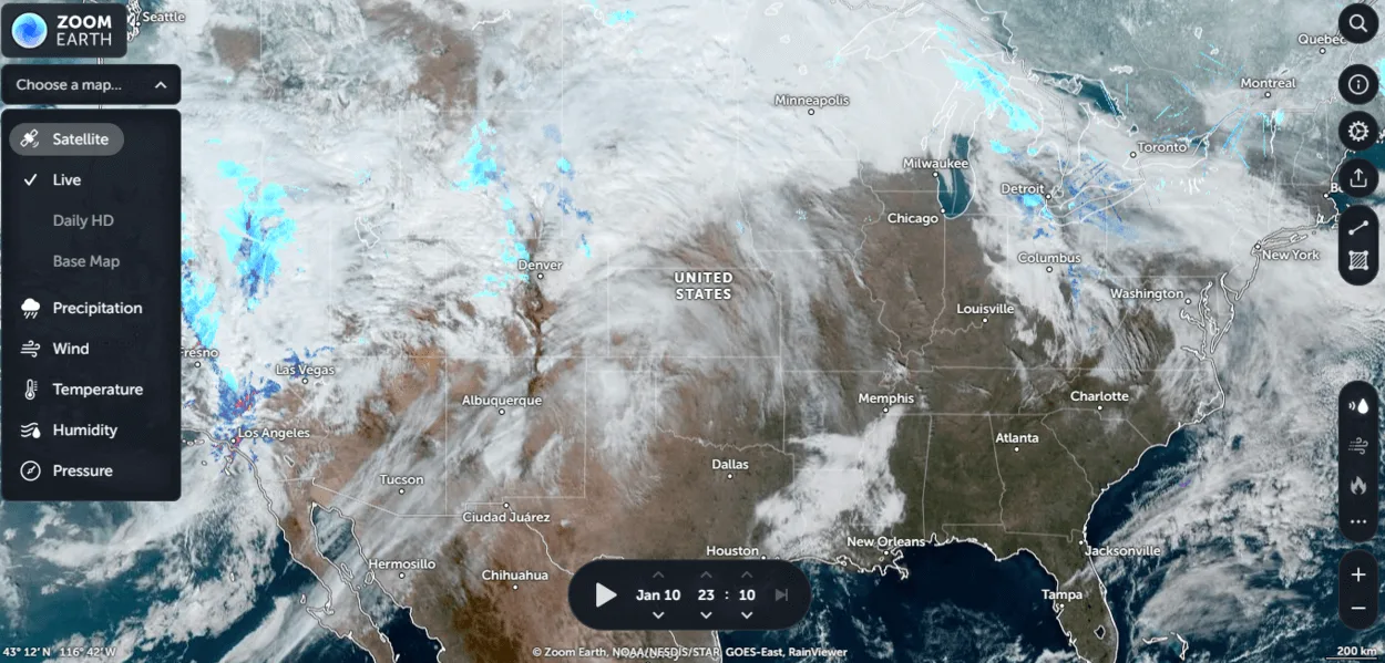
Zoom Earth interface
Zoom Earth is a web-based application that provides global satellite and aerial imagery from various sources.
Pros
Some of the pros of Zoom Earth include:
Zoom Earth is a free web-based application, available to users without any cost.
Zoom Earth is optimized for use on mobile devices, allowing users to easily access and explore the Earth on their phones or tablets.
Zoom Earth allows users to view historical satellite imagery of different locations, dating back to the mid-1990s.
Cons
Some of the cons of Zoom Earth include:
Zoom Earth doesn’t have as many features and tools as Google Earth, and may not be as suitable for advanced users or professional applications.
Some satellite imagery may not be available in Zoom Earth due to data limitations or other restrictions.
Zoom Earth is a web-based application that requires an internet connection and a web browser to use.
Some users may have concerns about data collection and privacy when using a web-based application like Zoom Earth.
FAQs
How Do I Access Google Earth?
Google Earth is available as a desktop application and as a mobile app for Android and iOS devices.
You can download the desktop version from the Google Earth website, and the mobile app from the App Store or Google Play Store.
How Do I Access Zoom Earth?
Zoom Earth is a web-based application.
You can access it by visiting the Zoom Earth website in a web browser.
Is Google Earth Better Than Zoom Earth?
Both Google Earth and Zoom Earth are useful applications for exploring the Earth and learning about its geography. The best choice for a user will depend on their specific needs and preferences.
Google Earth is a more feature-rich and powerful application, with a wide range of tools and features for exploring the Earth and learning about its geography. However, it’s a paid product (although a free version is also available) and may be more suitable for advanced users or professional applications.
Conclusion
Google Earth is a more feature-rich and powerful application, with a wide range of tools and features for exploring the Earth and learning about its geography. It includes high-quality satellite imagery, 3D imagery, a variety of maps, historical imagery, Street View, collaboration tools, and more.
Google Earth is a paid product (although a free version is also available) and may be more suitable for advanced users or professional applications.
Zoom Earth is a free web-based application that provides access to satellite imagery from multiple sources, including NASA, the European Space Agency (ESA), and commercial providers. It’s optimized for use on mobile devices and includes 3D imagery and historical imagery.
Zoom Earth doesn’t have as many features and tools as Google Earth, and may not be as suitable for advanced users or professional applications.
Ultimately, the choice between Google Earth and Zoom Earth will depend on the specific needs and preferences of the user. Both applications are useful tools for exploring the Earth and learning about its geography.
![Is Zoom Earth Better Than Google Earth?[Comparison]](https://gearthhacks.com/wp-content/uploads/2022/12/closeup-shot-black-white-wooden-globe-with-blurred-background_1250x.jpg)
![Is Zoom Earth Better Than Google Earth?[Comparison]](https://gearthhacks.com/wp-content/uploads/2022/12/closeup-shot-black-white-wooden-globe-with-blurred-background_1250x.jpg.webp)