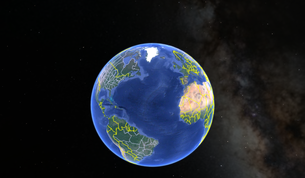
If you’re an explorer, then you must love Google Earth a lot. With many of its great features, the flying feature is definitely the cherry on top!
You can fly over different parts of the world, giving users a unique landscape view. But can you still fly on Google Earth?
The answer is yes. Despite recent changes to the Google Earth platform, flying is still a key feature that allows users to explore the world from above. Using your mouse and keyboard, you can control your flight and adjust settings such as speed and altitude to suit your preferences.
In this article, we’ll look closer at flying in Google Earth, including how to control your flight and customize your settings.
What do you mean by a Fly on Google Earth?
Google Earth’s “fly” feature is one of its most exhilarating tools, allowing users to travel virtually to different locations worldwide. This feature imitates a flight experience, taking users on a journey that provides a unique world perspective from a bird’s eye view.
By selecting the “fly” feature, Google Earth provides users with a simulated flight experience. Users can choose their destination, and the tool will automatically create a path that gives them a realistic sense of traveling through the virtual environment.
Users can customize their experience by adjusting the flight speed and the camera angle, allowing them to explore the world in their own way and at their own pace.
Apart from being fun, this feature is also educational. It gives users a unique and detailed view of the world’s geography and topography.
As users fly over different regions, they can observe the landscape, the distinct features that make each place unique, and the impact of human activities on the environment. This feature is particularly useful for students studying geography or anyone interested in learning about different parts of the world.

Google Earth’s “fly” feature is an excellent tool for anyone who wants to explore and learn about the world from a different perspective. Whether for educational or recreational purposes, this feature provides an interactive way to travel and experience the world virtually.
Can I Fly on Google Earth?
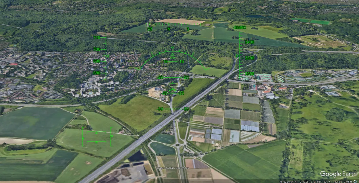
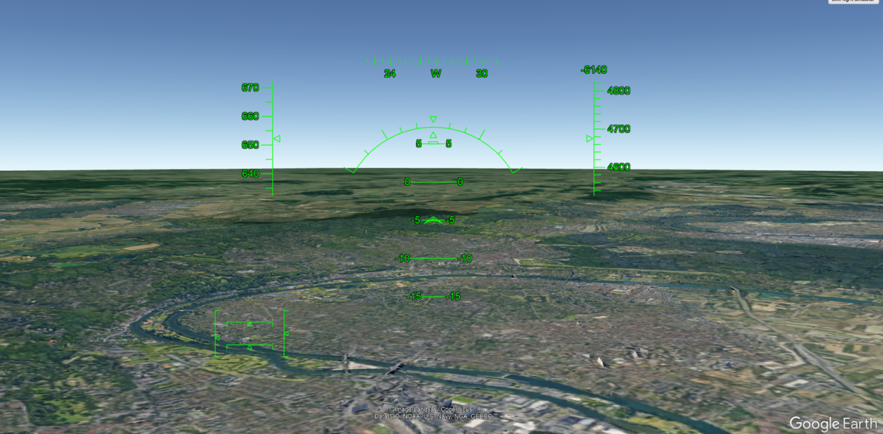
Although physical movement through the virtual environment isn’t possible with Google Earth, its flight simulator feature can simulate the experience of flying an aircraft.
Flight simulator feature available in Google Earth that enables users to simulate the experience of piloting an aircraft. This feature can be accessed through the Tools menu or by pressing specific keys on the keyboard.
The flight simulator feature includes various options, such as selecting different aircraft types, choosing start and end locations, and adjusting weather conditions and time of day. Users can control the aircraft’s pitch, roll, and yaw but cannot physically move through the virtual environment as they would in real life.
To sum up, although Google Earth doesn’t let users fly or move through the virtual environment physically, it does provide a flight simulator feature that offers a simulated experience of piloting an aircraft.

How do you Fly on Google Earth?
To fly on Google Earth, you must use the flight simulator feature built into the software. The following steps will guide you through the process of accessing and using the flight simulator:
- Open Google Earth: Launch the Google Earth application on your computer.
- Access Flight Simulator: Click on the “Tools” menu at the top of the screen, then select “Enter Flight Simulator” from the drop-down menu.
- Choose Your Aircraft: You can choose between two aircraft types: an F-16 fighter jet or a small propeller-driven airplane. Once you’ve selected your aircraft, you can customize the controls.
- Select Your Starting Location: You can choose any location on the map to begin your flight. You can search for a specific location or use the default starting point. Once you’ve selected your starting location, you can set your aircraft’s altitude, heading, and speed.
- Begin Your Flight: Once ready, click the “Start Flight” button to begin your flight. The simulator will take a few seconds to load, and then you’ll be in the cockpit of your aircraft, ready to take off.
- Control Your Flight: Use the keyboard or a joystick to control your aircraft. The simulator supports a variety of keyboard commands, including arrow keys for turning and tilting and Page Up and Page Down to adjust your altitude.
- End Your Flight: When you’re finished with your flight, click the “Exit Flight Simulator” button in the upper right-hand corner of the screen.
How do you Fly a Plane on Google Earth Web?
Flying a plane on Google Earth Web is an awesome experience that you can enjoy right from your computer. Here’s how you can do it:
First, head to the Google Earth website using your web browser. Once you’re there, click on the three vertical dots icon on the top left-hand side of the screen and select “Launch Earth in Chrome” from the drop-down menu. Next, click the “Tools” menu and select “Enter Flight Simulator.”
You’ll be able to choose from two types of aircraft: an F-16 fighter jet or a small propeller-driven plane. Once you’ve made your selection, you can customize the controls to suit your preferences.

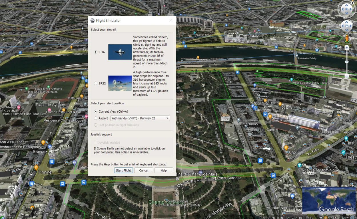
Select a starting location on the map and set your aircraft’s altitude, heading, and speed. Once you’re ready, click the “Start Flight” button and wait a few seconds for the simulator to load. You’ll then find yourself in the cockpit of your aircraft, ready to take off!
You can control your aircraft using your keyboard or a joystick. The simulator supports various keyboard commands, such as using the arrow keys to turn and tilt and Page Up and Page Down to adjust your altitude.
Finally, when you’re done with your flight, click on the “Exit Flight Simulator” button in the top right-hand corner of the screen.
How do I Control the Flight on Google Earth?
You can use your mouse and keyboard to control the flight in Google Earth. Here are the basic controls for flying on Google Earth:
| 1. | Launch Google Earth and click on the “Fly” button in the toolbar at the top of the screen. Alternatively, you can use the keyboard shortcut “Ctrl + Alt + A.” |
| 2. | Use the mouse to change the viewing angle. To do this, click and drag with the left mouse button. Moving the mouse up or down will adjust the altitude of your flight. |
| 3. | Use the arrow keys on your keyboard to move forward, backward, left, and right. Pressing the “Page Up” and “Page Down” keys will adjust your speed. |
| 4. | Use the “Ctrl” key to tilt your view up or down. Hold down the “Ctrl” key and use the up or down arrow keys to adjust the tilt angle. |
| 5. | Click the “Exit Flight” button in the toolbar to stop flying and return to a stationary view. |
If you want to check out a tutorial on Google Earth, then you can check it below:
FAQS
Why can’t you see planes on Google Earth?
Google Earth does show planes in the air, but they are typically represented as small, generic icons rather than detailed images of the actual planes. This is due to a number of factors, including limitations in satellite and aerial imagery resolution, privacy concerns, and the fact that real-time tracking of planes requires more sophisticated technology than what is currently available on Google Earth.
Can I fly anywhere on Google Earth?
While you can explore most parts of the world on Google Earth, there may be limitations to where you can fly. Google Earth uses 3D imagery and satellite data to render its virtual globe, and some areas may have lower quality or incomplete data.
Additionally, certain countries or regions may restrict access to certain parts of their territory. However, for the vast majority of the globe, you can fly freely and explore to your heart’s content.
Can I customize the flight settings in Google Earth?
Yes, you can customize the flight settings in Google Earth to suit your preferences. You can adjust the flight speed, altitude, and tilt, as well as the sensitivity of the mouse and keyboard controls.
To customize your flight settings, click on the “Tools” menu in Google Earth, select “Options,” and then choose the “Navigation” tab. From there, you can make the desired changes and save your settings.
Conclusion
- Flying in Google Earth allows you to explore the world in a unique and immersive way.
- You can control your flight using your mouse and keyboard and adjust settings such as speed and altitude to suit your preferences.
- Flying in Google Earth is a great way to explore 3D landmarks and buildings from a bird’s-eye view.
- You can customize your flight settings in Google Earth to make the experience more enjoyable and comfortable.
- Flying in Google Earth is a fun and educational way to learn more about the world and experience new perspectives.
Related Articles
- How Do You Change the Time in Google Earth 2023? [Answered]
- How Do I See Different Years in Google Earth on iPhone? [Find Out]
- How Do You Go Back in Time on Google Earth?[Guide]