![Where Is the Time Slider on Google Earth?[Answered]](https://gearthhacks.com/wp-content/uploads/2023/01/Timelapse_Blog_Hero-1.png)
![Where Is the Time Slider on Google Earth?[Answered]](https://gearthhacks.com/wp-content/uploads/2023/01/Timelapse_Blog_Hero-1.png.webp)
Google Earth is a powerful tool that allows users to explore the world in new and exciting ways. One of the most valuable features of Google Earth is the time slider, which allows users to view historical imagery and explore different time periods.
The time slider is a great tool for anyone interested in geography, history, or environmental science, and can be a fun and educational experience for all ages.
The time slider is located in the top right corner of the Google Earth screen, next to the compass and ruler icon. By clicking and dragging the time slider, users can navigate through different dates and times, and see how the Earth has changed over time. This feature is especially useful for studying land use, population density, and environmental changes.
In this blog post, we’ll guide you through the process of finding and using the time slider in Google Earth. We’ll also provide tips and tricks for using the time slider effectively, and troubleshooting common issues that users may encounter.
Navigating to the Desired Location
Navigating to the desired location in Google Earth is a relatively simple process that can be done in a few different ways. The most straightforward method is to use the search bar located at the top of the screen. To do this:
- Type in the address or name of the location you wish to view.
- Press “Enter” on your keyboard. Google Earth will automatically navigate to the location and display it on the map.
Another way to navigate to a specific location is by zooming and panning the map. You can zoom in or out using the scroll wheel on your mouse or by using the “+” and “-” buttons located on the bottom right of the screen.
You can also pan the map by clicking and dragging it with your mouse. This method of navigation is useful if you’re not sure of the exact address or name of a location, but you know its general location.
You can also navigate using the “Fly To” feature, which allows you to search for a location by entering its coordinates. This feature is great for navigating to remote or hard-to-find locations. To use this feature, click on the “Fly To” button on the top bar, and then enter the latitude and longitude of the location you want to go.
Additionally, Google Earth allows you to save your favorite locations, so you can quickly access them again in the future. To save a location:
- Right-click on it.
- Select “Save this location.”
- Give it a name.
- You can access these saved locations by going to the “My Places” section, which is located on the left sidebar.
Finding the Time Slider
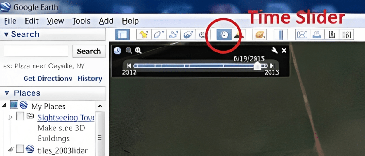
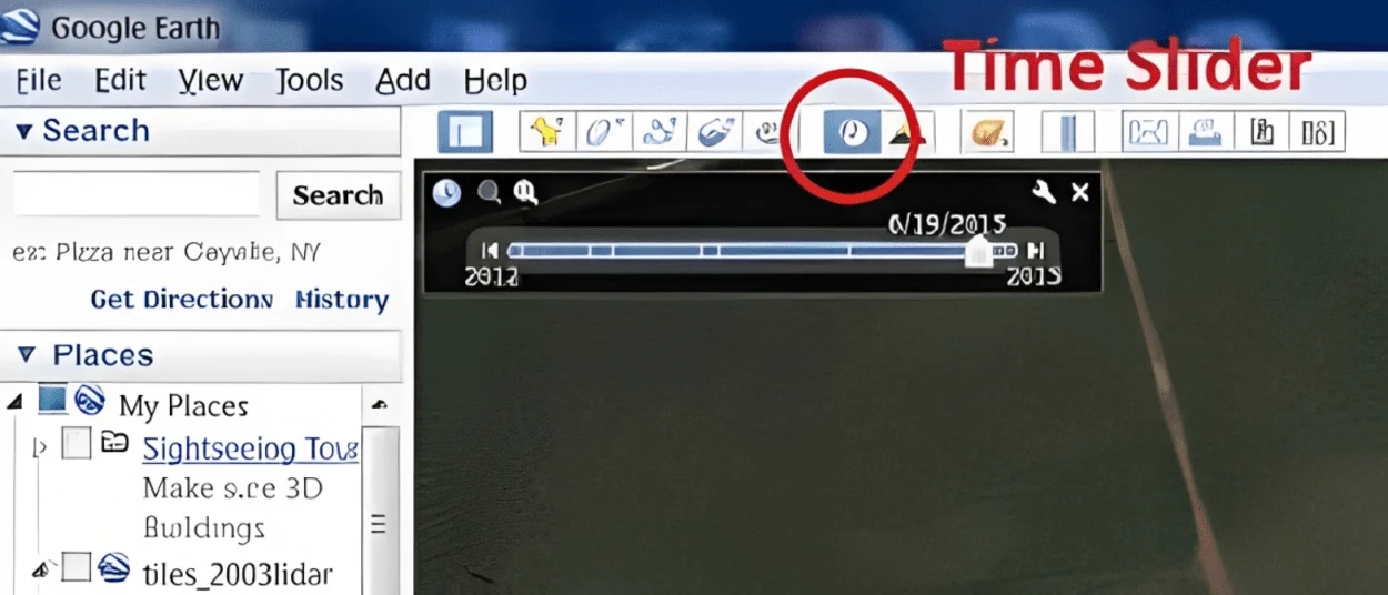
Finding the time slider in Google Earth is a simple process. The time slider is located in the top right corner of the screen, next to the compass and ruler icon. To access the time slider, follow these steps:
- Open Google Earth.
- Look for the compass and ruler icon in the top right corner of the screen.
- Next to the compass and ruler icon, you’ll see the time slider. It’s represented by a clock icon.
- Once you’ve located the time slider, you can start exploring different dates and times by clicking and dragging the slider. As you move the slider, the map will change to show the imagery of the selected date.
To further help you locate the time slider, a screenshot or an image can be added to the blog post to make it easier for readers to locate it on their screen. It’s worth noting that the time slider isn’t available in all versions of Google Earth.
For example, the time slider is not available in the browser version of Google Earth, but it’s available in the desktop and mobile versions.
With the time slider located, you can start to navigate through different dates and times, and see how the Earth has changed over time. This feature is especially useful for studying land use, population density, and environmental changes.
Using The Time Slider
| Steps | Description |
| 1 | Open the application – Google Earth. From the main menu, select ‘View’ and click on ‘Historical Imagery’ or press the shortcut keys Ctrl+Alt+H. |
| 2 | Click on the small arrow beside the ‘Timeline’ button towards the top-right corner of the screen. This will cause a drop-down list of dates to appear underneath it. |
| 3 | On this list, you can view all available satellite images from that area for different periods in time. To rapidly move through time, click and drag at either end of the timeline bar located at the bottom center of your screen. |
| 4 | The blue bar in between shows which period is being displayed, and it can be moved left or right to select a different period in time (the more you move it to one side, the farther back in time you go). By clicking anywhere within this timeline bar you can set a specific date in time as desired. |
| 5 | You can adjust how much time passes each step when you are sliding through by clicking on ‘Set Historical Imagery Time Interval’. Here you have options such as 1 month, 6 months, 1 year, or 5 years between steps. |
| 6 | If your image looks only somewhat older than expected, use the ‘Reset Time Range’ button (located beside ‘Set Historical Imagery Time Interval’) to reset your selection range and start over again. |
| 7 | As a last resort, if there’s still no suitable imagery available within a certain period of time, try changing your location slightly so that suitable images from another part of your area may be identified instead. |
To use the time slider in Google Earth, first, open the program and navigate to the location you would like to view. Once you are in the desired location, click on the “View” menu and select “Historical Imagery.” This will bring up the time slider at the top of the screen.
The time slider allows you to see how the location has changed over time by showing different satellite imagery from different years. You can use the slider to move through time and see how the location has changed. You can also use the “Play” button to automatically move through time and see the changes over time.
In addition to satellite imagery, the time slider also allows you to see how other features have changed over time. For example, you can use the time slider to see how buildings have been constructed or demolished, or how forests have grown or been cut down.
One of the most interesting uses of the time slider is to see how natural disasters have affected an area. For example, you can use the time slider to see how Hurricane Katrina affected New Orleans in 2005, or how the eruption of Mount St. Helens in 1980 changed the surrounding landscape.
In conclusion, the time slider in Google Earth is a powerful tool that allows users to see how the planet has changed over time. Whether you are interested in seeing how buildings have been constructed, how natural disasters have affected an area, or just how the landscape has changed over time, the time slider is a great way to explore the planet.
With a little bit of exploration, you’ll be able to see how the world has changed over time and appreciate the beauty of our planet even more.
Additional Features of Time Slider
One of the most interesting features is the ability to view changes in buildings and infrastructure. For example, you can use the time slider to see how a city has grown over time, how new buildings have been constructed, or how older buildings have been demolished. This can provide an interesting look into the development and history of a specific location.
Another feature of the time slider is the ability to view changes in the natural landscape. For example, you can use the time slider to see how forests have grown, how deserts have changed, or how glaciers have receded. This can provide an interesting look into the effects of climate change and other environmental factors on our planet.

One of the most powerful features of the time slider is its ability to show the impact of natural disasters. For example, you can use the time slider to see how Hurricane Katrina affected New Orleans in 2005, or how the eruption of Mount St. Helens in 1980 changed the surrounding landscape. This can provide a sobering look into the power of nature and the devastation it can cause.
The time slider also allows you to view how human activity has changed the earth. For example, you can see how urbanization has changed the land, how mining or drilling has changed the topography, or how farming or logging has changed the vegetation.
FAQs
Where Do I Find the Time Slider on Google Earth?
The time slider can be found in the “View” menu, under the option “Historical Imagery.”
Once selected, the time slider will appear at the top of the screen.
How Do I Use the Time Slider to View Historical Imagery?
To use the time slider to view historical imagery, first navigate to the location you wish to view. Then, select “Historical Imagery” from the “View” menu to bring up the time slider.
Use the slider to move through different time periods and view the changes in the imagery over time.
Can I Use the Time Slider to View Changes in Buildings and Natural Landscapes?
Yes, the time slider allows users to view changes in both buildings and natural landscapes over time.
This can provide an interesting look into the development and history of a specific location, as well as the effects of climate change and other environmental factors on our planet.
Can I Save My Favorite Locations When Using the Time Slider on Google Earth?
Yes, Google Earth allows users to save their favorite locations for easy access in the future. To save a location, right-click on it and select “Save this location” and give it a name.
These saved locations can be accessed by going to the “My Places” section, which is located on the left sidebar.
Conclusion
- The time slider in Google Earth is a powerful tool that can be used to explore the planet and see how it has changed over time.
- With this feature, users can navigate through different dates and times, view satellite imagery of specific locations, animate changes over time, and even view historical maps.
- Exploring our world with the time slider can help us better appreciate its beauty and learn more about its history.
- The time slider is located in the top right corner of the Google Earth screen, next to the compass and ruler icon. By clicking and dragging the time slider, users can navigate through different dates and times, and see how the Earth has changed over time. This feature is especially useful for studying land use, population density, and environmental changes.
- Now that you have an understanding of the features available with the time slider in Google Earth, all that’s left for you to do is to get out there and start exploring! Have fun!
Related Articles
- How Old Are the Images on Google Earth?[Revealed]
- How Often Does Google Earth Get Updated?[Truth]
- Where Does Google Earth Get its Data? [Revealed]