
If you’re a nostalgic person, you might love looking at old pictures. There’s something so fascinating about seeing how things used to be, especially if you’re looking at pictures of your own hometown.
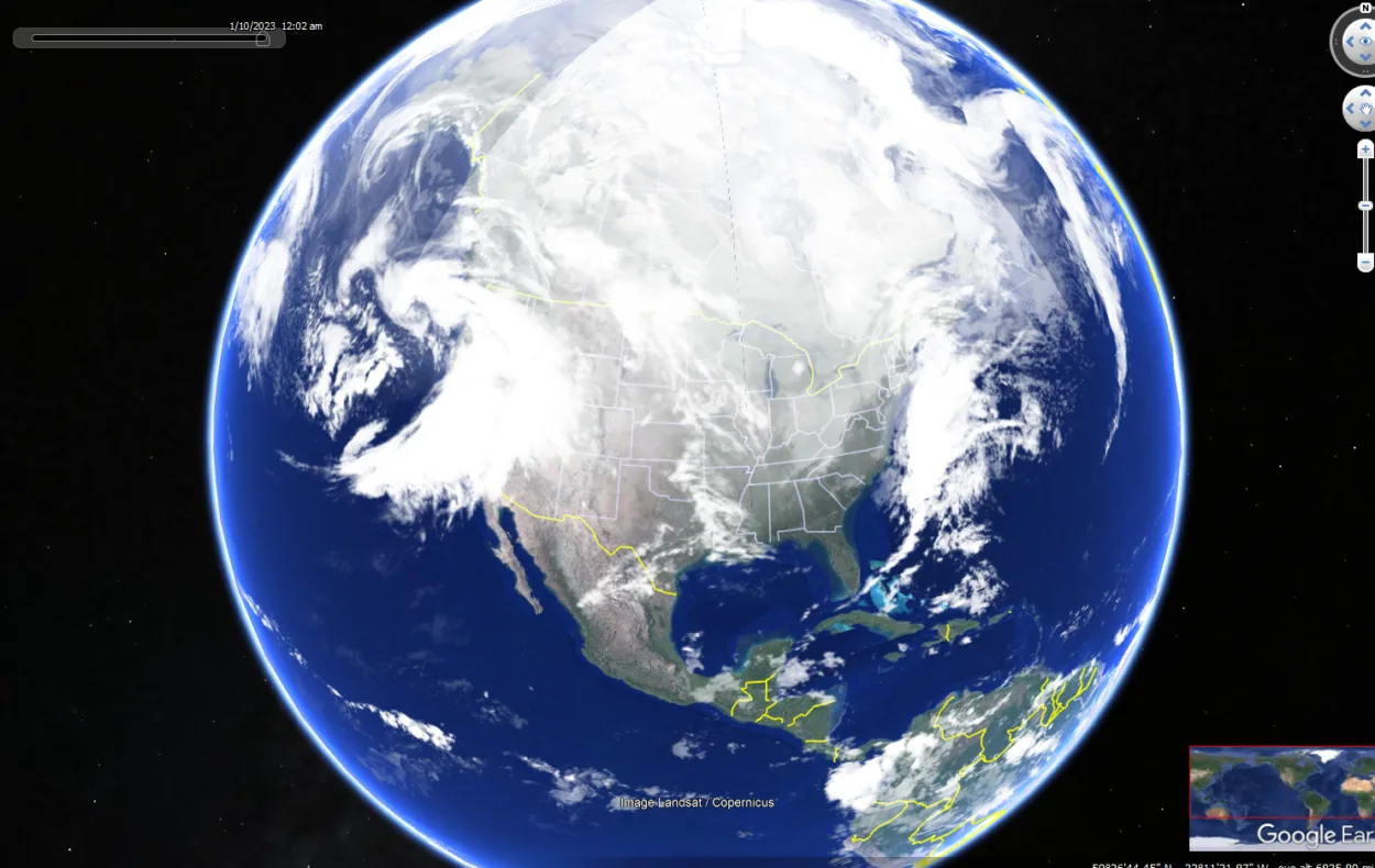
Thankfully, with the Google Earth app, you can do just that! The app has historical imagery and time-lapse features that lets you see how an area has changed over time. All you need to do is find the location you want to see and select the ‘Time-lapse’ option.
It’s really that simple. So if you’re feeling nostalgic or just curious about how your town used to look, be sure to check out this awesome feature on the Google Earth app!
What is the Historical Imagery Feature on Google Earth?
If you’ve ever used Google Earth, you’ve probably noticed the “historical imagery” feature, which lets you see how a particular location has changed over time. But what is this historical imagery, and how does Google Earth create it?
Historical imagery is a collection of images that show how a location has changed over time. Google Earth compiles these images from a variety of sources, including satellite imagery, aerial photography, and even street-level photography.
You can use the historical imagery feature to see how a location has changed due to urbanization, natural disasters, or even just the passage of time.
So the next time you’re curious about how a particular location has changed over the years, be sure to check out the historical imagery feature on Google Earth.

What is Time-Lapse on Google Earth?
Google Earth’s time-lapse feature is a tool that allows users to see how the Earth has changed over time. The feature uses high-resolution satellite images that are taken over the course of years to create a time-lapse video of the planet.
Time-lapse videos of the Earth can be used to show the effects of natural disasters, the growth of cities, the changing of seasons, and much more. This feature is a valuable tool for scientists, educators, and anyone who wants to see the Earth in a new way.
Can you go Back in Time on the Google Earth App?
Yes, you can definitely fly back in time on the Google Earth app by following certain simple steps, which are mentioned below:
| Step | Details | |
| 1 | Find the location you want to view historical imagery for and zoom in by typing it in the search bar. | |
| 2 | Click on the historical imagery feature from the file menu bar. | |
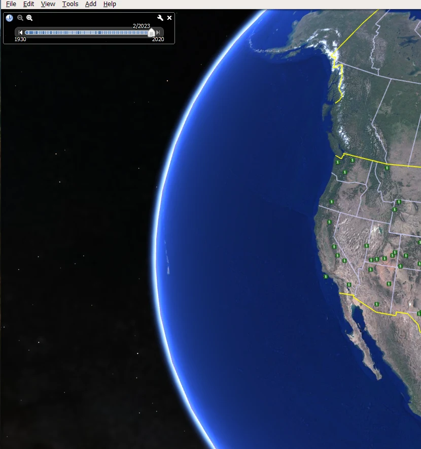
| 3 | A time slider will appear, which will have different years on it. | |
| 4 | Select the year you want to view from the list of available years. Imagery from that year will then be loaded onto the map. |
How Do I View Old Google Earth Images?
If you’re looking for a specific Google Earth image from the past, there are a few ways to find it. One way is to use the Google Earth app’s “Historical Imagery” feature. To do this, open the app and tap on the “Menu” icon in the top-left corner. Then, select “Historical Imagery.”
On the next screen, use the slider at the bottom of the screen to choose a date range. Then, zoom in on an area of interest and pan around until you find an image from the selected timeframe. Keep in mind that not all areas have historical imagery available.
You can check out the video below to see how Google Earth Historical Imagery works!
Another way to view old images is through the time-lapse option. This option will allow you to view the oldest satellite images.
Can you go back 10 Years on Google Earth?
Yes, you can definitely view 10 years older images on Google Earth.
In fact, most images you see on Google Earth are older than 5 years. The chances for this are more if you’re viewing an image from a rural area. However, the chances are low if you’re viewing an urban area.
Furthermore, you can also view images older than 10 years on Google Earth by historical imagery feature, which can let you view images from as far as 1985.
How far does Google Earth Images go Back?
We’ve all used Google Earth to zoom in on our houses, our favorite landmarks, or even that weird spot in the middle of nowhere. But have you ever wondered how far back the images go? Is it possible to see pictures of things that happened long ago?
The answer is yes – and no. Google Earth images are constantly being updated, so you can usually see fairly recent images of any given location. But there are also historical images available in some cases.
For example, you can view images of the Statue of Liberty from 1985, or you can view Time Square from 1990. So, Google Earth is a wonderful spot to start your search if you’re seeking contemporary or historic pictures.
How are the Images on Google Earth Captured?
Google Earth images are captured by satellites orbiting the Earth. These satellites are equipped with high-resolution cameras that can take detailed pictures of the Earth’s surface.
The satellites are constantly taking new pictures, which are then transmitted back to Google Earth. Google Earth stitches these images together to create a comprehensive view of the Earth’s surface.
However, one might wonder if satellites are capturing the images constantly, then why are the images so old? The answer is that satellites are orbiting, and they capture pictures of different areas. It might take a while for a satellite to orbit the same place and capture the pictures.
Therefore, some places have imaged a year older, while others have images older than 5 years or so.
How Old are Google Earth Images?
If you want to know how old an image on Google Earth is, you can simply know that by checking out the status bar.
All you’ve to do is, search for a particular location. Once you’ve reached a particular location, zoom it in. After zooming in on the image, you’ll be able to see the date of the image in the status bar.
However, in case you’re unable to view the image, then it’s possible that the provider of the picture hasn’t provided the date of the imagery. But you can request information related to the image.

How do I Search Google for a Specific Time Period?
Google Earth’s “Historical Imagery” tool is an effective tool that can be used to search for a specific period. You’ll be able to see pictures from various eras, which might be useful if you’re attempting to locate a certain event or place.
Make sure you have the most recent version of Google Earth before you can access the “Historical Imagery” function. Then launch Google Earth and select the “View” option from the menu at the top of the page. Choose “Historical Imagery” from the drop-down option that appears after that.
When you’ve finished, a new panel will show up on the right side of the screen. You may choose the precise year you wish to view from this screen.
Additionally, another option to do is to make use of the time-lapse feature in Google Earth, which allows you to view the changes on Earth from different time periods.
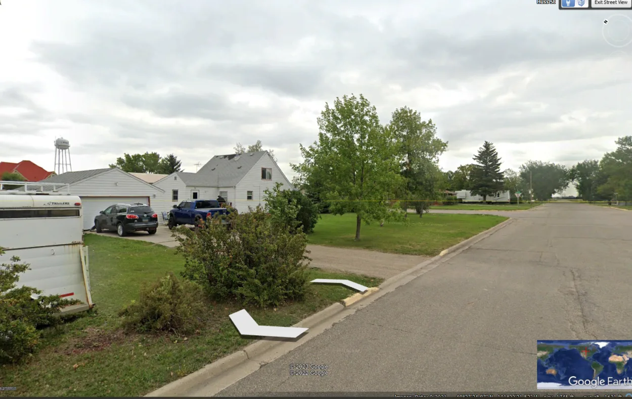
Why are the Images Blurred out on Google Earth?
There’re a few reasons why a house might be blurred out on Google Street View. One reason could be that the owner of the house has requested that their property be blurred out for privacy reasons.
Another reason could be that it’s also possible that Google Street View has not reached that particular location yet.
Conclusion
- To provide users with a more in-depth perspective of our world, Google Earth regularly refreshes its maps with fresh information.
- With this upgrade, users may quickly and easily explore other regions of the world or remain up to speed on developments in their immediate surroundings.
- However, some people might want to see the older images on Google Earth to track the changes on earth from different time periods.
- In order to view the old images, one can use historical imagery and the time-lapse feature on Google Earth.
- Historical imagery is a group of photos that demonstrate how a place has evolved over time. It allows you to explore the earth from older time periods easily with a simple time slider.
- Therefore, if you want to explore the earth, the historical imagery feature and the time-lapse option are two great features.
Related Articles
- Is Zoom Earth Better Than Google Earth?[Comparison]
- Is Google Earth Really Live? [Revealed]
- How Do I Change the Date in Google Earth? [Steps]